దస్త్రం:AtacamValley.jpg
Jump to navigation
Jump to search
ఈ మునుజూపు పరిమాణం: 800 × 501 పిక్సెళ్ళు. ఇతర రిజల్యూషన్లు: 320 × 200 పిక్సెళ్ళు | 640 × 400 పిక్సెళ్ళు | 1,024 × 641 పిక్సెళ్ళు | 1,600 × 1,001 పిక్సెళ్ళు.
అసలు దస్త్రం (1,600 × 1,001 పిక్సెళ్ళు, ఫైలు పరిమాణం: 1.09 MB, MIME రకం: image/jpeg)
This is a file from the Wikimedia Commons. Information from its description page there is shown below. Commons is a freely licensed media file repository. You can help. |
సారాంశం
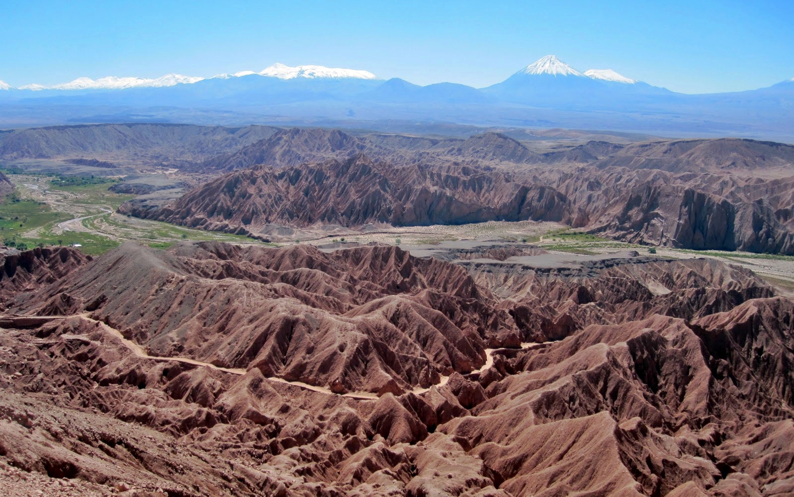
| వివరణ |
English: View during the Atacama Crossing 2011
Deutsch: Blick von der Cordillera de la Sal auf das Tal des Río San Pedro, im Norden von San Pedro de Atacama. Links Catarpe und seine Plateaus. |
||
| మూలం | స్వంత కృతి | ||
| కర్త | Smcmurtrey | ||
| అనుమతి (ఈ దస్త్రాన్ని పునర్వినియోగించుకోవడం) |
నేను, ఈ కృతి యొక్క కాపీహక్కుదారుని, దీన్ని ఇందుమూలముగా ఈ లైసెన్సుల క్రింద ప్రచురిస్తున్నాను:
This file is licensed under the Creative Commons Attribution-Share Alike 4.0 International, 3.0 Unported, 2.5 Generic, 2.0 Generic and 1.0 Generic license.
పైవాటిలో మీకు నచ్చిన లైసెన్సునును ఎంచుకోవచ్చు. |

| Camera location | | View this and other nearby images on: OpenStreetMap |
|---|
ఫైలు చరితం
తేదీ/సమయం ను నొక్కి ఆ సమయాన ఫైలు ఎలా ఉండేదో చూడవచ్చు.
| తేదీ/సమయం | నఖచిత్రం | కొలతలు | వాడుకరి | వ్యాఖ్య | |
|---|---|---|---|---|---|
| ప్రస్తుత | 13:10, 28 అక్టోబరు 2013 | | 1,600 × 1,001 (1.09 MB) | Chronus | == Summary == {{Information |Description ={{en|1=View during the Atacama Crossing 2011}} |Source ={{own}} |Author =Smcmurtrey |Date = |Permission = |other_versions = }} == Licensing == {{self|GFDL|c... |
| 18:56, 1 ఏప్రిల్ 2011 |  | 1,600 × 1,001 (366 KB) | Smcmurtrey | {{Information |Description ={{en|1=View during the Atacama Crossing 2011}} |Source ={{own}} |Author =Smcmurtrey |Date = |Permission = |other_versions = }} |
లింకులు
కింది పేజీలలో ఈ ఫైలుకు లింకులు ఉన్నాయి:
సార్వత్రిక ఫైలు వాడుక
ఈ దస్త్రాన్ని ఈ క్రింది ఇతర వికీలు ఉపయోగిస్తున్నాయి:
- cs.wikipedia.org లో వాడుక
- cy.wikipedia.org లో వాడుక
- en.wikipedia.org లో వాడుక
- fr.wikipedia.org లో వాడుక
- gu.wikipedia.org లో వాడుక
- he.wikipedia.org లో వాడుక
- hy.wikipedia.org లో వాడుక
- ml.wikipedia.org లో వాడుక
- pt.wikipedia.org లో వాడుక
- pt.wikibooks.org లో వాడుక
- sw.wikipedia.org లో వాడుక
- uk.wikipedia.org లో వాడుక
- ur.wikipedia.org లో వాడుక