దస్త్రం:Clark County Nevada Incorporated Areas Las Vegas highlighted.svg
Jump to navigation
Jump to search

ఈ ఫైలు SVG కు చెందిన ఈ మునుజూపు PNG పరిమాణం: 538 × 599 పిక్సెళ్ళు. ఇతర రిజల్యూషన్లు: 215 × 240 పిక్సెళ్ళు | 431 × 480 పిక్సెళ్ళు | 689 × 768 పిక్సెళ్ళు | 919 × 1,024 పిక్సెళ్ళు | 1,838 × 2,048 పిక్సెళ్ళు | 700 × 780 పిక్సెళ్ళు.
అసలు దస్త్రం (SVG ఫైలు, నామమాత్రంగా 700 × 780 పిక్సెళ్ళు, ఫైలు పరిమాణం: 139 KB)
This is a file from the Wikimedia Commons. Information from its description page there is shown below. Commons is a freely licensed media file repository. You can help. |
సారాంశం
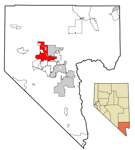
| వివరణ | This map shows the incorporated areas in Clark County, Nevada. Las Vegas is highlighted in red. I created it in using data from the following files: Census 2000 Block Map - Clark County (PDF) and Southern Nevada Public Lands Management Act Map (PDF) |
| తేదీ | |
| మూలం | My own work, based on government information. Though I strove to be as accurate in the detail as possible, the information shown is not guaranteed to be completely accurate. |
| కర్త | Ixnayonthetimmay |
| అనుమతి (ఈ దస్త్రాన్ని పునర్వినియోగించుకోవడం) |
Public Domain |
| ఇతర కూర్పులు | See Category:Maps of Clark County, Nevada for other versions of this image. |
లైసెన్సింగ్
| నేను, ఈ కృతి యొక్క కాపీహక్కుదారుని, ఈ కృతిని సార్వజనీనం'గా విడుదల చేస్తున్నాను. ఇది ప్రపంచవ్యాప్తంగా వర్తిస్తుంది. కొన్ని దేశాల్లో ఇది చట్టబద్ధంగా సాధ్యంకాకపోవచ్చు; అయితే: ఈ కృతిని ఎటువంటి షరతులు లేకుండా, అట్టి షరతులు చట్టం వల్ల తప్పనిసరి అయితే తప్ప, ఏ ఉద్దేశానికైనా ఉపయోగించుకునే హక్కును ఎవరికైనా నేను ప్రదానం చేస్తున్నాను. |
ఫైలు చరితం
తేదీ/సమయం ను నొక్కి ఆ సమయాన ఫైలు ఎలా ఉండేదో చూడవచ్చు.
| తేదీ/సమయం | నఖచిత్రం | కొలతలు | వాడుకరి | వ్యాఖ్య | |
|---|---|---|---|---|---|
| ప్రస్తుత | 01:09, 18 జూలై 2007 | | 700 × 780 (139 KB) | Ixnayonthetimmay | == Summary == {{Information |Description=This map shows the incorporated areas in Clark County, Nevada. Las Vegas is highlighted in red. I created it in [[en:Inksca |
లింకులు
కింది పేజీలలో ఈ ఫైలుకు లింకులు ఉన్నాయి:
సార్వత్రిక ఫైలు వాడుక
ఈ దస్త్రాన్ని ఈ క్రింది ఇతర వికీలు ఉపయోగిస్తున్నాయి:
- af.wikipedia.org లో వాడుక
- als.wikipedia.org లో వాడుక
- ang.wikipedia.org లో వాడుక
- arz.wikipedia.org లో వాడుక
- ast.wikipedia.org లో వాడుక
- azb.wikipedia.org లో వాడుక
- bn.wikipedia.org లో వాడుక
- br.wikipedia.org లో వాడుక
- bs.wikipedia.org లో వాడుక
- ca.wikipedia.org లో వాడుక
- ceb.wikipedia.org లో వాడుక
- cy.wikipedia.org లో వాడుక
- de.wikipedia.org లో వాడుక
- el.wikipedia.org లో వాడుక
- en.wikipedia.org లో వాడుక
- es.wikipedia.org లో వాడుక
- eu.wikipedia.org లో వాడుక
- fa.wikipedia.org లో వాడుక
- fi.wikipedia.org లో వాడుక
- fi.wiktionary.org లో వాడుక
- fr.wikipedia.org లో వాడుక
- fy.wikipedia.org లో వాడుక
- ga.wikipedia.org లో వాడుక
- gd.wikipedia.org లో వాడుక
- gl.wikipedia.org లో వాడుక
- hr.wikipedia.org లో వాడుక
- ht.wikipedia.org లో వాడుక
- hu.wikipedia.org లో వాడుక
- ia.wikipedia.org లో వాడుక
- id.wikipedia.org లో వాడుక
- ilo.wikipedia.org లో వాడుక
- it.wikipedia.org లో వాడుక
- ja.wikipedia.org లో వాడుక
- jv.wikipedia.org లో వాడుక
- kaa.wikipedia.org లో వాడుక
- ko.wikipedia.org లో వాడుక
- kw.wikipedia.org లో వాడుక
- la.wikipedia.org లో వాడుక
- lb.wikipedia.org లో వాడుక
- lmo.wikipedia.org లో వాడుక
- mai.wikipedia.org లో వాడుక
- min.wikipedia.org లో వాడుక
- ml.wikipedia.org లో వాడుక
- ms.wikipedia.org లో వాడుక
- my.wikipedia.org లో వాడుక
- ne.wikipedia.org లో వాడుక
- nl.wikipedia.org లో వాడుక
- no.wikipedia.org లో వాడుక
- oc.wikipedia.org లో వాడుక
ఈ దస్త్రపు మరింత సార్వత్రిక వాడుకను చూడండి.