దస్త్రం:Dallas County Texas Incorporated Areas Dallas highlighted.svg
Jump to navigation
Jump to search

ఈ ఫైలు SVG కు చెందిన ఈ మునుజూపు PNG పరిమాణం: 800 × 457 పిక్సెళ్ళు. ఇతర రిజల్యూషన్లు: 320 × 183 పిక్సెళ్ళు | 640 × 366 పిక్సెళ్ళు | 1,024 × 585 పిక్సెళ్ళు | 1,280 × 731 పిక్సెళ్ళు | 2,560 × 1,463 పిక్సెళ్ళు.
అసలు దస్త్రం (SVG ఫైలు, నామమాత్రంగా 1,050 × 600 పిక్సెళ్ళు, ఫైలు పరిమాణం: 248 KB)
This is a file from the Wikimedia Commons. Information from its description page there is shown below. Commons is a freely licensed media file repository. You can help. |
సారాంశం
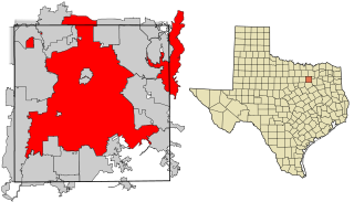
| వివరణ | This map shows the incorporated areas in Dallas County, Texas. Dallas is highlighted in red. I created it in Inkscape using data from the following links: North Central Texas Council of Governments Maps Website, Dallas County Commissioner District Map (PDF) |
| తేదీ | |
| మూలం | My own work, based on government information. Though I strove to be as accurate in the detail as possible, the information shown is not guaranteed to be completely accurate. |
| కర్త | Ixnayonthetimmay |
| అనుమతి (ఈ దస్త్రాన్ని పునర్వినియోగించుకోవడం) |
Public Domain |
| ఇతర కూర్పులు | See Category:Maps of Dallas County, Texas for other versions of this image. |
లైసెన్సింగ్
| నేను, ఈ కృతి యొక్క కాపీహక్కుదారుని, ఈ కృతిని సార్వజనీనం'గా విడుదల చేస్తున్నాను. ఇది ప్రపంచవ్యాప్తంగా వర్తిస్తుంది. కొన్ని దేశాల్లో ఇది చట్టబద్ధంగా సాధ్యంకాకపోవచ్చు; అయితే: ఈ కృతిని ఎటువంటి షరతులు లేకుండా, అట్టి షరతులు చట్టం వల్ల తప్పనిసరి అయితే తప్ప, ఏ ఉద్దేశానికైనా ఉపయోగించుకునే హక్కును ఎవరికైనా నేను ప్రదానం చేస్తున్నాను. |
ఫైలు చరితం
తేదీ/సమయం ను నొక్కి ఆ సమయాన ఫైలు ఎలా ఉండేదో చూడవచ్చు.
| తేదీ/సమయం | నఖచిత్రం | కొలతలు | వాడుకరి | వ్యాఖ్య | |
|---|---|---|---|---|---|
| ప్రస్తుత | 18:27, 9 ఆగస్టు 2007 | | 1,050 × 600 (248 KB) | Ixnayonthetimmay | == Summary == {{Information |Description=This map shows the incorporated areas in Dallas County, Texas. Dallas is highlighted in red. I created it in [[en:Inkscape|Inkscape] |
లింకులు
కింది పేజీలలో ఈ ఫైలుకు లింకులు ఉన్నాయి:
సార్వత్రిక ఫైలు వాడుక
ఈ దస్త్రాన్ని ఈ క్రింది ఇతర వికీలు ఉపయోగిస్తున్నాయి:
- als.wikipedia.org లో వాడుక
- ar.wikipedia.org లో వాడుక
- bn.wikipedia.org లో వాడుక
- br.wikipedia.org లో వాడుక
- ckb.wikipedia.org లో వాడుక
- de.wikipedia.org లో వాడుక
- en.wikipedia.org లో వాడుక
- fa.wikipedia.org లో వాడుక
- fi.wikipedia.org లో వాడుక
- fo.wikipedia.org లో వాడుక
- fr.wikipedia.org లో వాడుక
- fy.wikipedia.org లో వాడుక
- he.wikipedia.org లో వాడుక
- id.wikipedia.org లో వాడుక
- io.wikipedia.org లో వాడుక
- it.wikipedia.org లో వాడుక
- ja.wikipedia.org లో వాడుక
- ln.wikipedia.org లో వాడుక
- lv.wikipedia.org లో వాడుక
- ml.wikipedia.org లో వాడుక
- ms.wikipedia.org లో వాడుక
- my.wikipedia.org లో వాడుక
- nl.wikipedia.org లో వాడుక
- no.wikipedia.org లో వాడుక
- pnb.wikipedia.org లో వాడుక
- pt.wikipedia.org లో వాడుక
- qu.wikipedia.org లో వాడుక
- ro.wikipedia.org లో వాడుక
- sco.wikipedia.org లో వాడుక
- sc.wikipedia.org లో వాడుక
- sl.wikipedia.org లో వాడుక
- smn.wikipedia.org లో వాడుక
- srn.wikipedia.org లో వాడుక
- sv.wikipedia.org లో వాడుక
- ta.wikipedia.org లో వాడుక
- th.wikipedia.org లో వాడుక
- tl.wikipedia.org లో వాడుక
- tr.wikipedia.org లో వాడుక
- ug.wikipedia.org లో వాడుక
- ur.wikipedia.org లో వాడుక
- vi.wikipedia.org లో వాడుక
- yo.wikipedia.org లో వాడుక