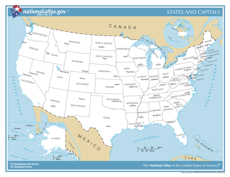
దస్త్రం:US map - states and capitals.png
Jump to navigation
Jump to search

ఈ మునుజూపు పరిమాణం: 776 × 600 పిక్సెళ్ళు. ఇతర రిజల్యూషన్లు: 311 × 240 పిక్సెళ్ళు | 621 × 480 పిక్సెళ్ళు | 994 × 768 పిక్సెళ్ళు | 1,280 × 989 పిక్సెళ్ళు | 2,560 × 1,978 పిక్సెళ్ళు | 5,499 × 4,249 పిక్సెళ్ళు.
అసలు దస్త్రం (5,499 × 4,249 పిక్సెళ్ళు, ఫైలు పరిమాణం: 3.27 MB, MIME రకం: image/png)
ఫైలు చరితం
తేదీ/సమయం ను నొక్కి ఆ సమయాన ఫైలు ఎలా ఉండేదో చూడవచ్చు.
| తేదీ/సమయం | నఖచిత్రం | కొలతలు | వాడుకరి | వ్యాఖ్య | |
|---|---|---|---|---|---|
| ప్రస్తుత | 15:03, 12 అక్టోబరు 2017 |  | 5,499 × 4,249 (3.27 MB) | Runner1928 | Higher resolution |
| 15:10, 12 నవంబరు 2004 |  | 1,584 × 1,224 (233 KB) | Duesentrieb | US-States and their capitals; Dept. of Interior, Public Domain |
లింకులు
కింది పేజీలలో ఈ ఫైలుకు లింకులు ఉన్నాయి:
సార్వత్రిక ఫైలు వాడుక
ఈ దస్త్రాన్ని ఈ క్రింది ఇతర వికీలు ఉపయోగిస్తున్నాయి:
- es.wikibooks.org లో వాడుక
- gag.wikipedia.org లో వాడుక
- rm.wikipedia.org లో వాడుక
- www.wikidata.org లో వాడుక
