దస్త్రం:Wimbledon map.jpg
Jump to navigation
Jump to search
ఈ మునుజూపు పరిమాణం: 514 × 599 పిక్సెళ్ళు. ఇతర రిజల్యూషన్లు: 206 × 240 పిక్సెళ్ళు | 412 × 480 పిక్సెళ్ళు | 659 × 768 పిక్సెళ్ళు | 879 × 1,024 పిక్సెళ్ళు | 2,218 × 2,585 పిక్సెళ్ళు.
అసలు దస్త్రం (2,218 × 2,585 పిక్సెళ్ళు, ఫైలు పరిమాణం: 4.6 MB, MIME రకం: image/jpeg)
This is a file from the Wikimedia Commons. Information from its description page there is shown below. Commons is a freely licensed media file repository. You can help. |
సారాంశం
| వివరణ |
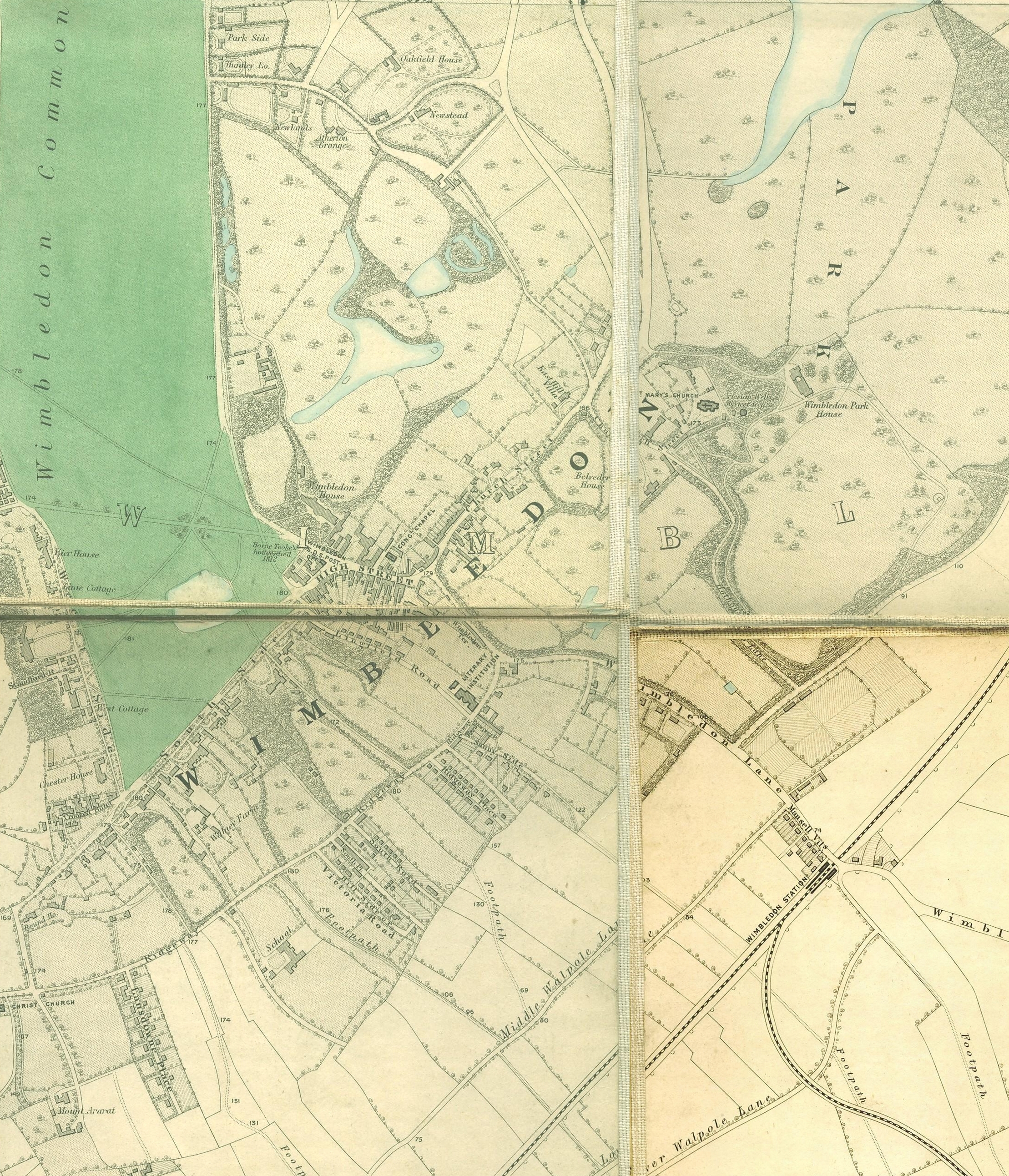
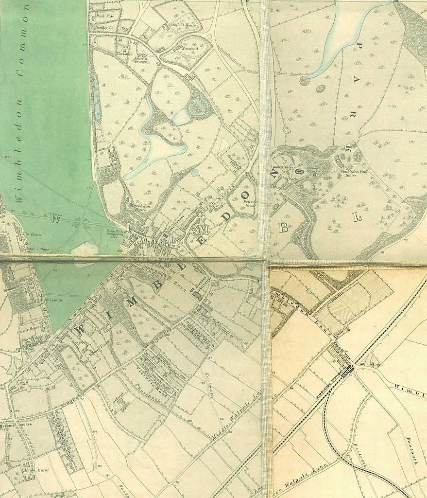
English: Wimbledon section of Edward Stanford's map of London, 1862 - 1871 |
|||||||||||||||||||
| తేదీ | ౧,౮౬౨.౦ - ౧,౮౭౧.౦ | |||||||||||||||||||
| మూలం | http://www.mappalondon.com/london/south-west/maps.htm | |||||||||||||||||||
| కర్త |
|
|||||||||||||||||||
లైసెన్సింగ్
|
This work is in the public domain in its country of origin and other countries and areas where the copyright term is the author's life plus 100 years or fewer. | |
| This file has been identified as being free of known restrictions under copyright law, including all related and neighboring rights. | |
ఫైలు చరితం
తేదీ/సమయం ను నొక్కి ఆ సమయాన ఫైలు ఎలా ఉండేదో చూడవచ్చు.
| తేదీ/సమయం | నఖచిత్రం | కొలతలు | వాడుకరి | వ్యాఖ్య | |
|---|---|---|---|---|---|
| ప్రస్తుత | 18:42, 14 జనవరి 2011 | | 2,218 × 2,585 (4.6 MB) | SilkTork | {{Information |Description={{en|1=Wimbledon section of Edward Stanford's map of London, 1862 - 1871 }} |Source=http://www.mappalondon.com/london/south-west/maps.htm |Author=Edward Stanford (died 1904) |Date=18 |
లింకులు
ఈ ఫైలును వాడుతున్న పేజీలు లేవు.
సార్వత్రిక ఫైలు వాడుక
ఈ దస్త్రాన్ని ఈ క్రింది ఇతర వికీలు ఉపయోగిస్తున్నాయి:
- en.wikipedia.org లో వాడుక
- hi.wikipedia.org లో వాడుక
- kn.wikipedia.org లో వాడుక