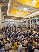
దస్త్రం:قم، حرم حضرت معصومه. شبستان جامع امام خمینی.jpg

అసలు దస్త్రం (2,000 × 1,333 పిక్సెళ్ళు, ఫైలు పరిమాణం: 2.56 MB, MIME రకం: image/jpeg)
This is a file from the Wikimedia Commons. Information from its description page there is shown below. Commons is a freely licensed media file repository. You can help. |
సారాంశం
| వివరణقم، حرم حضرت معصومه. شبستان جامع امام خمینی.jpg |
فارسی: حرم فاطمه معصومه
|
|||
| తేదీ | ||||
| మూలం | స్వంత కృతి | |||
| కర్త | Mostafameraji | |||
| ఇతర కూర్పులు |
|
| Object location | 34° 38′ 29.13″ N, 50° 52′ 42.08″ E | View this and other nearby images on: OpenStreetMap |
|---|
| Camera location | 34° 38′ 29.13″ N, 50° 52′ 42.08″ E | View this and other nearby images on: OpenStreetMap |
|---|
లైసెన్సింగ్
- ఇలా చేసేందుకు మీకు స్వేచ్ఛ ఉంది:
- పంచుకోడానికి – ఈ కృతిని కాపీ చేసుకోవచ్చు, పంపిణీ చేయవచ్చు, ప్రసారమూ చేయవచ్చు
- రీమిక్స్ చేయడానికి – కృతిని అనుకరించడానికి
- క్రింది షరతులకు లోబడి:
- ఆపాదింపు – సముచితమైన శ్రేయస్సును ఇవ్వాలి, లైసెన్సుకు లింకు ఇవ్వాలి, మార్పులేమైనా చేస్తే వాటిని సూచించాలి. అందుకు సముచితమైన పద్ధతి దేన్నైనా అవలంబించవచ్చు. కానీ మీకూ మీ వాడుకకూ హక్కుదారు అనుమతించారు అనే అర్థం వచ్చేటట్లుగా మాత్రం కాదు.
- share alike – మీరు ఈ కృతిని అనుకరిస్తే, మారిస్తే, లేదా మెరుగుపరిస్తే తత్ఫలిత కృతిని ఇదే లైసెన్సు లేదా దీనికి అనుగుణ్యమైన లైసెన్సు క్రింద మాత్రమే పంపిణీ చేయాలి.
| Annotations InfoField | This image is annotated: View the annotations at Commons |
جزء خوانی قرآن در ماه رمضان در صحن اصلی شبستان - در سی روز ماه رمضان افراد با حضور در این مراسم، هر روز یک جزء قرآن را بازخوانی میکنند
رحل قرآن. یک وسیله چوبی یا فلزی که برای نگاه داشتن قرآن در هنگام مطالعه از آن استفاده میشود.
عکس قم- شبستان امام خمینی در حرم فاطمه معصومه
Vault (French voûte, from Italian volta) is an architectural term for an arched form used to provide a space with a ceiling or roof.
拱頂是一個建築學用於,指平行的多個拱形製造出的天花板樣式。
Une voûte (ou voute) est un ouvrage architectural constitué d'un plancher construit en brique, moellon, pierre, ou en béton, dont le dessous (ou intrados) est fait en arc ou en plate-bande.
ヴォールト とは、アーチを平行に押し出した形状 を特徴とする天井様式および建築構造の総称である。
Свод в архитектуре тип перекрытия или покрытия пространства (помещения), ограниченного стенами, балками или столбами — конструкция, которая образуется наклонными поверхностями .
Voluntary associations
A crowd is a large group of people that are gathered or considered together. The term "the crowd" may sometimes refer to the lower orders of people in general (the mob).
A column or pillar in architecture and structural engineering is a structural element that transmits, through compression, the weight of the structure above to other structural elements below.
Eine Säule ist eine lotrechte, freistehende Stütze aus Holz, Stein, Ziegel oder Metall mit rundem oder polygonalem Querschnitt.
La colónna è un elemento architettonico verticale portante di sezione circolare formato generalmente da base, fusto e capitello; se la sezione del fusto ha una qualunque altra forma che non sia il cerchio, si parla più propriamente di pilastro.
Captions
Items portrayed in this file
చిత్రణ
Qom ఇంగ్లీష్
Fātima bint Mūsā ఇంగ్లీష్
Holiest sites in shia Islam ఇంగ్లీష్
Islamic architecture ఇంగ్లీష్
demographics of Iran ఇంగ్లీష్
Iranian peoples ఇంగ్లీష్
Mostafa Meraji ఇంగ్లీష్
some value
copyright status ఇంగ్లీష్
copyrighted ఇంగ్లీష్
30 జూన్ 2014
coordinates of the point of view ఇంగ్లీష్
34°38'29.13414"N, 50°52'42.08196"E
source of file ఇంగ్లీష్
original creation by uploader ఇంగ్లీష్
location of creation ఇంగ్లీష్
coordinates of depicted place ఇంగ్లీష్
34°38'29.13414"N, 50°52'42.08196"E
exposure time ఇంగ్లీష్
0.01666666666666666666 సెకను
f-number ఇంగ్లీష్
2.8
focal length ఇంగ్లీష్
11 మిల్లీమీటరు
MIME type ఇంగ్లీష్
image/jpeg
ఫైలు చరితం
తేదీ/సమయం ను నొక్కి ఆ సమయాన ఫైలు ఎలా ఉండేదో చూడవచ్చు.
| తేదీ/సమయం | నఖచిత్రం | కొలతలు | వాడుకరి | వ్యాఖ్య | |
|---|---|---|---|---|---|
| ప్రస్తుత | 08:38, 6 జనవరి 2017 |  | 2,000 × 1,333 (2.56 MB) | Mostafameraji | User created page with UploadWizard |
లింకులు
ఈ ఫైలును వాడుతున్న పేజీలు లేవు.
సార్వత్రిక ఫైలు వాడుక
ఈ దస్త్రాన్ని ఈ క్రింది ఇతర వికీలు ఉపయోగిస్తున్నాయి:
- az.wikipedia.org లో వాడుక
- bar.wikipedia.org లో వాడుక
- cs.wikipedia.org లో వాడుక
- fa.wikipedia.org లో వాడుక
- sl.wikipedia.org లో వాడుక
మెటాడేటా
ఈ ఫైలులో అదనపు సమాచారం ఉంది, బహుశా దీన్ని సృష్టించడానికి లేదా సాంఖ్యీకరించడానికి వాడిన డిజిటల్ కేమెరా లేదా స్కానర్ ఆ సమాచారాన్ని చేర్చివుండవచ్చు. ఈ ఫైలును అసలు స్థితి నుండి మారిస్తే, ఆ మారిన ఫైలులో కొన్ని వివరాలు పూర్తిగా ప్రతిఫలించకపోవచ్చు.
| కృతికర్త | Mostafa Meraji iranian Photographer Qom City |
|---|---|
| కాపీ హక్కుదారు |
|
| ఎక్స్పోజరు సమయం | 1/60 క్షణ (0.016666666666667) |
| F సంఖ్య | f/2.8 |
| డేటా తయారైన తేదీ, సమయం | 15:17, 30 జూన్ 2014 |
| కటకపు నాభ్యంతరం | 11 mm |
| దిశ | సాధారణ |
| క్షితిజసమాంతర స్పష్టత | 300 dpi |
| లంబ స్పష్టత | 300 dpi |
| ఉపయోగించిన సాఫ్ట్వేర్ | Adobe Photoshop CC 2015.5 (Windows) |
| ఫైలు మార్చిన తేదీ, సమయం | 00:31, 6 జనవరి 2017 |
| డిజిటైజు చేసిన తేదీ, సమయం | 15:17, 30 జూన్ 2014 |
| APEX షట్టరు వేగం | 5.906891 |
| APEX ఎపర్చరు | 2.970854 |
| ఎక్స్పోజరు బయాస్ | 0 |
| గరిష్ఠ లాండు ఎపర్చరు | 3 APEX (f/2.83) |
| తేదీసమయం ఉపక్షణాలు | 25 |
| DateTimeOriginal ఉపసెకండ్లు | 25 |
| DateTimeDigitized ఉపసెకండ్లు | 25 |
| వర్ణస్థలం | క్రమాంకితం కానిది |
| X నాభి తలపు స్పష్టత | 5,715.545755237 |
| Y నాభి తలపు స్పష్టత | 5,808.4033613445 |
| నాభితలపు స్పష్టత కొలమానం | అంగుళాలు |
| కస్టమ్ బొమ్మ ప్రాసెసింగు | సాధారణ ప్రక్రియ |
| ఎక్స్పోజరు పద్ధతి | అమర్చిన ఎక్స్పోజరు |
| దృశ్య సంగ్రహ పద్ధతి | ప్రామాణిక |
| కెమేరా యొక్క సీరియల్ నంబర్ | 2361201480 |
| వాడిన కటకం | Tokina AT-X 116 PRO DX II 11-16mm F2.8 |
| రేటింగు (5 కి గాను) | 0 |
| Date metadata was last modified | 16:31, 5 జనవరి 2017 |
| మూల దస్త్రం యొక్క విశిష్ఠ ఐడీ | F7B8107C8E6E3825EE0FC622E49E5A8A |
