దస్త్రం:A compleat chart of the coast of Asia and America with the great South Sea - R.W. Seale del. et sculp. NYPL465242.tiff
Jump to navigation
Jump to search

ఈ ఫైలు TIF కు చెందిన ఈ మునుజూపు PNG పరిమాణం: 800 × 514 పిక్సెళ్ళు. ఇతర రిజల్యూషన్లు: 320 × 206 పిక్సెళ్ళు | 640 × 411 పిక్సెళ్ళు | 1,024 × 658 పిక్సెళ్ళు | 1,280 × 823 పిక్సెళ్ళు | 2,560 × 1,645 పిక్సెళ్ళు | 5,158 × 3,315 పిక్సెళ్ళు.
అసలు దస్త్రం (5,158 × 3,315 పిక్సెళ్ళు, ఫైలు పరిమాణం: 65.23 MB, MIME రకం: image/tiff)
This is a file from the Wikimedia Commons. Information from its description page there is shown below. Commons is a freely licensed media file repository. You can help. |
సారాంశం
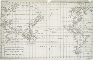
| వివరణ | A compleat chart of the coast of Asia and America with the great South Sea / R.W. Seale del. et sculp.; John H. Levine Collection | |||||||||||||||||||||||
| Notes | John H. Levine Bequest. ''Note 2.'') National Endowment for the Humanities Grant for Access to Early Maps of the Middle Atlantic Seaboard. ''Note 3.'') Prime meridian: London. | |||||||||||||||||||||||
| Catalogue call number | Map Div. 96-7702 [Levine] | |||||||||||||||||||||||
| తేదీ | circa 1754 | |||||||||||||||||||||||
| మూలం |
http://digitalgallery.nypl.org/nypldigital/dgkeysearchdetail.cfm?imageID=465242
|
|||||||||||||||||||||||
| కర్త | Seale, Richard William -- Engraver | |||||||||||||||||||||||
| అనుమతి (ఈ దస్త్రాన్ని పునర్వినియోగించుకోవడం) |
From The Lionel Pincus and Princess Firyal Map Division. http://maps.nypl.org
|
|||||||||||||||||||||||
| Location | Stephen A. Schwarzman Building / The Lionel Pincus and Princess Firyal Map Division | |||||||||||||||||||||||
| Digital item published | 2-3-2004; updated 3-25-2011 | |||||||||||||||||||||||
| Digital ID | 465242 | |||||||||||||||||||||||

The making of this file was supported by Wikimedia UK.
To see other files made with the support of Wikimedia UK, please see the category Supported by Wikimedia UK.
|
ఫైలు చరితం
తేదీ/సమయం ను నొక్కి ఆ సమయాన ఫైలు ఎలా ఉండేదో చూడవచ్చు.
| తేదీ/సమయం | నఖచిత్రం | కొలతలు | వాడుకరి | వ్యాఖ్య | |
|---|---|---|---|---|---|
| ప్రస్తుత | 21:39, 24 సెప్టెంబరు 2022 |  | 5,158 × 3,315 (65.23 MB) | Enyavar | Cropped 11 % horizontally, 27 % vertically, rotated -0.2° using CropTool with precise mode. |
| 02:01, 7 మార్చి 2016 |  | 5,779 × 4,520 (74.77 MB) | SteinsplitterBot | Bot: Image rotated by 270° | |
| 08:31, 20 ఏప్రిల్ 2014 |  | 4,520 × 5,779 (74.74 MB) | Fæ | GWToolset:: Creating mediafile for Fæ. Tranche 2.389 |
లింకులు
కింది పేజీలలో ఈ ఫైలుకు లింకులు ఉన్నాయి:
సార్వత్రిక ఫైలు వాడుక
ఈ దస్త్రాన్ని ఈ క్రింది ఇతర వికీలు ఉపయోగిస్తున్నాయి:
- bn.wikipedia.org లో వాడుక
- en.wikipedia.org లో వాడుక
- ilo.wikipedia.org లో వాడుక
- ka.wikipedia.org లో వాడుక
- kk.wikipedia.org లో వాడుక
- sl.wikipedia.org లో వాడుక
- vi.wikipedia.org లో వాడుక