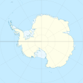
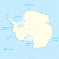
దస్త్రం:Antarctica location map.svg
Jump to navigation
Jump to search

ఈ ఫైలు SVG కు చెందిన ఈ మునుజూపు PNG పరిమాణం: 600 × 600 పిక్సెళ్ళు. ఇతర రిజల్యూషన్లు: 240 × 240 పిక్సెళ్ళు | 480 × 480 పిక్సెళ్ళు | 768 × 768 పిక్సెళ్ళు | 1,024 × 1,024 పిక్సెళ్ళు | 2,048 × 2,048 పిక్సెళ్ళు | 1,200 × 1,200 పిక్సెళ్ళు.
అసలు దస్త్రం (SVG ఫైలు, నామమాత్రంగా 1,200 × 1,200 పిక్సెళ్ళు, ఫైలు పరిమాణం: 233 KB)
ఫైలు చరితం
తేదీ/సమయం ను నొక్కి ఆ సమయాన ఫైలు ఎలా ఉండేదో చూడవచ్చు.
| తేదీ/సమయం | నఖచిత్రం | కొలతలు | వాడుకరి | వ్యాఖ్య | |
|---|---|---|---|---|---|
| ప్రస్తుత | 00:31, 9 ఏప్రిల్ 2015 |  | 1,200 × 1,200 (233 KB) | Ravenpuff | Minor changes |
| 16:16, 3 మే 2011 |  | 1,200 × 1,200 (232 KB) | Alexrk2 | - | |
| 16:14, 3 మే 2011 |  | 1,200 × 1,200 (232 KB) | Alexrk2 | + Peter I. Insel | |
| 14:24, 21 ఫిబ్రవరి 2010 |  | 1,200 × 1,200 (217 KB) | Alexrk2 | == Summary == {{Information |Description= {{de|Positionskarte Antarktis, Mittabstandstreue Azimutalprojektion}} {{en|Location map Antarctica, Azimuthal equidistant projection}} * Longitude of central meridian: 0° * La |
లింకులు
కింది పేజీలలో ఈ ఫైలుకు లింకులు ఉన్నాయి:
సార్వత్రిక ఫైలు వాడుక
ఈ దస్త్రాన్ని ఈ క్రింది ఇతర వికీలు ఉపయోగిస్తున్నాయి:
- af.wikipedia.org లో వాడుక
- ar.wikipedia.org లో వాడుక
- arz.wikipedia.org లో వాడుక
- ast.wikipedia.org లో వాడుక
- Polu Sur
- Islla Esperanto
- Monte Hope (L'Antártida)
- Islles Shetland del Sur
- Base Vostok
- Base Antártica Juan Carlos I
- Base Concordia
- Islla White (L'Antártida)
- Monte Erebus
- Mar d'Amundsen
- Mar de Bellingshausen
- Mar de Ross
- Mar de Weddell
- Macizu Vinson
- Montes Tresantárticos
- Llagu Vostok
- Península Antártica
- Islla Berkner
- Barrera de xelu Filchner-Ronne
- Tierra de Coats
- Indlandsis de L'Antártida
- L'Antártida Occidental
- Barrera de xelu Larsen
- Península Trinidá
- Capa de xelu de L'Antártida occidental
- Islla Pedru I
- Tierra de Marie Byrd
- Módulu:Mapa de llocalización/datos/Antártida
- Módulu:Mapa de llocalización/datos/Antártida/usu
- Picu del Príncipe d'Asturies
- Aeródromu Teniente Rodolfo Marsh Martin
- Aeródromu Wilkins
- Aeródromu de Molodiózhnaya
- Aeródromu de Punta Rothera
- Aeródromu de Troll
- Base Casey
- Base Davis
- Base Edgeworth David
- Base Fossil Bluff
- Base Halley
- Base Mario Zucchelli
- Base Mawson
ఈ దస్త్రపు మరింత సార్వత్రిక వాడుకను చూడండి.


