దస్త్రం:Caucasus central asia political map 2000.jpg
Jump to navigation
Jump to search

ఈ మునుజూపు పరిమాణం: 800 × 596 పిక్సెళ్ళు. ఇతర రిజల్యూషన్లు: 320 × 239 పిక్సెళ్ళు | 640 × 477 పిక్సెళ్ళు | 1,024 × 763 పిక్సెళ్ళు | 1,280 × 954 పిక్సెళ్ళు | 1,390 × 1,036 పిక్సెళ్ళు.
అసలు దస్త్రం (1,390 × 1,036 పిక్సెళ్ళు, ఫైలు పరిమాణం: 164 KB, MIME రకం: image/jpeg)
This is a file from the Wikimedia Commons. Information from its description page there is shown below. Commons is a freely licensed media file repository. You can help. |
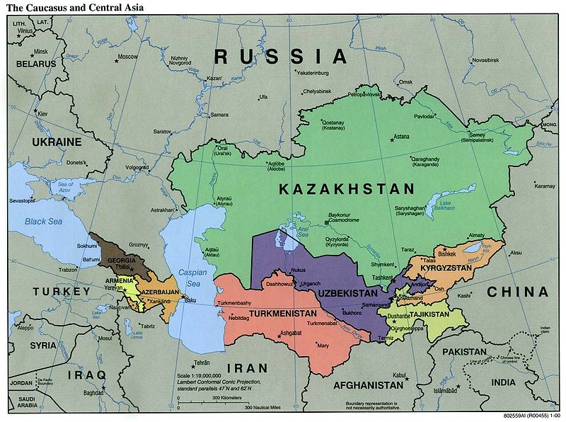
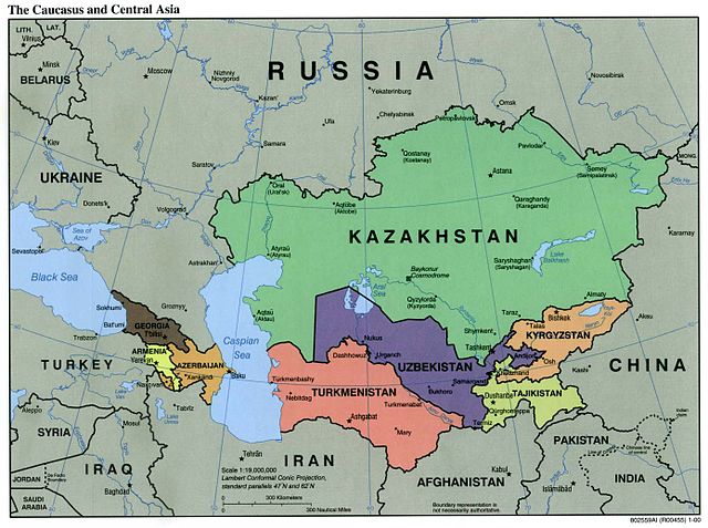
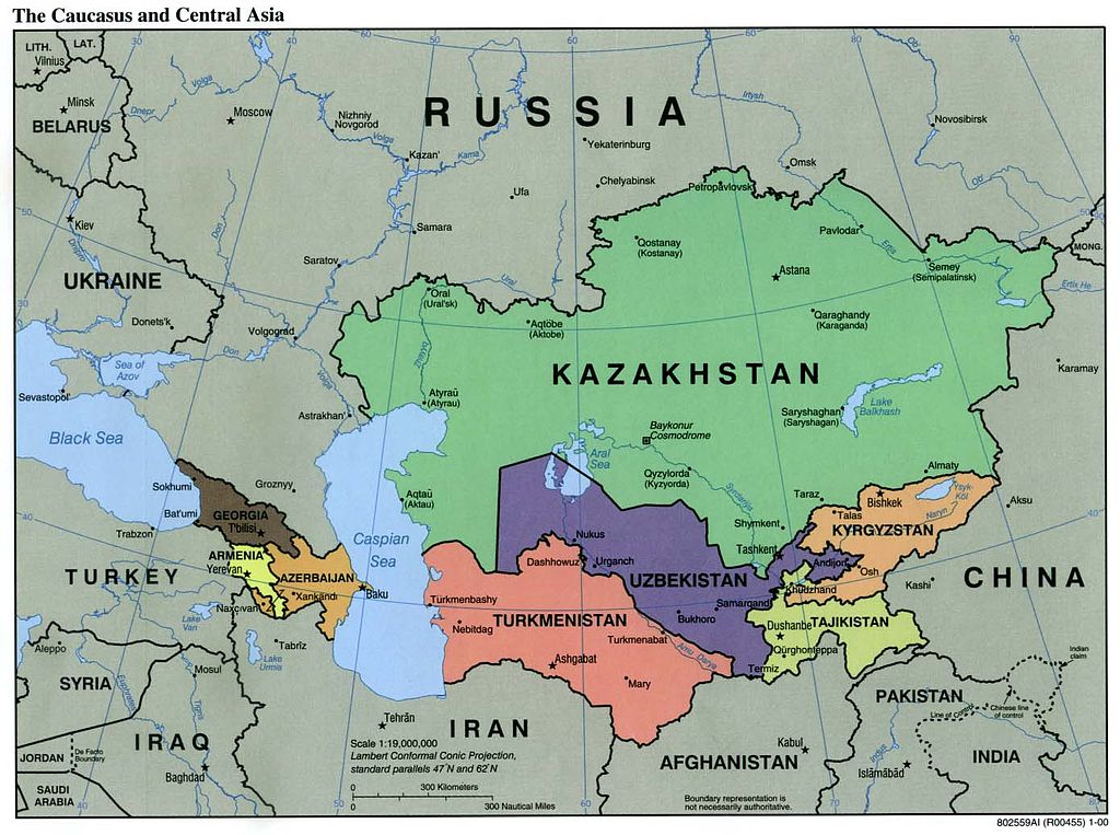
| వివరణ | Political Map of the Caucasus and Central Asia | ||||||
| మూలం | http://ftp.lib.utexas.edu/maps/kazakhstan.html (CIA-Scans) | ||||||
| కర్త | CIA | ||||||
| అనుమతి (ఈ దస్త్రాన్ని పునర్వినియోగించుకోవడం) |
|
||||||
| ఇతర కూర్పులు | Derivative works of this file: Central Asia - political map.svg | ||||||

ఫైలు చరితం
తేదీ/సమయం ను నొక్కి ఆ సమయాన ఫైలు ఎలా ఉండేదో చూడవచ్చు.
| తేదీ/సమయం | నఖచిత్రం | కొలతలు | వాడుకరి | వ్యాఖ్య | |
|---|---|---|---|---|---|
| ప్రస్తుత | 01:20, 9 నవంబరు 2004 | | 1,390 × 1,036 (164 KB) | Annalog~commonswiki | The Caucasus and Central Asia Political Map 2000 |
లింకులు
కింది పేజీలలో ఈ ఫైలుకు లింకులు ఉన్నాయి:
సార్వత్రిక ఫైలు వాడుక
ఈ దస్త్రాన్ని ఈ క్రింది ఇతర వికీలు ఉపయోగిస్తున్నాయి:
- en.wikipedia.org లో వాడుక
- es.wikipedia.org లో వాడుక
- id.wikipedia.org లో వాడుక
- jv.wikipedia.org లో వాడుక
- min.wikipedia.org లో వాడుక
- ml.wikipedia.org లో వాడుక
- ro.wikipedia.org లో వాడుక
- th.wikipedia.org లో వాడుక
- tl.wikipedia.org లో వాడుక
- zh-min-nan.wikipedia.org లో వాడుక