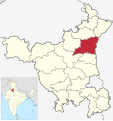
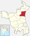
దస్త్రం:India - Haryana - Karnal.svg
Jump to navigation
Jump to search

ఈ ఫైలు SVG కు చెందిన ఈ మునుజూపు PNG పరిమాణం: 564 × 600 పిక్సెళ్ళు. ఇతర రిజల్యూషన్లు: 226 × 240 పిక్సెళ్ళు | 451 × 480 పిక్సెళ్ళు | 722 × 768 పిక్సెళ్ళు | 963 × 1,024 పిక్సెళ్ళు | 1,925 × 2,048 పిక్సెళ్ళు | 676 × 719 పిక్సెళ్ళు.
అసలు దస్త్రం (SVG ఫైలు, నామమాత్రంగా 676 × 719 పిక్సెళ్ళు, ఫైలు పరిమాణం: 1.65 MB)
ఫైలు చరితం
తేదీ/సమయం ను నొక్కి ఆ సమయాన ఫైలు ఎలా ఉండేదో చూడవచ్చు.
| తేదీ/సమయం | నఖచిత్రం | కొలతలు | వాడుకరి | వ్యాఖ్య | |
|---|---|---|---|---|---|
| ప్రస్తుత | 15:14, 18 మార్చి 2022 |  | 676 × 719 (1.65 MB) | C1MM | Reverted to version as of 08:00, 8 March 2022 (UTC) |
| 06:10, 18 మార్చి 2022 |  | 845 × 899 (534 KB) | C1MM | updated bounds | |
| 08:00, 8 మార్చి 2022 |  | 676 × 719 (1.65 MB) | Furfur | corrected district borders | |
| 05:21, 13 ఆగస్టు 2021 |  | 845 × 899 (606 KB) | C1MM | c bounds | |
| 04:48, 26 జూలై 2018 |  | 626 × 750 (423 KB) | Milenioscuro | corrected | |
| 13:00, 5 జూలై 2018 |  | 579 × 611 (369 KB) | Ankit2 | Updated map with 22 districts. | |
| 00:57, 6 నవంబరు 2016 |  | 626 × 750 (292 KB) | Milenioscuro | User created page with UploadWizard |
లింకులు
కింది పేజీలలో ఈ ఫైలుకు లింకులు ఉన్నాయి:
సార్వత్రిక ఫైలు వాడుక
ఈ దస్త్రాన్ని ఈ క్రింది ఇతర వికీలు ఉపయోగిస్తున్నాయి:
- ar.wikipedia.org లో వాడుక
- arz.wikipedia.org లో వాడుక
- awa.wikipedia.org లో వాడుక
- bh.wikipedia.org లో వాడుక
- bn.wikipedia.org లో వాడుక
- ca.wikipedia.org లో వాడుక
- de.wikipedia.org లో వాడుక
- en.wikipedia.org లో వాడుక
- es.wikipedia.org లో వాడుక
- eu.wikipedia.org లో వాడుక
- fa.wikipedia.org లో వాడుక
- fi.wikipedia.org లో వాడుక
- fr.wikipedia.org లో వాడుక
- gu.wikipedia.org లో వాడుక
- hi.wikipedia.org లో వాడుక
- incubator.wikimedia.org లో వాడుక
- ml.wikipedia.org లో వాడుక
- nl.wikipedia.org లో వాడుక
- no.wikipedia.org లో వాడుక
- pa.wikipedia.org లో వాడుక
- pnb.wikipedia.org లో వాడుక
- pt.wikipedia.org లో వాడుక
- ru.wikipedia.org లో వాడుక
- sat.wikipedia.org లో వాడుక
- sa.wikipedia.org లో వాడుక
- simple.wikipedia.org లో వాడుక
- ta.wikipedia.org లో వాడుక
- ur.wikipedia.org లో వాడుక
ఈ దస్త్రపు మరింత సార్వత్రిక వాడుకను చూడండి.