దస్త్రం:Map of Ireland's capitals.png
Jump to navigation
Jump to search

ఈ మునుజూపు పరిమాణం: 470 × 599 పిక్సెళ్ళు. ఇతర రిజల్యూషన్లు: 188 × 240 పిక్సెళ్ళు | 376 × 480 పిక్సెళ్ళు | 602 × 768 పిక్సెళ్ళు | 803 × 1,024 పిక్సెళ్ళు | 1,630 × 2,078 పిక్సెళ్ళు.
అసలు దస్త్రం (1,630 × 2,078 పిక్సెళ్ళు, ఫైలు పరిమాణం: 136 KB, MIME రకం: image/png)
This is a file from the Wikimedia Commons. Information from its description page there is shown below. Commons is a freely licensed media file repository. You can help. |
సారాంశం

|
This map image could be re-created using vector graphics as an SVG file. This has several advantages; see Commons:Media for cleanup for more information. If an SVG form of this image is available, please upload it and afterwards replace this template with
{{vector version available|new image name}}.
It is recommended to name the SVG file “Map of Ireland's capitals.svg”—then the template Vector version available (or Vva) does not need the new image name parameter. |
| వివరణ |
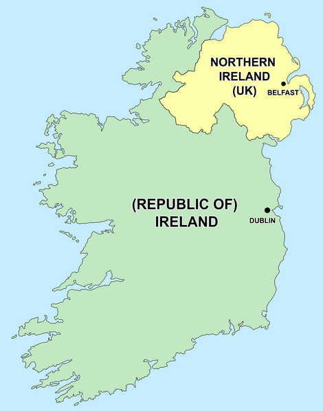
English: Political capitals of the countries Ireland and Northern Ireland Bahasa Indonesia: Ibu kota dari negara Irlandia Utara (Belfast) dan Republik Irlandia (Dublin) |
| తేదీ | 26 డిసెంబరు 2006 (original upload date) |
| మూలం | Transferred from en.wikipedia to Commons by Kajasudhakarababu using CommonsHelper. |
| కర్త | The original uploader was Jonto at ఇంగ్లీష్ వికీపీడియా. |
లైసెన్సింగ్
| ఈ దస్త్రం క్రియేటివ్ కామన్స్ Attribution-Share Alike 3.0 Unported లైసెన్సు క్రింద లభ్యం. Subject to disclaimers. | ||
| ||
| GFDL లైసెన్సు తాజాకరణలో భాగంగా ఈ దస్త్రానికి ఈ లైసెన్సింగు ట్యాగుని చేర్చారు. |

|
ఈ కృతి యొక్క కర్తనైన నేను, ఇక నుండీ ఈ కృతిని కాపీ చేసుకోవడానికి, పంచి పెట్టడానికి మరియు/లేదా మార్పులు-చేర్పులు చేసుకోవడానికి GFDL, లైసెన్సు వెర్షను 1.2 లేదా దాని తరువాత స్వేచ్చా సాఫ్టువేరు ఫౌండేషను విడుదలచేసే ఏ GFDL లైసెన్సు ద్వారా నయినా అనుమతి ఇస్తున్నాను; ఈ కృతిలో మార్చకూడని బాగాలు లేవు, Front-Cover పాఠం లేదు, Back-Cover పాఠం లేదు. ఈ లైసెన్సు యొక్క పత్రం నకలును "జిఎన్యూ ఉచిత డాక్యుమెంటేషను లైసెన్సు" అని పిలుస్తున్న విభాగంలో ఉంది. Subject to disclaimers. |
అసలు ఎక్కింపుల చిట్టా
- delete all current 21:50, 26 December 2006 Thumbnail for version as of 21:50, 26 December 2006 415×541 (13 KB) Jonto (Talk | contribs | block) (Updated as per talk.)
- delete revert 13:42, 11 October 2006 Thumbnail for version as of 13:42, 11 October 2006 415×541 (11 KB) Evertype (Talk | contribs | block) (I re-coloured the existing map and replaced the text on the island.)
- delete revert 04:08, 11 January 2006 Thumbnail for version as of 04:08, 11 January 2006 415×541 (5 KB) Zscout370 (Talk | contribs | block) (Compression)
- delete revert 07:31, 31 May 2005 Thumbnail for version as of 07:31, 31 May 2005 415×541 (14 KB) WikiDon (Talk | contribs | block)
en:Category:Maps of Northern Ireland
ఫైలు చరితం
తేదీ/సమయం ను నొక్కి ఆ సమయాన ఫైలు ఎలా ఉండేదో చూడవచ్చు.
| తేదీ/సమయం | నఖచిత్రం | కొలతలు | వాడుకరి | వ్యాఖ్య | |
|---|---|---|---|---|---|
| ప్రస్తుత | 14:22, 5 జూలై 2015 | | 1,630 × 2,078 (136 KB) | Cmdrjameson | Compressed with pngout. Reduced by 93kB (40% decrease). |
| 00:11, 19 సెప్టెంబరు 2014 |  | 1,630 × 2,078 (229 KB) | Wiki01916 | Improved text legibility and colour as per Map Maker best practises guide. | |
| 01:01, 9 డిసెంబరు 2013 |  | 804 × 1,023 (125 KB) | Asarlaí | Reverted to version as of 12 August 2012. This has much clearer writing, shows the border more clearly, shows the size of the capitals more accurately, and has a more neutral color for NI | |
| 10:26, 16 సెప్టెంబరు 2013 |  | 817 × 1,042 (106 KB) | Setanta Saki | Minor fix | |
| 06:58, 16 సెప్టెంబరు 2013 |  | 817 × 1,042 (105 KB) | Setanta Saki | minor fix | |
| 06:44, 16 సెప్టెంబరు 2013 |  | 817 × 1,042 (104 KB) | Setanta Saki | Update with higher quality map and titles | |
| 16:22, 5 ఆగస్టు 2013 |  | 804 × 1,023 (113 KB) | SonofSetanta | Lifting colour of Northern Ireland away from Green - more neutral. | |
| 19:47, 12 ఆగస్టు 2012 |  | 804 × 1,023 (125 KB) | Asarlaí | ||
| 13:41, 17 మే 2012 |  | 415 × 541 (8 KB) | HighKing | Reverted to version as of 13:46, 1 May 2011 This is a political map. As per IMOS and IRE-IRL , use correct names. | |
| 04:44, 31 జూలై 2011 |  | 415 × 541 (13 KB) | BoutYeBigLad | For clarity. The map does NOT clearly dispel any confusion as it is not made clear that Ireland has been primarily the name of the island for hundreds of years.. |
లింకులు
ఈ ఫైలును వాడుతున్న పేజీలు లేవు.
సార్వత్రిక ఫైలు వాడుక
ఈ దస్త్రాన్ని ఈ క్రింది ఇతర వికీలు ఉపయోగిస్తున్నాయి:
- ar.wikipedia.org లో వాడుక
- arz.wikipedia.org లో వాడుక
- ast.wikipedia.org లో వాడుక
- be-tarask.wikipedia.org లో వాడుక
- bg.wikipedia.org లో వాడుక
- bs.wikipedia.org లో వాడుక
- ca.wikipedia.org లో వాడుక
- cs.wikipedia.org లో వాడుక
- da.wikipedia.org లో వాడుక
- el.wikipedia.org లో వాడుక
- en.wikipedia.org లో వాడుక
- The Troubles
- Talk:Westminster system
- Talk:Casimir III the Great
- Talk:Ivory Coast/Archive 1
- Talk:Tartar sauce
- Talk:Patrick Pearse/Archive 1
- Talk:Pope Paul VI/Archive 1
- User talk:Bernfarr
- Talk:Paul Martin
- User:Jtdirl
- Talk:Culture of New Zealand/Archive 1
- User talk:Michael Hardy/Archive2
- Talk:Irish Free State
- Talk:Empress Elisabeth of Austria
- Talk:North Macedonia/Archive 7
- Talk:Nelson, New Zealand
- Talk:James VI and I/Archive 1
- Talk:Prime minister/Archive 1
- Talk:Charlotte of Belgium
- Talk:Lucian Pulvermacher
- Talk:Patrice de MacMahon
- Talk:First lady
- Talk:Loyalism
- Talk:Parliament House, Dublin
- Talk:Mary Robinson
- History of the Republic of Ireland
- User talk:Karl Schalike
- Talk:John O'Connor (cardinal)
- Talk:Swiss Guards
- Talk:Geraldine of Albania
- Talk:Monarchy of Canada/Archive 2
- Talk:Duarte Pio, Duke of Braganza
- User talk:Gidonb/Archive 2005
- User talk:Lunkwill
ఈ దస్త్రపు మరింత సార్వత్రిక వాడుకను చూడండి.