దస్త్రం:Map of Brunei Demis.png
Jump to navigation
Jump to search
ఈ మునుజూపు పరిమాణం: 527 × 599 పిక్సెళ్ళు. ఇతర రిజల్యూషన్లు: 211 × 240 పిక్సెళ్ళు | 422 × 480 పిక్సెళ్ళు | 938 × 1,066 పిక్సెళ్ళు.
అసలు దస్త్రం (938 × 1,066 పిక్సెళ్ళు, ఫైలు పరిమాణం: 238 KB, MIME రకం: image/png)
This is a file from the Wikimedia Commons. Information from its description page there is shown below. Commons is a freely licensed media file repository. You can help. |
సారాంశం
| వివరణ |
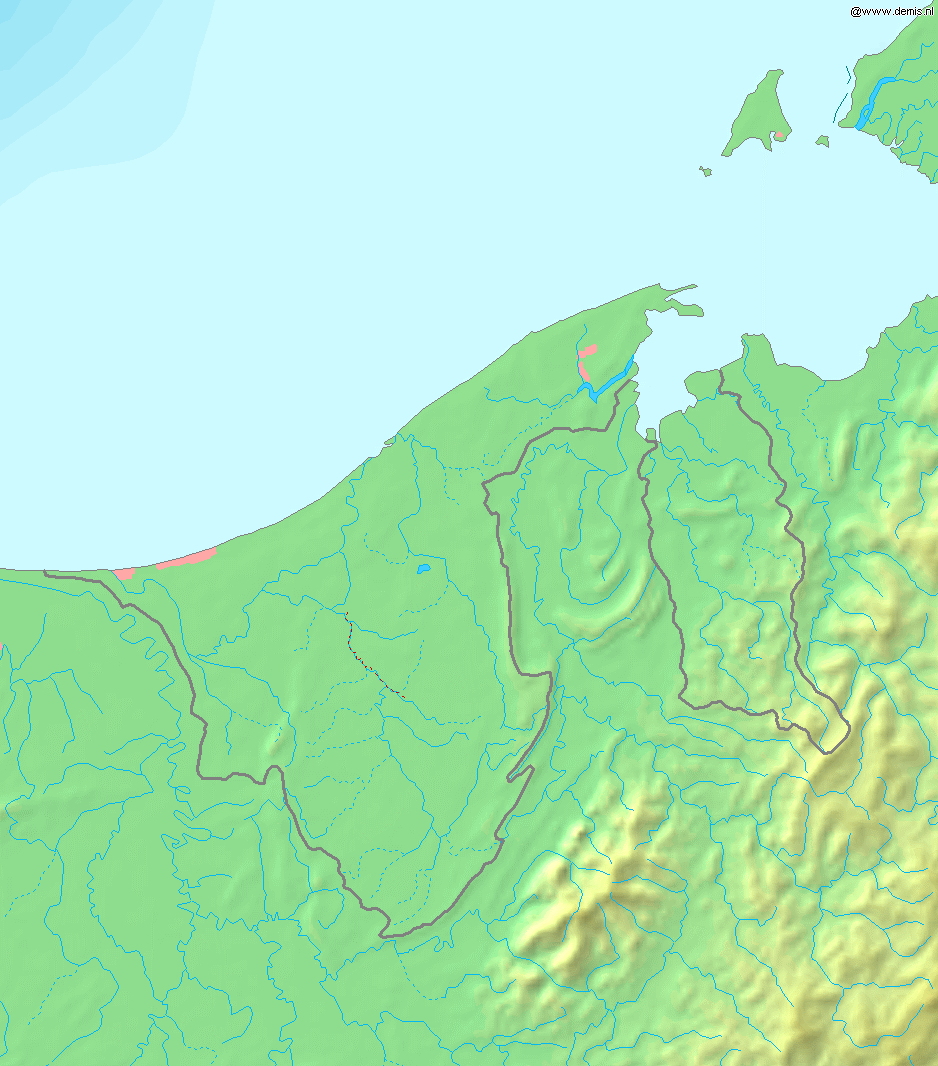
Deutsch: Topografische Karte von Brunei. Quadratische Plattkarte, Zentrum: 4°39′00″N 114°45′00″E / 4.65000°N 114.75000°E. Geographische Begrenzung der Karte:
English: Blank relief map of Brunei. Equirectangular projection centered at 4°39′00″N 114°45′00″E / 4.65000°N 114.75000°E. Geographic limits of the map:
Français : Carte du relief vierge du Brunei. Projection équirectangulaire centrée en 4°39′00″N 114°45′00″E / 4.65000°N 114.75000°E. Limites géographiques de la carte :
|
| తేదీ | |
| మూలం | స్వంత కృతి, using Demis data |
| కర్త | Mats Halldin (talk) |
లైసెన్సింగ్
This image is in the public domain because it came from the site https://www.demis.nl/products/web-map-server/examples/ and was released by the copyright holder. Permission is granted to copy, distribute and/or modify this map since it is based on free of copyright images from: www.demis.nl. See also approval email on de.wp and its clarification.
|
| This work has been released into the public domain' by its copyright holder, www.demis.nl. This applies worldwide. కొన్ని దేశాల్లో ఇది చట్టబద్ధంగా సాధ్యంకాకపోవచ్చు; అయితే: ఈ కృతిని ఎటువంటి షరతులు లేకుండా, అట్టి షరతులు చట్టం వల్ల తప్పనిసరి అయితే తప్ప, ఏ ఉద్దేశానికైనా ఉపయోగించుకునే హక్కును ఎవరికైనా www.demis.nl ప్రదానం చేస్తున్నారు.
|
ఫైలు చరితం
తేదీ/సమయం ను నొక్కి ఆ సమయాన ఫైలు ఎలా ఉండేదో చూడవచ్చు.
| తేదీ/సమయం | నఖచిత్రం | కొలతలు | వాడుకరి | వ్యాఖ్య | |
|---|---|---|---|---|---|
| ప్రస్తుత | 18:11, 20 డిసెంబరు 2006 | | 938 × 1,066 (238 KB) | Mats Halldin~commonswiki | Map of Brunei Bounding box West 114°, South 3.8°, East 115.5°, North 5.5°. Center at {{coor d|4.65000|N|114.75000|E|scale:1020000}}. {{demis-pd}} Category:Maps of Brunei |
లింకులు
కింది పేజీలలో ఈ ఫైలుకు లింకులు ఉన్నాయి:
సార్వత్రిక ఫైలు వాడుక
ఈ దస్త్రాన్ని ఈ క్రింది ఇతర వికీలు ఉపయోగిస్తున్నాయి:
- ar.wikipedia.org లో వాడుక
- az.wikipedia.org లో వాడుక
- bg.wikipedia.org లో వాడుక
- ca.wikipedia.org లో వాడుక
- en.wikipedia.org లో వాడుక
- ja.wikipedia.org లో వాడుక
- la.wikipedia.org లో వాడుక
- ms.wikipedia.org లో వాడుక
- pt.wikipedia.org లో వాడుక
- sq.wikipedia.org లో వాడుక
- th.wikipedia.org లో వాడుక
- uk.wikipedia.org లో వాడుక
- vep.wikipedia.org లో వాడుక
- zh-yue.wikipedia.org లో వాడుక
- zh.wikipedia.org లో వాడుక