దస్త్రం:Satara 1855.jpg
Jump to navigation
Jump to search

ఈ మునుజూపు పరిమాణం: 800 × 545 పిక్సెళ్ళు. ఇతర రిజల్యూషన్లు: 320 × 218 పిక్సెళ్ళు | 640 × 436 పిక్సెళ్ళు | 1,024 × 697 పిక్సెళ్ళు | 1,280 × 871 పిక్సెళ్ళు | 2,525 × 1,719 పిక్సెళ్ళు.
అసలు దస్త్రం (2,525 × 1,719 పిక్సెళ్ళు, ఫైలు పరిమాణం: 2.14 MB, MIME రకం: image/jpeg)
This is a file from the Wikimedia Commons. Information from its description page there is shown below. Commons is a freely licensed media file repository. You can help. |
సారాంశం
| Description |
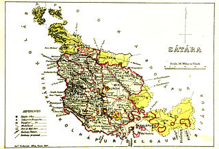
English: Map of Satara |
|||||||||
| తేదీ | ||||||||||
| మూలం | Gazetteer of the Bombay Presidency. (1896) by James M. Campbell | |||||||||
| స్రష్ట |
Various |
|||||||||
| Geotemporal data | ||||||||||
| Bounding box |
|
|||||||||
| Georeferencing | ||||||||||
లైసెన్సింగ్
|
This work is in the public domain in its country of origin and other countries and areas where the copyright term is the author's life plus 70 years or fewer. This work is in the public domain in the United States because it was published (or registered with the U.S. Copyright Office) before January 1, 1929. | |
| This file has been identified as being free of known restrictions under copyright law, including all related and neighboring rights. | |
ఫైలు చరితం
తేదీ/సమయం ను నొక్కి ఆ సమయాన ఫైలు ఎలా ఉండేదో చూడవచ్చు.
| తేదీ/సమయం | నఖచిత్రం | కొలతలు | వాడుకరి | వ్యాఖ్య | |
|---|---|---|---|---|---|
| ప్రస్తుత | 15:19, 5 నవంబరు 2014 | | 2,525 × 1,719 (2.14 MB) | Shyamal | User created page with UploadWizard |
లింకులు
కింది పేజీలలో ఈ ఫైలుకు లింకులు ఉన్నాయి:
సార్వత్రిక ఫైలు వాడుక
ఈ దస్త్రాన్ని ఈ క్రింది ఇతర వికీలు ఉపయోగిస్తున్నాయి:
- bn.wikipedia.org లో వాడుక
- en.wikipedia.org లో వాడుక
- pa.wikipedia.org లో వాడుక
- ta.wikipedia.org లో వాడుక