దస్త్రం:Trans-Alaska Pipeline System Luca Galuzzi 2005.jpg

అసలు దస్త్రం (2,000 × 1,333 పిక్సెళ్ళు, ఫైలు పరిమాణం: 1.71 MB, MIME రకం: image/jpeg)
This is a file from the Wikimedia Commons. Information from its description page there is shown below. Commons is a freely licensed media file repository. You can help. |
| వివరణ |
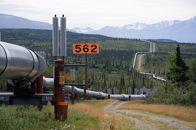
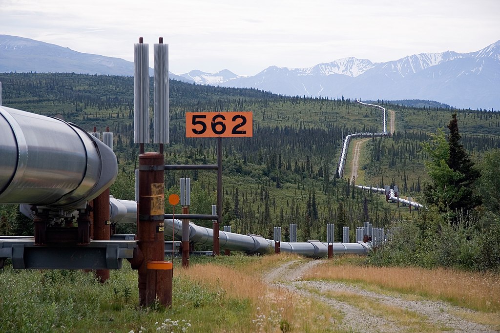
English: Trans-Alaska Pipeline System. It runs from the Arctic Ocean to the Gulf of Alaska at Valdez 800 miles (1,300 km)
Italiano: Oleodotto Trans-Alaska. Lunga 1,300 km va dall'Oceano Artico fino al Golfo dell'Alaska a Valdez
Nederlands: De Trans-Alaska pijplijn loopt 1300 km dwars door Alaska, van de Poolzee tot aan de Golf van Alaska bij Valdez. |
||
| తేదీ | |||
| మూలం | Photo taken by (Luca Galuzzi) * http://www.galuzzi.it | ||
| కర్త | Luca Galuzzi (Lucag) | ||
| అనుమతి (ఈ దస్త్రాన్ని పునర్వినియోగించుకోవడం) |
I, Luca Galuzzi, ఈ కృతి యొక్క కాపీహక్కుదారు, దీన్ని ఇందుమూలముగా ఈ లైసెన్సు క్రింద ప్రచురిస్తున్నారు: ఈ దస్త్రం క్రియేటివ్ కామన్స్ ఆపాదింపు-యథాతథ పంచుకోలు 2.5 సాధారణం లైసెన్సు క్రింద లభ్యం. ఆపాదింపు: I, Luca Galuzzi
|

| Camera location | | View this and other nearby images on: OpenStreetMap |
|---|
ఫైలు చరితం
తేదీ/సమయం ను నొక్కి ఆ సమయాన ఫైలు ఎలా ఉండేదో చూడవచ్చు.
| తేదీ/సమయం | నఖచిత్రం | కొలతలు | వాడుకరి | వ్యాఖ్య | |
|---|---|---|---|---|---|
| ప్రస్తుత | 23:40, 26 మే 2007 | | 2,000 × 1,333 (1.71 MB) | Lucag | {{Information |Description={{en|Trans-Alaska Pipeline System. It runs from the Arctic Ocean to the Gulf of Alaska at Valdez 800 miles (1,300 km)}} {{it|Oleodotto Trans-Alaska. Lunga 1,300 km va dall'Oceano Artico fino al Golfo dell'Alaska a Valdez}} |Sour |
లింకులు
ఈ ఫైలును వాడుతున్న పేజీలు లేవు.
సార్వత్రిక ఫైలు వాడుక
ఈ దస్త్రాన్ని ఈ క్రింది ఇతర వికీలు ఉపయోగిస్తున్నాయి:
- ar.wikipedia.org లో వాడుక
- as.wikipedia.org లో వాడుక
- bn.wikipedia.org లో వాడుక
- bs.wikipedia.org లో వాడుక
- cs.wikipedia.org లో వాడుక
- en.wikipedia.org లో వాడుక
- en.wikibooks.org లో వాడుక
- eo.wikipedia.org లో వాడుక
- es.wikipedia.org లో వాడుక
- et.wikipedia.org లో వాడుక
- eu.wikipedia.org లో వాడుక
- fa.wikipedia.org లో వాడుక
- fi.wikipedia.org లో వాడుక
- fr.wikipedia.org లో వాడుక
- fr.wikiversity.org లో వాడుక
- fy.wikipedia.org లో వాడుక
- he.wikipedia.org లో వాడుక
- hi.wikipedia.org లో వాడుక
- hu.wikipedia.org లో వాడుక
- hy.wikipedia.org లో వాడుక
- id.wikipedia.org లో వాడుక
ఈ దస్త్రపు మరింత సార్వత్రిక వాడుకను చూడండి.