జాతీయ రహదారి 69 (భారతదేశం): కూర్పుల మధ్య తేడాలు
Jump to navigation
Jump to search
Content deleted Content added
RahmanuddinBot (చర్చ | రచనలు) చి ఆంద్ర -> ఆంధ్ర |
చి →బయటి లింకులు: {{commons category|NH 4 (India)}} ? |
||
| పంక్తి 44: | పంక్తి 44: | ||
==బయటి లింకులు== |
==బయటి లింకులు== |
||
{{commons category|NH 4 (India)}} |
|||
*[http://www.nhai.org/NH4_Mumbai_Chennai_english.htm Map of NH4 from the National Highways Authority of India] |
*[http://www.nhai.org/NH4_Mumbai_Chennai_english.htm Map of NH4 from the National Highways Authority of India] |
||
*[http://www.mapsofindia.com/driving-directions-maps/nh4-driving-directions-map.html Detailed map at Maps of India-NH 4] |
*[http://www.mapsofindia.com/driving-directions-maps/nh4-driving-directions-map.html Detailed map at Maps of India-NH 4] |
||
00:30, 26 మార్చి 2018 నాటి కూర్పు
| జాతీయ రహదారి 69 | |
|---|---|
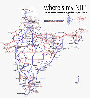
 Schematic map of Renumbered National Highways in India | |
| Major junctions | |
| పశ్చిమం end | కర్ణాటక సరిహద్దు |
| దక్షిణం end | చిత్తూరు రొడ్డు, ఆంధ్ర ప్రదేశ్ |
| Location | |
| Country | India |
| States | ఆంధ్ర ప్రదేశ్ |
| Primary destinations | రాయచూరు - ఉరవకొండ - అనంతపురం - మదనపల్లె - కృష్ణగిరి రొడ్డు |
| రహదారి వ్యవస్థ | |

జాతీయ రహదారి 69 (ఆంగ్లం: National Highway 69) (పాత సంఖ్య: జాతీయ రహదారి 4) భారతదేశంలో ప్రధానమైన రహదారి. ఇది కర్ణాటక సరిహద్దు మరియు ఆంధ్ర ప్రదేశ్లొని చిత్తూరు రొడ్డుతొ కలుపుతుంది.[1] ఈ రహదారి సంఖ్య జాతీయ రహదారి 4 నుండి 69 గా మార్చబడింది.[2]
రాష్ట్రాల వారి పొడవు
- ఆంధ్ర ప్రదేశ్ – 62.00 km (38.53 mi)[2]
దారి
- ఈ రహదారి మహారాష్ట్రలో బొంబాయి, పూణె మరియు కొల్హాపూర్ పట్టణాల ద్వారా ప్రయాణిస్తుంది.
- ఈ రహదారి కర్ణాటకలో బెల్గాం, ధర్వాడ్, హుబ్లీ, హవేరి, రాణెబెన్నూరు, హరిహర్, దావణగెరె, చిత్రదుర్గ, హిరియూర్, సిరా,తుంకూర్, బెంగుళూరు మరియు కోలార్ పట్టణాల ద్వారా ప్రయాణిస్తుంది.
- ఈ రహదారి ఆంధ్ర ప్రదేశ్ లోచిత్తూరు పట్టణం ద్వారా ప్రయాణిస్తుంది.
- ఈ రహదారి తమిళనాడులో వాలాజపేట, కాంచీపురం, శ్రీపెరంబుదూర్,పూనమల్లె మరియు చెన్నై ద్వారా ప్రయాణిస్తుంది.
కూడళ్ళు
- ఇది హుబ్లీ వద్ద ఎన్.హెచ్.63 తో కూడలి ఏర్పరుస్తుంది.
ఇవి కూడా చూడండి
మూలాలు
- ↑ "Rationalisation of Numbering Systems of National Highways" (PDF). New Delhi: Department of Road Transport and Highways. Retrieved 3 April 2012.
- ↑ 2.0 2.1 "List of National Highways passing through A.P. State". Roads and Buildings Department. Government of Andhra Pradesh. Retrieved 11 February 2016.
బయటి లింకులు
వికీమీడియా కామన్స్లో NH 4 (India)కి సంబంధించి దస్త్రాలు ఉన్నాయి.
