పసిఫిక్ మహాసముద్రం: కూర్పుల మధ్య తేడాలు
| పంక్తి 216: | పంక్తి 216: | ||
File:Los Molinos.JPG|దక్షిణ చిలీ సముద్రతీరంలోని లాస్ మోలినోస్ |
File:Los Molinos.JPG|దక్షిణ చిలీ సముద్రతీరంలోని లాస్ మోలినోస్ |
||
</gallery> |
</gallery> |
||
== Water characteristics == |
|||
[[File:Sunset Marina.JPG|thumb|right|Sunset in [[Monterey County, California]], U.S.]] |
|||
The volume of the Pacific Ocean, representing about 50.1 percent of the world's oceanic water, has been estimated at some {{convert|714|e6km3|e6cumi|sp=us|abbr=off}}.<ref>{{cite web|url=http://www.pwlf.org/pacific.htm |title=PWLF.org – The Pacific WildLife Foundation – The Pacific Ocean |accessdate=23 August 2013 |url-status=dead |archiveurl=https://web.archive.org/web/20120421015555/http://www.pwlf.org/pacific.htm |archivedate=21 April 2012 |df= }}</ref> Surface water temperatures in the Pacific can vary from {{convert|-1.4|°C|°F|abbr=on}}, the freezing point of sea water, in the poleward areas to about {{convert|30|°C|°F|abbr=on}} near the equator.<ref name="Mongillo2000">{{cite book|last=Mongillo|first=John F.|title=Encyclopedia of Environmental Science|url=https://books.google.com/books?id=ozAN5vLbssgC&pg=PA255|date=2000|publisher=University Rochester Press|isbn=978-1-57356-147-1|page=255}}</ref> [[Salinity]] also varies latitudinally, reaching a maximum of 37 parts per thousand in the southeastern area. The water near the equator, which can have a salinity as low as 34 parts per thousand, is less salty than that found in the mid-latitudes because of abundant equatorial precipitation throughout the year. The lowest counts of less than 32 parts per thousand are found in the far north as less evaporation of seawater takes place in these frigid areas.<ref>[http://www.britannica.com/EBchecked/topic/437703/Pacific-Ocean/36092/Salinity "Pacific Ocean: Salinity"], ''Encyclopædia Britannica''. Retrieved 9 June 2013.</ref> The motion of Pacific waters is generally clockwise in the [[Northern Hemisphere]] (the [[Ocean gyre|North Pacific gyre]]) and counter-clockwise in the [[Southern Hemisphere]]. The [[North Equatorial Current]], driven westward along [[15th parallel north|latitude 15°N]] by the [[trade winds]], turns north near the Philippines to become the warm Japan or [[Kuroshio Current]].<ref>[http://oceanmotion.org/html/background/equatorial-currents.htm "Wind Driven Surface Currents: Equatorial Currents Background"], Ocean Motion. Retrieved 9 June 2013.</ref> |
|||
Turning eastward at about [[45th parallel north|45°N]], the Kuroshio forks and some water moves northward as the [[Aleutian Current]], while the rest turns southward to rejoin the North Equatorial Current.<ref>[http://www.britannica.com/EBchecked/topic/325346/Kuroshio "Kuroshio"], ''Encyclopædia Britannica''. Retrieved 9 June 2013.</ref> The Aleutian Current branches as it approaches North America and forms the base of a counter-clockwise circulation in the [[Bering Sea]]. Its southern arm becomes the chilled slow, south-flowing [[California Current]].<ref>[http://www.britannica.com/EBchecked/topic/13933/Aleutian-Current "Aleutian Current"], ''Encyclopædia Britannica''. Retrieved 9 June 2013.</ref> The [[South Equatorial Current]], flowing west along the equator, swings southward east of [[New Guinea]], turns east at about [[50th parallel south|50°S]], and joins the main westerly circulation of the South Pacific, which includes the Earth-circling [[Antarctic Circumpolar Current]]. As it approaches the Chilean coast, the South Equatorial Current divides; one branch flows around [[Cape Horn]] and the other turns north to form the Peru or [[Humboldt Current]].<ref>[http://www.britannica.com/EBchecked/topic/437770/Pacific-South-Equatorial-Current "South Equatorial Current"], ''Encyclopædia Britannica''. Retrieved 9 June 2013.</ref> |
|||
== వెలుపలి లింకులు == |
== వెలుపలి లింకులు == |
||
13:23, 24 నవంబరు 2020 నాటి కూర్పు
భూమి మీద ఉన్న మహాసముద్రాలలో పసిఫిక్ మహాసముద్రం (Pacific Ocean) అతి పెద్దది. పోర్చుగీసు నావికుడు ఫెర్డినాండ్ మాగెల్లాన్ లాటిన్ భాషలో ఈ మహాసముద్రానికి "మేర్ పసిఫికమ్" Mare Pacificum అన్న పేరు సూచించాడు. ఈ పేరుకు "ప్రశాంతమైన సముద్రం" అని అర్థం.
పేరు వెనుక చరిత్ర
చరిత్రపూర్వ కాలం నుండి ఆసియా, ఓషియానియా ప్రజలు పసిఫిక్ మహాసముద్రంలో ప్రయాణించారు. స్పానిష్ అన్వేషకుడు వాస్కో నీజ్ డి బాల్బోవా 1513 లో పనామా ఇస్తమస్ను దాటి దక్షిణ పసిఫిక్ సముద్రాన్ని చూసి దానికి ఆయన " మార్ డెల్ సుర్ " (స్పానిష్ భాషలో) అని పేరు పెట్టాడు. 1521 లో స్పానిషు నావికులు ప్రపంచ ప్రదక్షిణ చేసిన సమయంలో బృందంలోని పోర్చుగీసు అన్వేషకుడు ఫెర్డినాండ్ మాగెల్లాన్ ఈ మహాసముద్రానికి ప్రస్తుత పేరును ఉపయోగించాడు. ఆయన సముద్రం చేరుకోవడానికి అనుకూలమైన గాలులను ఎదుర్కొన్నందున ఈ మహాసముద్రానికి ఆయన " మార్ పాసిఫికో " పేరు పెట్టాడు. పోర్చుగీసు, స్పానిషు రెండుభాషలలో మార్ పసిఫికో అనే పదానికి "ప్రశాంతమైన సముద్రం" అని అర్ధం.
పసిఫిక్ మహాసముద్రంలోని అతి పెద్ద సముద్రాలు
- ఆస్ట్రేలియన్ మెడిటరేనియన్ సముద్రం– 9.080 మిలియన్ల కి.మీ2
- ఫిలిప్పియన్ సముద్రం - 5.695 మిలియన్ల కి.మీ 2
- పగడపు సముద్రం – 4.791 మిలియన్ల కి.మీ 2
- దక్షిణ చైనా సముద్రం – 3.5 మిలియన్ల కి.మీ 2
- టాస్మన్ సముద్రం – 2.3 మిలియన్ల కి.మీ 2
- బెరింగు సముద్రం – 2 మిలియన్ల కి.మీ 2
- ఒకోట్సక్ సముద్రం – 1.583 మిలియన్ల కి.మీ 2
- అలాస్కాఖాతం – 1.533 మిలియన్ల కి.మీ 2
- తూర్పు చైనా సముద్రం – 1.249 మిలియన్ల కి.మీ 2
- మార్ డీ గ్రౌ – 1.14 మిలియన్ల కి.మీ 2
- జపాన్ సముద్రం – 978,000 కి.మీ2
- సాల్మన్ సముద్రం – 720,000 కి.మీ 2
- బండా సముద్రం – 695,000 కి.మీ 2
- అరాఫురా సముద్రం – 650,000 కి.మీ km2
- తిమూరు సముద్రం – 610,000 కి.మీ 2
- ఎల్లో సముద్రం – 380,000 కి.మీ 2
- జావా సముద్రం – 320,000 కి.మీ 2
- తాయిలాండు ఖాతం – 320,000 కి.మీ 2
- కార్పెంటరియా ఖాతం – 300,000 కి.మీ 2
- సెలెబ్స్ సముద్రం – 280,000 2
- సులు సముద్రం – 260,000 కి.మీ 2
- అనాడిర్ ఖాతం – 200,000 కి.మీ 2
- మొలుక్కా సముద్రం – 200,000 కి.మీ 2
- కలిఫోర్నియా ఖాతం – 160,000 కి.మీ 2
- టొంకిన్ ఖాతం – 126,250 కి.మీ 2
- హాల్మహేరా సముద్రం – 95,000 కి.మీ 2
- బొహై సముద్రం – 78,000 2
- బాలి సముద్రం – 45,000 కి.మీ 2
- బిస్మార్క్ సముద్రం – 40,000 కి.మీ 2
- సవు సముద్రం - 35,000 కి.మీ 2
- సెటో ద్వీపసముద్రం – 23,203 కి.మీ 2
- సెరం సముద్రం – 12,000 కి.మీ 2
భోగోళిక స్వరూపం
పసిఫిక్ మహాసముద్రం ఉత్తరాన ఆర్కిటిక్ వలయం నుండి దక్షిణాన అంటార్కిటిక్ ఖండం వరకు వ్యాపించి ఉంది. 169.2 మిలియన్ చదరపు కిలోమీటర్ల వైశాల్యంతో ఈ మహాసముద్రం భూవైశల్యంలో మొత్తంలో 32 శాతాన్ని, జలభాగంలో 46 శాతాన్ని ఆక్రమించింది. ఈ మహాసముద్ర వైశాల్యం మొత్తం అన్ని ఖండాలన్నిటి సమైక్య వైశాల్యం కన్నా ఎక్కువ. భూమధ్య రేఖకు ఇరువైపులా ఉన్న ఈ మహాసముద్రాన్ని ఉత్తర పసిఫిక్ సముద్రం, దక్షిణ పసిఫిక్ సముద్రాలుగా వ్యవహరిస్తారు. వాయువ్య పసిఫిక్ లో గల మరియానా అగడ్త భూమిపై అత్యంత లోతైన ప్రదేశం. ఈ ప్రదేశంయొక్క లోతు 10,911 మీటర్లు.భూమి పై ఉన్న అనీ అగ్ని పర్వతాలలోకీ అత్యంత చురుకైనవిగా పేరు బడ్డ అగ్నిపర్వతాలు పసిఫిక్ లోనే ఉన్నాయి. ఈ పర్వతాలు ఉన్న ప్రాంతానికి అగ్ని వలయమని పేరు. పసిఫిక్ ఉపరితల జలాలు సాధారణంగా ఉత్తరార్ధ గోళంలో సవ్యదిశలోనూ, దక్షిణార్ధ గోళంలో అపసవ్య దిశలోనూ ప్రవహిస్తాయి.
చరిత్ర

చరిత్రకు అందని రోజులలో పసిఫిక్ ప్రాంతంలో ప్రముఖమైన మానవ వలసలు జరిగాయి. వీటిలో ఆస్ట్రోనేషియన్లు, పొలినేషియన్ల వలసలు ముఖ్యమైనవని భావిస్తున్నారు. వీరు ఆసియా ఖండం నుండి తాహితి ద్వీపానికి, అక్కడ నుండి హవాయి, న్యూజిలాండ్ కు, ఆ తరువాత చాలా కాలానికి ఈస్టర్ ద్వీపానికి వలస వెళ్ళారు.
16వ శతాబ్దంలో యూరోపియన్లు ఈ సముద్రాన్ని తొలిసారి వీక్షించారు. తొలిసారిగా 1513 లో స్పెయిన్ నావికుడు వాస్కో న్యూనెజ్ డి బాల్బొవా తరువాత తన భూప్రదక్షిణంలో భాగంగా మాగెల్లాన్ (1519-1522) ఈ సముద్రం మీద ప్రయాణించారు.
ఐరోపా అన్వేషకులు


1512 లో ఐరోపా నావికులు ఆంటోనియో డి అబ్రూ , ఫ్రాన్సిస్కో సెర్రియో పసిఫిక్ మహాసముద్రం పశ్చిమ అంచులోని లెసెర్ సుండా దీవుల మీదుగా మలుకు దీవులకు చేరుకోవడంతో ఐరోపియా నావికుల పసిఫిక్ మహాసముద్ర అణ్వేషణ మొదలుకావడంతో పోర్చుగీస్ నావికుల పసిఫిక్ యాత్రలు కొనసాగాయి.[4][5] 1513 [6] 1513లో మలక్కా నుండి అఫోన్సో డి అల్బుకెర్కీ ఆదేశంతో జార్జ్ అల్వారెస్ దక్షిణ చైనాకు యాత్ర చేసాడు.
1513 లో స్పానిష్ అన్వేషకుడు వాస్కో నీజ్ డి బాల్బోవా తన అణ్వేషణలో భాగంగా మహాసముద్రం తూర్పు వైపుకు చేరుకున్నాడు. తరువాత ఆయన యాత్ర ఇస్తమస్ ఆఫ్ పనామా దాటి కొత్త సముద్రానికి చేరుకున్నాడు.[7] సముద్రం ఇస్త్ముస్ తీరానికి దక్షిణంగా ఉంది కనుక ఆయన దీనికి మార్ డెల్ సుర్ ("దక్షిణ సముద్రం" లేదా "దక్షిణ సముద్రం" అని పేరు పెట్టాడు). ఇది ఆయన మొదట పసిఫిక్ యాత్రగా గుర్తించబడింది.

16 నుండి 18 వ శతాబ్దాల వరకు పసిఫిక్ మహాసముద్రం అంతటా పెద్ద సంఖ్యలో స్పానిష్ యాత్రలను చూపించే మ్యాప్, అకాపుల్కో, మనీలా మధ్య మనీలా గాలెయన్ మార్గంతో సహా, చరిత్రలో మొట్టమొదటి పారదర్శక వాణిజ్య మార్గం.
స్పానిష్ నావికుల స్పైస్ దీవుల యాత్రలో భాగంగా 1520 లో ఫెర్డినాండ్ మాగెల్లాన్, ఆయన సిబ్బంది పసిఫిక్ మహాసంద్రాన్ని దాటారు. అలా వారు పసిఫిక్ మహాసముద్రాన్ని దాటిన నావికుల నమోదితచరిత్రలో మొదటివారుగా గుర్తించబడ్డారు. చివరికి ఈ యాత్ర మొదటి ప్రపంచ ప్రదక్షిణకు దారితీసింది. కేప్ హార్న్ నుండి తుఫానులతో కూడిన సముద్రాల మీదుగా ప్రయాణించిన తరువాత స్పానిష్ నావికులు ప్రశాంతమైన ఈ మహాసంద్ర జలాలను కనుగొన్నారు కనుక మాగెల్లాన్ ఈ సముద్రాన్ని పకాఫికో (లేదా "పసిఫిక్" అంటే "శాంతియుత" అని పిలుస్తారు) అని పిలిచాడు. 18వ శతాబ్దం వరకు ఆయన గౌరవార్థం ఈ సముద్రాన్ని మాగెల్లాన్ సముద్రం అని కూడా పిలిచారు.[8] 1521 మార్చిలో గువామ్లో ఆగే ముందు మాగెల్లాన్ జనావాసాలు లేని పసిఫిక్ ద్వీపంలో ఆగిపోయాడు.[9] 1521 లో మాగెల్లాన్ ఫిలిప్పీన్స్లో మరణించినప్పటికీ స్పానిష్ నావిగేటర్ జువాన్ సెబాస్టియన్ ఎల్కానో హిందూ మహాసముద్రం మీదుగా స్పెయిన్కు తిరిగి వెళ్లి కేప్ ఆఫ్ గుడ్ హోప్ చుట్టూ తిరుగుతూ 1522 లో మొదటి ప్రపంచ ప్రదక్షిణను పూర్తి చేశాడు. [10] 1525 - 1527 మధ్య మొలుకాస్ తూర్పున ప్రయాణించిన పోర్చుగీస్ యాత్రలు కరోలిన్ దీవులను,[11] అరు ద్వీపాలు,[12] పాపువా న్యూ గినియాలను కనుగొన్నారు.[13] 1542–43లో పోర్చుగీసువారు జపాన్కు కూడా చేరుకున్నారు.[14]
1564 లో మిగ్యుల్ లోపెజ్ డి లెగాజ్పి నేతృత్వంలో 379 మంది అన్వేషకులతో ఐదు స్పానిష్ నౌకలు మెక్సికో సముద్రం మీదుగా ఫిలిప్పీన్సు, మరియానా దీవులకు ప్రయాణించాయి.[15]తరువాత మిగిలిన 16 వ శతాబ్దం అంతటా స్పానిష్ ప్రభావం ప్రాముఖ్యత సంతరించుకుంది. స్పానిషు నావికులు మెక్సికో, పెరూ నుండి గువాం మీదుగా పసిఫిక్ మహాసముద్రం మీదుగా ప్రయాణించి ఫిలిప్పీన్స్కు చేరుకుని స్పానిషు ఈస్ట్ ఇండీసును స్థాపించారు. మనీలా గాలెయన్లు రెండున్నర శతాబ్దాలుగా మనీలా, అకాపుల్కోలను కలుపుతూ చరిత్రలో అతి పొడవైన వాణిజ్య మార్గాన్ని స్తాపించాయి. స్పానిషు యాత్రల ద్వారా నావికులు కుక్ దీవులు, సోలమన్ దీవులు, దక్షిణ పసిఫిక్ లోని అడ్మిరల్టీ ద్వీపాలు, టువాలు, మార్క్వాసాస్ కూడా కనుగొన్నారు.[16]
తరువాత టెర్రా ఆస్ట్రాలిస్ ("దక్షిణ భూమి") కోసం చేసిన అన్వేషణలో భాగంగా 17 వ శతాబ్దంలో పోర్చుగీస్ నావిగేటర్ పెడ్రో ఫెర్నాండెజ్ డి క్వీరెస్ నేతృత్వంలో స్పానిష్ అన్వేషణలు పిట్కెయిర్ను వనాటు ద్వీపసమూహాలను కనుగొన్నారు. తరువాత ఆస్ట్రేలియా, న్యూ గినియా మధ్య ఉన్న టోర్రెస్ జలసంధికి నావిగేటర్ లూయిస్ వాజ్ డి టోర్రెస్ పేరు పెట్టారు. డచ్ అన్వేషకులు, దక్షిణ ఆఫ్రికా చుట్టూ ప్రయాణించి వాణిజ్యంలో కూడా నిమగ్నమయ్యారు; విల్లెం జాన్స్జూన్, ఆస్ట్రేలియాలో (1606), కేప్ యార్క్ ద్వీపకల్పంలో[17] కాలుమోపి దానిని మొట్టమొదటిసారిగా నమోదుచేసాడు. 1642 లో అబెల్ జాన్స్జూన్ టాస్మాన్ అనే నావికుడు ప్రదక్షిణమార్గంలో ఆస్ట్రేలియా ఖండాంతర తీరంలో ప్రయాణించి చివరికి టాస్మానియా న్యూజిలాండ్లను కనుగొన్నాడు. [18]
16 - 17 వ శతాబ్దాలలో స్పెయిన్ పసిఫిక్ మహాసముద్రం ఒక " మరే క్లాజుగా " పరిగణించింది-ఇది ఇతర నావికా శక్తులకు మూసివేయబడిన సముద్రంగా ఉండేది. అట్లాంటిక్ నుండి తెలిసిన ఏకైక ప్రవేశ ద్వారంలా ఉండే మాగెల్లాన్ జలసంధిలో ఇతర నావికులు ప్రవేశించకుండా స్పానిష్ నౌకాదళాలు పహరాకాసింది. డచ్ పసిఫిక్ మహాసముద్రం పశ్చిమ భాగంలో స్పానిషు ఫిలిప్పీంసును బెదిరించింది. [19]
18 వ శతాబ్దం డానిషు రష్యన్ నావికాదళ అధికారి " విటస్ బెరింగు " నేతృత్వంలో మొదటి కమ్చట్కా యాత్ర చేసి తరువాత గ్రేట్ నార్తర్ను ఎక్స్పెడిషన్ అని పేర్కొనబడిన అలస్కా, అలూటియన్ దీవుల అన్వేషణకు రష్యన్లు నాంది పలికారు. స్పెయిన్ పసిఫిక్ నార్త్వెస్ట్కు దండయాత్రలు పంపి, దక్షిణ కెనడాలోని వాంకోవర్ ద్వీపం, అలాస్కాకు చేరుకుంది. ఫ్రెంచి వారు పాలినేషియాను అన్వేషించి అక్కడే వారు స్థిరపడ్డారు. బ్రిటిషు వారు జేమ్స్ కుక్ నాయకత్వంలో దక్షిణ పసిఫిక్, ఆస్ట్రేలియా, హవాయి, ఉత్తర అమెరికా పసిఫిక్ వాయువ్య ప్రాంతాలకు మూడు ప్రయాణాలు చేశారు. 1768 లో పియరీ-ఆంటోయిన్ వూరాన్ యువ ఖగోళ శాస్త్రవేత్త లూయిస్ ఆంటోయిన్ డి బౌగెన్విల్లేతో కలిసి చేసిన అన్వేషణలో చరిత్రలో మొదటిసారిగా ఖచ్చితత్వంతో పసిఫిక్ సముద్ర వెడల్పు కొలతను కనుగొన్నాడు.[20] 1789–1794 స్పెయిన్ చేసిన శాస్త్రీయ అన్వేషణ ప్రారంభ ప్రయాణాలలో భాగంగా మాలాస్పినా యాత్రలో ఒకదానిని నిర్వహించింది. ఈ యాత్రలో నావికులు కేప్ హార్న్ నుండి అలాస్కా, గువాం, ఫిలిప్పీన్స్, న్యూజిలాండ్, ఆస్ట్రేలియా, దక్షిణ పసిఫిక్ వంటి విస్తారమైన పసిఫిక్ ప్రాంతాలకు ప్రయాణించారు. [16]
కొత్త సాంరాజ్యవాదం
_over_the_Marianas_Trench,_23_January_1960_(NH_96797).jpg)
19 వ శతాబ్దంలో పెరుగుతున్న సామ్రాజ్యవాదం ఫలితంగా ఐరోపా శక్తులు, జపాన్, అమెరికా సమ్యుక్తరాష్ట్రాలు ఓషినియాను ఆక్రమించాయి. 1830 లలో హెచ్ఎంఎస్ బీగల్ సముద్రయానాల ద్వారా చార్లెస్ డార్విన్;[21] 1870 లలో హెచ్ఎంఎస్ ఛాలెంజర్;[22] యుఎస్ఎస్ టుస్కరోరా (1873–76);[23]జర్మన్ గజెల్. (1874–76) ఒషియానోగ్రాఫిక్ విఙానం వెలుగులోకి వచ్చింది.[24]

ఓషియానియాలో వరుసగా 1842 - తాహితీ 1853 లో న్యూ కాలెడోనియా ప్రొటెక్టరేట్లను తయారు చేసిన తరువాత ఈ ప్రాంతంలో ఫ్రాన్సు ఒక సామ్రాజ్య శక్తిగా ప్రముఖ స్థానాన్ని పొందింది.[25] 1875 - 1887 లలో చిలీ నావికాదళ అధికారి పోలికార్పో టోరో ఈస్టరు ద్వీపానికి నావికాదళ సందర్శనలు చేసిన తరువాత 1888 లో స్థానిక రాపానుయ్తో ఈ ద్వీపాన్ని చిలీలో చేర్చడానికి చర్చలు జరిపారు. ఈస్టరు ద్వీపాన్ని ఆక్రమించడం ద్వారా చిలీ సామ్రాజ్య దేశాలలో ఒకటైంది.[26]: 53 1900 నాటికి దాదాపు పసిఫిక్ ద్వీపాలు అన్నీ బ్రిటన్, ఫ్రాన్స్, యునైటెడ్ స్టేట్స్, జర్మనీ, జపాన్, చిలీపై నియంత్రణలో ఉన్నాయి.[25]
1898 లో స్పెయిన్ నుండి అమెరికా సమ్యుక్తరాష్ట్రాలు గువాం, ఫిలిప్పీన్సు మీద నియంత్రణ సాధించినప్పటికీ[27] 1914 నాటికి జపాన్ పశ్చిమ పసిఫిక్లో ఎక్కువ భాగాన్ని నియంత్రిస్తూ పసిఫిక్ యుద్ధంలో అనేక ఇతర ద్వీపాలను ఆక్రమించింది; అయినప్పటికీ ఆ యుద్ధం ముగిసే సమయానికి, జపాన్ ఓడిపోయింది. యు.ఎస్. పసిఫిక్ ఫ్లీట్ సముద్రం వర్చువల్ మాస్టరు అయింది. జపానీస్ పాలిత ఉత్తర మరియానా దీవులు అమెరికా సమ్యుక్తరాష్ట్రాల నియంత్రణలోకి వచ్చాయి.[28] రెండవ ప్రపంచ యుద్ధం ముగిసినప్పటి నుండి, పసిఫిక్ లోని అనేక పూర్వ కాలనీలు స్వతంత్ర రాష్ట్రాలుగా మారాయి.
భౌగోళికం

పసిఫిక్ మహాసముద్రం ఆసియా, ఆస్ట్రేలియాను అమెరికా నుండి వేరు చేస్తుంది. భూమధ్యరేఖ ఆధారంగా దీనిని ఉత్తర (ఉత్తర పసిఫిక్), దక్షిణ (దక్షిణ పసిఫిక్) భాగాలుగా విభజించవచ్చు. ఇది దక్షిణాన అంటార్కిటిక్ ప్రాంతం నుండి ఉత్తరాన ఆర్కిటిక్ వరకు విస్తరించి ఉంది. [29] 16,52,00,000 కిమీ 2 (63,800,000 చదరపు మైళ్ళు) విస్తీర్ణం కలిగిన పసిఫిక్ మహాసముద్రం భూమి ఉపరితలంలో మూడింట ఒక వంతును కలిగి ఆక్రమించి ఉంది. - ఇది భూమి మొత్తం భూభాగం విస్త్రీర్ణం కంటే అధికం. పసిఫిక్ మహాసముద్రం మొత్తం విస్త్రీర్ణం 15,00,00,000 కిమీ 2 (58,000,000 చదరపు మైళ్ళు).[30]
ఆర్కిటిక్లోని బెరింగ్ సముద్రం నుండి సర్క్యూపోలార్ దక్షిణ మహాసముద్రం ఉత్తరాన 60 ° దక్షిణంలో సుమారు 15,500 కిమీ (9,600 మైళ్ళు) వరకు విస్తరించి (పాత నిర్వచనాలు దీనిని అంటార్కిటికా రాస్ సముద్రం వరకు విస్తరిస్తాయి) పసిఫిక్ అత్యధిక తూర్పు-పడమర వెడల్పుకు చేరుకుంటుంది 5 ° ఉత్తర అక్షాంశంలో ఇండోనేషియా నుండి కొలంబియా తీరంలో సుమారు 19,800 కిమీ (12,300 మైళ్ళు) విస్తరించి ఉంది. ప్రపంచవ్యాసంలో ఇది సగం అలాగే చంద్రుని వ్యాసం కంటే ఐదు రెట్లు ఎక్కువ.[31] అతి తక్కువ పాయింట్-మరియానా ట్రెంచ్-సముద్ర మట్టానికి 10,911 మీ (35,797 అడుగులు; 5,966 ఫాథమ్స్) ఉంది. దీని సగటు లోతు 4,280 మీ (14,040 అడుగులు), మొత్తం నీటి పరిమాణం సుమారు 71,00,00,000 క్యూబిక్ కిమీ 3 (17,00,00,000 క్యూబిక్ మై) ఉంది. వద్ద ఉంచుతుంది.[29]
ప్లేట్ టెక్టోనిక్స్ ప్రభావాల కారణంగా ప్రస్తుతం పసిఫిక్ మహాసముద్రం వార్షికంగా మూడు వైపులా సుమారు 2.5 సెం.మీ (1 అంగుళాలు) కుంచించుకుపోతోంది. సంవత్సరానికి సగటున 0.52 చదరపు కిమీ 2 (0.20 చదరపు మైళ్ళు). దీనికి విరుద్ధంగా అట్లాంటిక్ మహాసముద్రం పరిమాణం విస్తరిస్తుంది.[32][33]
పసిఫిక్ మహాసముద్రం పశ్చిమ అంచులలో అనేక క్రమరహిత సముద్రాలు ఉన్నాయి. వీటిలో అతిపెద్దవైన సెలెబ్స్ సముద్రం, పగడపు సముద్రం, తూర్పు చైనా సముద్రం (తూర్పు సముద్రం), ఫిలిప్పీన్ సముద్రం, జపాన్ సముద్రం, దక్షిణ చైనా సముద్రం (దక్షిణ సముద్రం), సులు సముద్రం, టాస్మాన్ సముద్రం, పసుపు సముద్రం (కొరియా పశ్చిమ సముద్రం) ఉన్నాయి. ఇండోనేషియా సముద్రమార్గం (మలక్కా జలసంధి, టోర్రెస్ జలసంధితో సహా) పసిఫిక్, హిందూ మహాసముద్రంలో పశ్చిమాన కలుస్తుంది. డ్రేక్ పాసేజ్, మాగెల్లాన్ జలసంధి పసిఫిక్ మహాసముద్రాన్ని తూర్పున అట్లాంటిక్ మహాసముద్రంతో కలుపుతాయి. ఉత్తరాన, బేరింగ్ జలసంధి పసిఫిక్ మహాసముద్రాన్ని ఆర్కిటిక్ మహాసముద్రంతో కలుపుతుంది.[34]
పసిఫిక్ 180 వ మెరిడియన్ తరువాత పశ్చిమ పసిఫిక్ (లేదా ఆసియాకు సమీపంలో పశ్చిమ పసిఫిక్) తూర్పు అర్ధగోళంలో ఉంది. తూర్పు పసిఫిక్ (లేదా తూర్పు పసిఫిక్, అమెరికాకు సమీపంలో) పశ్చిమ అర్ధగోళంలో ఉంది.[35]
దక్షిణ పసిఫిక్ మహాసముద్రం ఆస్ట్రేలియా దక్షిణం దాటి ఆగ్నేయ ఇండియన్ రిడ్జ్ క్రాసింగ్ను పసిఫిక్-అంటార్కిటిక్ రిడ్జ్ (దక్షిణ ధ్రువానికి ఉత్తరం) గా మారుస్తుంది. తరువాత మరొక తీరం (దక్షిణ అమెరికాకు దక్షిణాన) విలీనం అయ్యి తూర్పు పసిఫిక్ రైజ్ను ఏర్పరుస్తూ ఇది జువాన్ డి ఫుకా రిడ్జ్ (ఉత్తర అమెరికాకు దక్షిణాన)ను కూడా కలుపుతుంది.
ఫిలిప్పైన్ తీరంలోని " మగెల్లాన్ జసంధి " సముద్రయాత్రలో అణ్వేషకుడు ఈ మహాసముద్రం ప్రశాంతంగా ఉంటుంది. అయినప్పటికీ పసిఫిక్ మహాసముద్రం ఎప్పుడూ ప్రశాంతంగా ఉంటుంది. ఎనేక ఉష్ణమండల తుఫానులు పసిఫిక్ ద్వీపాలలో విధ్వశం సృష్టిస్తుంది.[36] పసిఫిక్ రిం చుట్టూ ఉండే అనేక అగ్నిపర్వతాల కారణంగా ఈ ప్రాంతంలో భూకంపాలు సంభవిస్తుంటాయి.[37]జలాంతర్భాగంలో సంభవించే భూకంపాల కారణంగా సునామీ సంభవించి కొన్ని నగరాలలో విధ్వంశం సృష్టించింది.[38]
మాగెల్లాన్ జలసంధి నుండి ఫిలిప్పీన్స్ వరకు మాగెల్లాన్ చేసిన చాలా ప్రయాణాలకు, అన్వేషకుడు వాస్తవానికి సముద్రాన్ని ప్రశాంతంగా ః లో మార్టిన్ వాల్డ్సీమల్లర్ మ్యాప్ మొదటిసారిగా అమెరికా ఖండాలను వేరుచేసే రెండు విభిన్న మహాసముద్రాలను చూపించింది.[39] 1529 నాటి డియోగో రిబీరో మ్యాప్మొదటిసారిగా పసిఫిక్ను సరైన పరిమాణంలో చూపించింది. మొదటిది.[40]
తీరంలో ఉన్న దేశాలు - భూభాగాలు


సార్వభౌమదేశాలు
- ఆస్ట్రేలియా
- బ్రూనై
- కంబోడియా
- కెనడా
- చిలీ
- చైనా
- కొలంబియా
- కుక్ ద్వీపాలు
- కోస్టారికా
- ఈక్వడార్
- ఎల్ సాల్వడార్
- ఫెడరేటెడ్ స్టేట్స్ ఆఫ్ మైక్రోనేషియా
- ఫిజీ
- గౌతమాలా
- హొండూరస్
- ఇండోనేషియా
- జపాన్
- కిరిబతి
- మలేషియా
- మార్షల్ ద్వీపాలు
- మెక్సికో
- నౌరు
- New Zealand
- నికరగువా
- నియూ
- ఉత్తరకొరియా
- పాలౌ
- పనామా
- పపుయా న్యూగినియా
- పెరూ
- ఫిలిప్పైంస్
- రష్యా
- సమో
- సిగపూర్
- సోలొమన్ ద్వీపాలు
- ఉత్తర కొరియా
- తైవాన్
- తాయ్లాండ్
- తమూరు-లెస్తె
- టోంగా
- తువలు
- అమెరికా సమ్యుక్తరాష్ట్రాలు
- వనౌయాటు
- వియత్నాం
భూభాగాలు
- అమెరికన్ సామొ (యు.ఎస్)
- బేకర్ ద్వీపాలు (యు.ఎస్)
- క్లిప్పర్టన్ ద్వీపాలు (ఫ్రాంసు)
- కోరల్ సముద్రద్వీపాలు (ఆస్ట్రేలియా)
- ఫ్రెంచి పాలినేషియా (ఫ్రాంసు)
- గుయాం (యు.ఎస్)
- హాంగ్ కింగ్ (చైనా)
- హాలాండ్ ద్వీపాలు (యు.ఎస్)
- జావిస్ ద్వీపాలు (యు.ఎస్)
- జాంస్టన్ ద్వీపాలు (యు.ఎస్)
- కింగ్మాన్ రీఫ్ (యు.ఎస్)
- మాకౌ (చైనా)
- మిడ్వే (యు.ఎస్)
- న్యూ కలెడోనియా (ఫ్రాంస్)
- నార్ఫోల్క్ ద్వీపాలు (ఆస్ట్రేలియా)
- ఉత్తర మరియానా ద్వీపాలు (యు.ఎస్)
- పాల్మియారా (యు.ఎస్)
- పికైర్న్ ద్వీపాలు (యు.కె)
- టోక్యూ (న్యూజీలాండ్)
- వాలిస్ & ఫుటూనా (ఫ్రాంసు)
- వేక్ ద్వీపాలు (యు.ఎస్)
భూఖండాలు - ద్వీపాలు

పసిఫిక్ మహాసముద్రంలో ప్రపంచంలోని అనేక ద్వీపాలు ఉన్నాయి. పసిఫిక్ మహాసముద్రంలో సుమారు 25,000 ద్వీపాలు ఉన్నాయి.[41][42][43] పూర్తిగా పసిఫిక్ మహాసముద్రంలో ఉన్న ద్వీపాలను మైక్రోనేషియా, మెలనేషియా, పాలినేషియా అని పిలువబడే మూడు ప్రధాన సమూహాలుగా విభజించారు. భూమధ్యరేఖకు ఉత్తరం, అంతర్జాతీయ కాలరేఖకు పశ్చిమంలో ఉన్న మైక్రోనేషియాలో, వాయువ్య దిశలో మరియానా దీవులు, మధ్యలో ఉన్న కరోలిన్ దీవులు, తూర్పున మార్షల్ దీవులు, ఆగ్నేయంలో కిరిబాటి ద్వీపాలు ఉన్నాయి.[44][45]
నైరుతి దిశలో ఉన్న మెలానేసియాలో న్యూజినియా పపంచంలో రెండవ అతిపెద్ద ద్వీపం (గ్రీన్లాండు తరువాత)గానూ పసిఫిక్ ద్వీపాలలో అతిపెద్దదిగానూ గుర్తించబడుతుంది. ఉత్తరం నుండి దక్షిణం మెలనేసియన్ సమూహాలు బిస్మార్కు ద్వీపసమూహం, సోలమన్ దీవులు, శాంటా క్రజ్, వనాటు, ఫిజి, న్యూ కాలెడోనియా వంటి ఇతర ద్వీపసమూహాలు ఉన్నాయి.[46]
అతిపెద్ద ప్రాంతం అయిన పాలినేషియా ఉత్తరాన హవాయి నుండి దక్షిణాన న్యూజిలాండ్ వరకు విస్తరించి ఉంది. వీటి చుట్టూ తువాలు, టోకెలావ్, సమోవా, టోంగా, పశ్చిమాన కెర్మాడెక్ దీవులు, కుక్ దీవులు, సొసైటీ దీవులు, ఆస్ట్రేలియా ద్వీపాలు ఉన్నాయి. తూర్పున మార్క్వాస్ దీవులు, తుయామోటు, మంగరేవా దీవులు, ఈస్టర్ ద్వీపం ఉన్నాయి.[47]
పసిఫిక్ మహాసముద్రంలోని ద్వీపాలు నాలుగు ప్రాథమిక రకాలు: ఖండాంతర ద్వీపాలు, ఎత్తైన ద్వీపాలు, పగడపు దిబ్బలు, ఉద్ధరించబడిన పగడపు వేదికలు. కాంటినెంటల్ ద్వీపాలు ఆండసైట్ రేఖకు వెలుపల ఉన్నాయి. వీటిలో భాగంగా న్యూ గినియా, న్యూజిలాండ్ ద్వీపాలు, ఫిలిప్పీన్స్ ఉన్నాయి. నిర్మాణాత్మకంగా ఈ ద్వీపాలలో కొన్ని సమీప ఖండాలతో సంబంధం కలిగి ఉన్నాయి. ఎత్తైన ద్వీపాలు అగ్నిపర్వత మూలంతో చైతన్యవంతమైన అగ్నిపర్వతాలు ఉన్నాయి. వీటిలో బౌగెన్విల్లే, హవాయి, సోలమన్ దీవులు భాగంగా ఉన్నాయి.[48]
దక్షిణ పసిఫిక్ పగడపు దిబ్బలు సముద్రపు ఉపరితలం క్రింద బసాల్టిక్ లావా ప్రవాహాల లోతట్టు నిర్మాణాలు ఉన్నాయి. ఈశాన్య ఆస్ట్రేలియాకు దూరంగా ఉన్న గ్రేట్ బారియర్ రీఫ్ పాచెస్ గొలుసులతో బంధీకృతమై ఉంది. పగడంతో ఏర్పడిన రెండవ ద్వీపం రకం ఎత్తైన పగడపు దిబ్బగా ఉండి సాధారణంగా లోతట్టు పగడపు ద్వీపాల కంటే కొంచెం పెద్దదిగా ఉంటుంది. ఫ్రెంచ్ పాలినేషియా తుయామోటు సమూహంలో బనాబా (గతంలో ఓషన్ ద్వీపం), మకాటియా ఉన్నాయి.[49][50]
-
 చోకో నేచురల్ రీజన్లోని " లాడిరిల్లెరోస్ " సముద్రతీరం.
 -
 పాయింట్ రేయెస్ హెడ్లాండ్స్,పాయింట్ రేయాస్ నేషనల్ సీ షోర్ (కలిఫోర్నియా)
 -
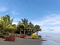
 తహునా మారు ద్వీపబిందువు
 -
 దక్షిణ చిలీ సముద్రతీరంలోని లాస్ మోలినోస్


Water characteristics

The volume of the Pacific Ocean, representing about 50.1 percent of the world's oceanic water, has been estimated at some 714 million cubic kilometers (171 million cubic miles).[51] Surface water temperatures in the Pacific can vary from −1.4 °C (29.5 °F), the freezing point of sea water, in the poleward areas to about 30 °C (86 °F) near the equator.[52] Salinity also varies latitudinally, reaching a maximum of 37 parts per thousand in the southeastern area. The water near the equator, which can have a salinity as low as 34 parts per thousand, is less salty than that found in the mid-latitudes because of abundant equatorial precipitation throughout the year. The lowest counts of less than 32 parts per thousand are found in the far north as less evaporation of seawater takes place in these frigid areas.[53] The motion of Pacific waters is generally clockwise in the Northern Hemisphere (the North Pacific gyre) and counter-clockwise in the Southern Hemisphere. The North Equatorial Current, driven westward along latitude 15°N by the trade winds, turns north near the Philippines to become the warm Japan or Kuroshio Current.[54]
Turning eastward at about 45°N, the Kuroshio forks and some water moves northward as the Aleutian Current, while the rest turns southward to rejoin the North Equatorial Current.[55] The Aleutian Current branches as it approaches North America and forms the base of a counter-clockwise circulation in the Bering Sea. Its southern arm becomes the chilled slow, south-flowing California Current.[56] The South Equatorial Current, flowing west along the equator, swings southward east of New Guinea, turns east at about 50°S, and joins the main westerly circulation of the South Pacific, which includes the Earth-circling Antarctic Circumpolar Current. As it approaches the Chilean coast, the South Equatorial Current divides; one branch flows around Cape Horn and the other turns north to form the Peru or Humboldt Current.[57]
వెలుపలి లింకులు
|
| ||||||||||||||||||||||||
| ప్రపంచ ఖండాలు కూడా చూడండి | |||||||||||||||||||||||||
- ↑ https://www.livescience.com/29533-the-worlds-biggest-oceans-and-seas.html
- ↑ https://www.worldatlas.com/
- ↑ http://listofseas.com/
- ↑ Hannard, Willard A. (1991). Indonesian Banda: Colonialism and its Aftermath in the Nutmeg Islands. Bandanaira: Yayasan Warisan dan Budaya Banda Naira. p. 7.
- ↑ Milton, Giles (1999). Nathaniel's Nutmeg. London: Sceptre. pp. 5, 7. ISBN 978-0-340-69676-7.
- ↑ Porter, Jonathan. (1996). Macau, the Imaginary City: Culture and Society, 1557 to the Present. Westview Press. ISBN 0-8133-3749-6
- ↑ Ober, Frederick Albion (2010). Vasco Nuñez de Balboa. Library of Alexandria. p. 129. ISBN 978-1-4655-7034-5.
- ↑ Camino, Mercedes Maroto. Producing the Pacific: Maps and Narratives of Spanish Exploration (1567–1606), p. 76. 2005.
- ↑ Guampedia entry on Ferdinand Magellan| url = https://www.guampedia.com/ferdinand-magellan/
- ↑ "Life in the sea: Pacific Ocean" [dead link], Oceanário de Lisboa. Retrieved 9 June 2013.
- ↑ Galvano, Antonio (2004) [1563]. The Discoveries of the World from Their First Original Unto the Year of Our Lord 1555, issued by the Hakluyt Society. Kessinger Publishing. p. 168. ISBN 978-0-7661-9022-1.
- ↑ Kratoska, Paul H. (2001). South East Asia, Colonial History: Imperialism before 1800, Volume 1 de South East Asia, Colonial History. Taylor & Francis. pp. 52–56.[1]
- ↑ Whiteway, Richard Stephen (1899). The rise of Portuguese power in India, 1497–1550. Westminster: A. Constable. p. 333.
- ↑ Steven Thomas, "Portuguese in Japan". Steven's Balagan. 25 April 2006. Retrieved 22 May 2015.
- ↑ Henderson, James D.; Delpar, Helen; Brungardt, Maurice Philip; Weldon, Richard N. (2000). A Reference Guide to Latin American History. M.E. Sharpe. p. 28. ISBN 978-1-56324-744-6.
- ↑ 16.0 16.1 Fernandez-Armesto, Felipe (2006). Pathfinders: A Global History of Exploration. W.W. Norton & Company. pp. 305–307. ISBN 978-0-393-06259-5.
- ↑ J.P. Sigmond and L.H. Zuiderbaan (1979) Dutch Discoveries of Australia.Rigby Ltd, Australia. pp. 19–30 ISBN 0-7270-0800-5
- ↑ Primary Australian History: Book F [B6] Ages 10–11. R.I.C. Publications. 2008. p. 6. ISBN 978-1-74126-688-7.
- ↑ Lytle Schurz, William (1922), "The Spanish Lake", The Hispanic American Historical Review, 5 (2): 181–194, doi:10.2307/2506024, JSTOR 2506024
- ↑ Williams, Glyndwr (2004). Captain Cook: Explorations And Reassessments. Boydell Press. p. 143. ISBN 978-1-84383-100-6.
- ↑ Marty, Christoph. "Charles Darwin's Travels on the HMS Beagle". Scientific American (in ఇంగ్లీష్). Retrieved 23 March 2018.
- ↑ "The Voyage of HMS Challenger". www.interactiveoceans.washington.edu. Retrieved 23 March 2018.
- ↑ A Synopsis of the Cruise of the U.S.S. "Tuscarora": From the Date of Her Commission to Her Arrival in San Francisco, Cal. Sept. 2d, 1874 (in ఇంగ్లీష్). Cosmopolitan printing Company. 1874.
- ↑ Johnston, Keith (1881). "A Physical, Historical, Political, & Descriptive Geography". Nature (in ఇంగ్లీష్). 22 (553): 95. Bibcode:1880Natur..22Q..95.. doi:10.1038/022095a0. S2CID 4070183.
- ↑ 25.0 25.1 Bernard Eccleston, Michael Dawson. 1998. The Asia-Pacific Profile. Routledge. p. 250.
- ↑ William Sater, Chile and the United States: Empires in Conflict, 1990 by the University of Georgia Press, ISBN 0-8203-1249-5
- ↑ Tewari, Nita; Alvarez, Alvin N. (2008). Asian American Psychology: Current Perspectives. CRC Press. p. 161. ISBN 978-1-84169-749-9.
- ↑ The Covenant to Establish a Commonwealth of the Northern Mariana Islands in Political Union With the United States of America, మూస:USStatute
- ↑ 29.0 29.1 ఉల్లేఖన లోపం: చెల్లని
<ref>ట్యాగు;ebcఅనే పేరుగల ref లలో పాఠ్యమేమీ ఇవ్వలేదు - ↑ "Area of Earth's Land Surface", The Physics Factbook. Retrieved 9 June 2013.
- ↑ Nuttall, Mark (2005). Encyclopedia of the Arctic: A-F. Routledge. p. 1461. ISBN 978-1-57958-436-8.
- ↑ "Plate Tectonics". Bucknell University. Archived from the original on 25 February 2014. Retrieved 9 June 2013.
- ↑ Young, Greg (2009). Plate Tectonics. Capstone. p. 9. ISBN 978-0-7565-4232-0.
- ↑ International Hydrographic Organization (1953). "Limits of Oceans and Seas". Nature. 172 (4376): 484. Bibcode:1953Natur.172R.484.. doi:10.1038/172484b0. S2CID 36029611.
- ↑ Agno, Lydia (1998). Basic Geography. Goodwill Trading Co., Inc. p. 25. ISBN 978-971-11-0165-7.
- ↑ "Pacific Ocean: The trade winds", Encyclopædia Britannica. Retrieved 9 June 2013.
- ↑ Shirley Rousseau Murphy (1979). The Ring of Fire. Avon. ISBN 978-0-380-47191-1.
- ↑ Bryant, Edward (2008). Tsunami: The Underrated Hazard. Springer. p. 26. ISBN 978-3-540-74274-6.
- ↑ "The Map That Named America". www.loc.gov. Retrieved 3 December 2014.
- ↑ Ribero, Diego, Carta universal en que se contiene todo lo que del mundo se ha descubierto fasta agora / hizola Diego Ribero cosmographo de su magestad, ano de 1529, e[n] Sevilla, W. Griggs, retrieved 30 September 2017
- ↑ K, Harsh (19 March 2017). "This ocean has most of the islands in the world". Mysticalroads. Archived from the original on 2 August 2017. Retrieved 6 April 2017.
- ↑ Ishihara, Masahide; Hoshino, Eiichi; Fujita, Yoko (2016). Self-determinable Development of Small Islands (in ఇంగ్లీష్). Springer. p. 180. ISBN 978-981-10-0132-1.
- ↑ United States. National Oceanic and Atmospheric Administration; Western Pacific Regional Fishery Management Council (2009). Toward an Ecosystem Approach for the Western Pacific Region: from Species-based Fishery Management Plans to Place-based Fishery Ecosystem Plans: Environmental Impact Statement (in ఇంగ్లీష్). Evanston, IL: Northwestern University. p. 60.
- ↑ Academic American encyclopedia. Grolier Incorporated. 1997. p. 8. ISBN 978-0-7172-2068-7.
- ↑ Lal, Brij Vilash; Fortune, Kate (2000). The Pacific Islands: An Encyclopedia. University of Hawaii Press. p. 63. ISBN 978-0-8248-2265-1.
- ↑ West, Barbara A. (2009). Encyclopedia of the Peoples of Asia and Oceania. Infobase Publishing. p. 521. ISBN 978-1-4381-1913-7.
- ↑ Dunford, Betty; Ridgell, Reilly (1996). Pacific Neighbors: The Islands of Micronesia, Melanesia, and Polynesia. Bess Press. p. 125. ISBN 978-1-57306-022-6.
- ↑ Gillespie, Rosemary G.; Clague, David A. (2009). Encyclopedia of Islands. University of California Press. p. 706. ISBN 978-0-520-25649-1.
- ↑ "Coral island", Encyclopædia Britannica. Retrieved 22 June 2013.
- ↑ "Nauru", Charting the Pacific. Retrieved 22 June 2013.
- ↑ "PWLF.org – The Pacific WildLife Foundation – The Pacific Ocean". Archived from the original on 21 April 2012. Retrieved 23 August 2013.
- ↑ Mongillo, John F. (2000). Encyclopedia of Environmental Science. University Rochester Press. p. 255. ISBN 978-1-57356-147-1.
- ↑ "Pacific Ocean: Salinity", Encyclopædia Britannica. Retrieved 9 June 2013.
- ↑ "Wind Driven Surface Currents: Equatorial Currents Background", Ocean Motion. Retrieved 9 June 2013.
- ↑ "Kuroshio", Encyclopædia Britannica. Retrieved 9 June 2013.
- ↑ "Aleutian Current", Encyclopædia Britannica. Retrieved 9 June 2013.
- ↑ "South Equatorial Current", Encyclopædia Britannica. Retrieved 9 June 2013.