దస్త్రం:Bodensee satellit.jpg
Jump to navigation
Jump to search

ఈ మునుజూపు పరిమాణం: 800 × 496 పిక్సెళ్ళు. ఇతర రిజల్యూషన్లు: 320 × 198 పిక్సెళ్ళు | 640 × 397 పిక్సెళ్ళు | 1,024 × 635 పిక్సెళ్ళు | 1,394 × 864 పిక్సెళ్ళు.
అసలు దస్త్రం (1,394 × 864 పిక్సెళ్ళు, ఫైలు పరిమాణం: 224 KB, MIME రకం: image/jpeg)
This is a file from the Wikimedia Commons. Information from its description page there is shown below. Commons is a freely licensed media file repository. You can help. |
సారాంశం
| వివరణ |
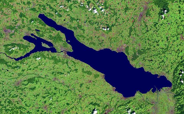
Deutsch: Satellitenaufnahme vom Bodensee |
| తేదీ | before 17 ఆగస్టు 2005 |
| మూలం | from NASA World Wind - Free Satellite Image |
| కర్త | NASA |
సారాంశం
| This image is in the public domain because it is a screenshot from NASA’s globe software World Wind using a public domain layer, such as Blue Marble, MODIS, Landsat, SRTM, USGS or GLOBE.
|
 |
ఫైలు చరితం
తేదీ/సమయం ను నొక్కి ఆ సమయాన ఫైలు ఎలా ఉండేదో చూడవచ్చు.
| తేదీ/సమయం | నఖచిత్రం | కొలతలు | వాడుకరి | వ్యాఖ్య | |
|---|---|---|---|---|---|
| ప్రస్తుత | 15:28, 1 డిసెంబరు 2005 | | 1,394 × 864 (224 KB) | Wiki-vr | enhanced |
| 00:44, 17 ఆగస్టు 2005 |  | 1,394 × 864 (138 KB) | APPER | * Satellitenaufnahme vom Bodensee * from Nasa World Wind - Free Satellite Image {{PD-USGov}} |
లింకులు
కింది పేజీలలో ఈ ఫైలుకు లింకులు ఉన్నాయి:
సార్వత్రిక ఫైలు వాడుక
ఈ దస్త్రాన్ని ఈ క్రింది ఇతర వికీలు ఉపయోగిస్తున్నాయి:
- af.wikipedia.org లో వాడుక
- als.wikipedia.org లో వాడుక
- arz.wikipedia.org లో వాడుక
- az.wikipedia.org లో వాడుక
- ba.wikipedia.org లో వాడుక
- bg.wikipedia.org లో వాడుక
- bs.wikipedia.org లో వాడుక
- ceb.wikipedia.org లో వాడుక
- da.wikipedia.org లో వాడుక
- de.wikipedia.org లో వాడుక
- Bodensee
- Benutzer:Itta
- Mainau
- Reichenau (Insel)
- Benutzer:Rhinux
- Hoy (Bodensee)
- Werd (Bodensee)
- Benutzer:Marcel601
- Benutzer:Ralfonso
- Seerhein
- Benutzer:Trinityfolium
- Benutzer:Vorlage/Herkunftsvorlagen
- Benutzer:NicolasK
- Benutzer:Sir.toby
- Benutzer:Manerr
- Benutzer:NetCuRLi
- Galgeninsel
- Benutzer:Vorlage/vom Bodensee
- Benutzer:Shippo~dewiki
- Benutzer:Mkt.berlin88
- Benutzer:Mk-fn
- Benutzer:Widipedia
- Benutzer:Zollernalb
- Portal:Ungarn/Quiz
- Benutzer:Manu-LA
- Benutzer:Vorlage/Herkunftsvorlagen/Baden-Württemberg
- Benutzer:Vorlage/Herkunftsvorlagen/Bayern
- Bodensee-Rundweg
- Benutzer:TwilightFreak
- Benutzer:Master baerr
- Benutzer:MP Trixi
- Benutzer:Weber Mi
- Benutzer:Hintze
- Benutzer:KMJagger
- Benutzer:Sweet Chily
- Benutzer:Maasty
- Benutzer:Rudolf von Rheinfelden/Labor/Artikelbaustelle 2
ఈ దస్త్రపు మరింత సార్వత్రిక వాడుకను చూడండి.