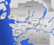
దస్త్రం:GVA-map.png
Jump to navigation
Jump to search

ఈ మునుజూపు పరిమాణం: 724 × 600 పిక్సెళ్ళు. ఇతర రిజల్యూషన్లు: 290 × 240 పిక్సెళ్ళు | 579 × 480 పిక్సెళ్ళు | 846 × 701 పిక్సెళ్ళు.
అసలు దస్త్రం (846 × 701 పిక్సెళ్ళు, ఫైలు పరిమాణం: 223 KB, MIME రకం: image/png)
ఫైలు చరితం
తేదీ/సమయం ను నొక్కి ఆ సమయాన ఫైలు ఎలా ఉండేదో చూడవచ్చు.
| తేదీ/సమయం | నఖచిత్రం | కొలతలు | వాడుకరి | వ్యాఖ్య | |
|---|---|---|---|---|---|
| ప్రస్తుత | 21:07, 2 జనవరి 2007 |  | 846 × 701 (223 KB) | Qyd | pale sea |
| 20:25, 2 జనవరి 2007 |  | 846 × 701 (231 KB) | Qyd | {{Information |Description=Blank map of the Greater Vancouver Area, [[British Columbia, Canada |Source=GIS data |Date=Jan 2007 |Author={{User|Qyd}} |Permission=All |other_versions=Image:Greater Vancouver Area.png (with municipalities names) } |
లింకులు
ఈ ఫైలును వాడుతున్న పేజీలు లేవు.
సార్వత్రిక ఫైలు వాడుక
ఈ దస్త్రాన్ని ఈ క్రింది ఇతర వికీలు ఉపయోగిస్తున్నాయి:
- ar.wikipedia.org లో వాడుక
- en.wikipedia.org లో వాడుక
- eo.wikipedia.org లో వాడుక
- fa.wikipedia.org లో వాడుక
- الگو:Location map Canada Vancouver
- فرودگاه بینالمللی آبی ونکوور
- الگو:Location map Canada Vancouver/توضیحات
- الگو:Location map Canada Vancouver/doc
- بیمارستان زنان و مرکز سلامت بی.سی.
- موزه مردمشناسی دانشگاه بریتیش کلمبیا
- مترو ونکوور
- انگلیش بی، ونکوور
- پل لاینز گیت
- گستاون
- گالری هنر ونکوور
- متروتاون، برنابی
- رنفرو–کولینگوود
- fr.wikipedia.org లో వాడుక
- id.wikipedia.org లో వాడుక
- ja.wikipedia.org లో వాడుక
- kn.wikipedia.org లో వాడుక
- pl.wikipedia.org లో వాడుక
ఈ దస్త్రపు మరింత సార్వత్రిక వాడుకను చూడండి.


