దస్త్రం:Karta FP Societe isl.PNG
Jump to navigation
Jump to search
మరింత స్పష్టమైన బొమ్మ లేదు.
Karta_FP_Societe_isl.PNG (450 × 400 పిక్సెళ్ళు, ఫైలు పరిమాణం: 6 KB, MIME రకం: image/png)
This is a file from the Wikimedia Commons. Information from its description page there is shown below. Commons is a freely licensed media file repository. You can help. |
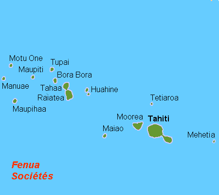
సారాంశం
| వివరణ |
Deutsch: Karte der Gesellschaftsinseln, Französisch Polynesien
English: Map (rough) of the Society Islands, French Polynesia, own work composed from various mapreferences
Svenska: Karta över Sällskapsöarna, Franska Polynesien |
| తేదీ | |
| మూలం | స్వంత కృతి |
| కర్త | Hobe / Holger Behr |
లైసెన్సింగ్
| నేను, ఈ కృతి యొక్క కాపీహక్కుదారుని, ఈ కృతిని సార్వజనీనం'గా విడుదల చేస్తున్నాను. ఇది ప్రపంచవ్యాప్తంగా వర్తిస్తుంది. కొన్ని దేశాల్లో ఇది చట్టబద్ధంగా సాధ్యంకాకపోవచ్చు; అయితే: ఈ కృతిని ఎటువంటి షరతులు లేకుండా, అట్టి షరతులు చట్టం వల్ల తప్పనిసరి అయితే తప్ప, ఏ ఉద్దేశానికైనా ఉపయోగించుకునే హక్కును ఎవరికైనా నేను ప్రదానం చేస్తున్నాను. |

|
This locator map image could be re-created using vector graphics as an SVG file. This has several advantages; see Commons:Media for cleanup for more information. If an SVG form of this image is available, please upload it and afterwards replace this template with
{{vector version available|new image name}}.
It is recommended to name the SVG file “Karta FP Societe isl.svg”—then the template Vector version available (or Vva) does not need the new image name parameter. |
ఫైలు చరితం
తేదీ/సమయం ను నొక్కి ఆ సమయాన ఫైలు ఎలా ఉండేదో చూడవచ్చు.
| తేదీ/సమయం | నఖచిత్రం | కొలతలు | వాడుకరి | వ్యాఖ్య | |
|---|---|---|---|---|---|
| ప్రస్తుత | 13:08, 21 ఏప్రిల్ 2007 | | 450 × 400 (6 KB) | Hobe | karta Societeisl FP, Holger Behr, own work |
లింకులు
ఈ ఫైలును వాడుతున్న పేజీలు లేవు.
సార్వత్రిక ఫైలు వాడుక
ఈ దస్త్రాన్ని ఈ క్రింది ఇతర వికీలు ఉపయోగిస్తున్నాయి:
- af.wikipedia.org లో వాడుక
- ar.wikipedia.org లో వాడుక
- bg.wikipedia.org లో వాడుక
- bn.wikipedia.org లో వాడుక
- br.wikipedia.org లో వాడుక
- ca.wikipedia.org లో వాడుక
- ckb.wikipedia.org లో వాడుక
- cs.wikipedia.org లో వాడుక
- da.wikipedia.org లో వాడుక
- de.wikipedia.org లో వాడుక
- de.wikivoyage.org లో వాడుక
- el.wikipedia.org లో వాడుక
- en.wikipedia.org లో వాడుక
- Raiatea
- Tetiꞌaroa
- Windward Islands (Society Islands)
- Maupiti
- Motu One (Society Islands)
- Society Islands
- Maiao
- Maupihaa
- Mehetia
- Wikipedia:Graphics Lab/Map workshop/Archive/Dec 2011
- Wikipedia:Graphics Lab/Map workshop/Archive/May 2012
- Wikipedia:Graphics Lab/Map workshop/Archive/Jul 2012
- The Brando Resort
- Society Islands tropical moist forests
- eo.wikipedia.org లో వాడుక
ఈ దస్త్రపు మరింత సార్వత్రిక వాడుకను చూడండి.