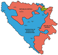
దస్త్రం:Map Bih entities.png
Jump to navigation
Jump to search

ఈ మునుజూపు పరిమాణం: 633 × 599 పిక్సెళ్ళు. ఇతర రిజల్యూషన్లు: 254 × 240 పిక్సెళ్ళు | 507 × 480 పిక్సెళ్ళు | 811 × 768 పిక్సెళ్ళు | 1,103 × 1,044 పిక్సెళ్ళు.
అసలు దస్త్రం (1,103 × 1,044 పిక్సెళ్ళు, ఫైలు పరిమాణం: 67 KB, MIME రకం: image/png)
ఫైలు చరితం
తేదీ/సమయం ను నొక్కి ఆ సమయాన ఫైలు ఎలా ఉండేదో చూడవచ్చు.
| తేదీ/సమయం | నఖచిత్రం | కొలతలు | వాడుకరి | వ్యాఖ్య | |
|---|---|---|---|---|---|
| ప్రస్తుత | 21:38, 6 జూలై 2010 |  | 1,103 × 1,044 (67 KB) | PANONIAN | Reverted to version as of 23:51, 12 March 2010 - I do not agree that these are better colours. it is subjective opinion and it is bad idea that every user should upload new file version because he have different opinion about "better" colours |
| 12:26, 6 జూలై 2010 |  | 1,103 × 1,044 (58 KB) | Mostarac | better colors | |
| 12:25, 6 జూలై 2010 |  | 1,103 × 1,044 (58 KB) | Mostarac | better colors and cities. | |
| 23:51, 12 మార్చి 2010 |  | 1,103 × 1,044 (67 KB) | Dungodung | Well, I beg to differ. This one shows cities and is of better quality | |
| 11:55, 9 మార్చి 2010 |  | 700 × 615 (172 KB) | Mostarac | revert, bolje boje! | |
| 21:10, 20 డిసెంబరు 2009 |  | 1,103 × 1,044 (67 KB) | PANONIAN | improved version | |
| 08:05, 16 జూలై 2007 |  | 700 × 615 (13 KB) | Nihad Hamzic | This image was once a JPEG, the author had simply directly converted it to JPEG. I have grealty optimised its size by removing JPEG artifacts, and reducing color domain. | |
| 22:42, 28 జనవరి 2006 |  | 700 × 615 (172 KB) | (:Julien:) | Map of the 2 entities of the BiH and the Brčko district, author: en:User:PANONIAN, source: en:Image:M_bih03.png, PANONIAN is the creator and released it under PD. Category:Bosnia and Herzegovina |
లింకులు
కింది పేజీలలో ఈ ఫైలుకు లింకులు ఉన్నాయి:
సార్వత్రిక ఫైలు వాడుక
ఈ దస్త్రాన్ని ఈ క్రింది ఇతర వికీలు ఉపయోగిస్తున్నాయి:
- af.wikipedia.org లో వాడుక
- ami.wikipedia.org లో వాడుక
- am.wikipedia.org లో వాడుక
- arc.wikipedia.org లో వాడుక
- ar.wikipedia.org లో వాడుక
- arz.wikipedia.org లో వాడుక
- ast.wikipedia.org లో వాడుక
- az.wikipedia.org లో వాడుక
- bat-smg.wikipedia.org లో వాడుక
- be-tarask.wikipedia.org లో వాడుక
- bi.wikipedia.org లో వాడుక
- bjn.wikipedia.org లో వాడుక
- bn.wikipedia.org లో వాడుక
- bo.wikipedia.org లో వాడుక
- bpy.wikipedia.org లో వాడుక
- br.wikipedia.org లో వాడుక
- bs.wikipedia.org లో వాడుక
- ca.wikipedia.org లో వాడుక
- ceb.wikipedia.org లో వాడుక
- ce.wikipedia.org లో వాడుక
- ckb.wikipedia.org లో వాడుక
- co.wikipedia.org లో వాడుక
- crh.wikipedia.org లో వాడుక
- csb.wikipedia.org లో వాడుక
- cs.wikipedia.org లో వాడుక
- cs.wikinews.org లో వాడుక
- cv.wikipedia.org లో వాడుక
- cy.wikipedia.org లో వాడుక
- da.wikipedia.org లో వాడుక
- de.wikipedia.org లో వాడుక
- diq.wikipedia.org లో వాడుక
- dv.wikipedia.org లో వాడుక
- ee.wikipedia.org లో వాడుక
- el.wikipedia.org లో వాడుక
- en.wikipedia.org లో వాడుక
- Bosnia and Herzegovina
- History of Bosnia and Herzegovina
- Multinational state
- Republika Srpska (1992–1995)
- Inter-Entity Boundary Line
- Talk:Inter-Entity Boundary Line
- Portal:Bosnia and Herzegovina
- User:Jonny-mt/Gallery of current first-level administrative country subdivisions maps
- Politics of country subdivisions
- Talk:Federation of Bosnia and Herzegovina/Archive 1
- en.wikivoyage.org లో వాడుక
ఈ దస్త్రపు మరింత సార్వత్రిక వాడుకను చూడండి.


