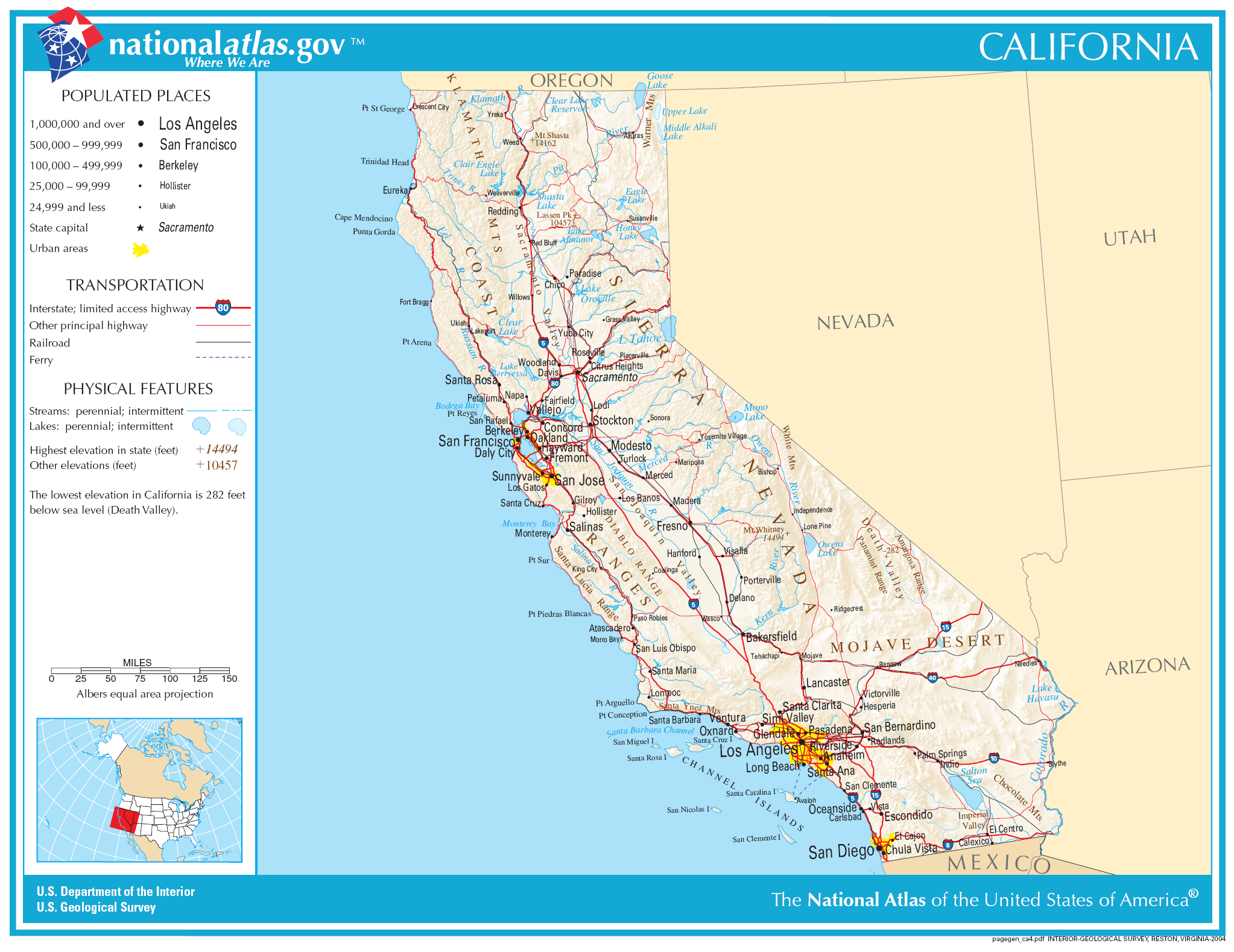
దస్త్రం:Map of California NA.png
Jump to navigation
Jump to search
ఈ మునుజూపు పరిమాణం: 777 × 600 పిక్సెళ్ళు. ఇతర రిజల్యూషన్లు: 311 × 240 పిక్సెళ్ళు | 622 × 480 పిక్సెళ్ళు | 995 × 768 పిక్సెళ్ళు | 1,280 × 988 పిక్సెళ్ళు | 2,046 × 1,579 పిక్సెళ్ళు.
అసలు దస్త్రం (2,046 × 1,579 పిక్సెళ్ళు, ఫైలు పరిమాణం: 1.48 MB, MIME రకం: image/png)
This is a file from the Wikimedia Commons. Information from its description page there is shown below. Commons is a freely licensed media file repository. You can help. |
సారాంశం
| వివరణ | |
| తేదీ | |
| మూలం | |
| కర్త | National Atlas of the United States |
| అనుమతి (ఈ దస్త్రాన్ని పునర్వినియోగించుకోవడం) |
Public domain |
లైసెన్సింగ్
This map was obtained from an edition of the National Atlas of the United States. Like almost all works of the U.S. federal government, works from the National Atlas are in the public domain in the United States.
Online access: NationalAtlas.gov | 1970 print edition: Library of Congress, Perry-Castañeda Library
|
ఫైలు చరితం
తేదీ/సమయం ను నొక్కి ఆ సమయాన ఫైలు ఎలా ఉండేదో చూడవచ్చు.
| తేదీ/సమయం | నఖచిత్రం | కొలతలు | వాడుకరి | వ్యాఖ్య | |
|---|---|---|---|---|---|
| ప్రస్తుత | 06:34, 30 నవంబరు 2006 | | 2,046 × 1,579 (1.48 MB) | Jengod | Crop to reduce excess whitespace on border |
| 20:19, 14 ఆగస్టు 2006 |  | 2,122 × 1,640 (1.55 MB) | Huebi~commonswiki | {{Information| |Description=Map of Valifornia |Source=[http://www.nationalatlas.gov National Atlas] }} Category:Maps of the United States Category:Maps of California {{PD-USGov-Atlas}} |
లింకులు
కింది పేజీలలో ఈ ఫైలుకు లింకులు ఉన్నాయి:
సార్వత్రిక ఫైలు వాడుక
ఈ దస్త్రాన్ని ఈ క్రింది ఇతర వికీలు ఉపయోగిస్తున్నాయి:
- als.wikipedia.org లో వాడుక
- be-tarask.wikipedia.org లో వాడుక
- bh.wikipedia.org లో వాడుక
- ca.wikipedia.org లో వాడుక
- de.wikipedia.org లో వాడుక
- en.wikipedia.org లో వాడుక
- eo.wikipedia.org లో వాడుక
- fa.wikipedia.org లో వాడుక
- fo.wikipedia.org లో వాడుక
- hi.wikipedia.org లో వాడుక
- hsb.wikipedia.org లో వాడుక
- hu.wikipedia.org లో వాడుక
- id.wikipedia.org లో వాడుక
- ilo.wikipedia.org లో వాడుక
- incubator.wikimedia.org లో వాడుక
- it.wikipedia.org లో వాడుక
- ja.wikipedia.org లో వాడుక
ఈ దస్త్రపు మరింత సార్వత్రిక వాడుకను చూడండి.