దస్త్రం:Meghalaya locator map.svg
Jump to navigation
Jump to search

ఈ ఫైలు SVG కు చెందిన ఈ మునుజూపు PNG పరిమాణం: 734 × 600 పిక్సెళ్ళు. ఇతర రిజల్యూషన్లు: 294 × 240 పిక్సెళ్ళు | 587 × 480 పిక్సెళ్ళు | 940 × 768 పిక్సెళ్ళు | 1,253 × 1,024 పిక్సెళ్ళు | 2,506 × 2,048 పిక్సెళ్ళు | 2,393 × 1,956 పిక్సెళ్ళు.
అసలు దస్త్రం (SVG ఫైలు, నామమాత్రంగా 2,393 × 1,956 పిక్సెళ్ళు, ఫైలు పరిమాణం: 260 KB)
This is a file from the Wikimedia Commons. Information from its description page there is shown below. Commons is a freely licensed media file repository. You can help. |
| శీర్షిక |
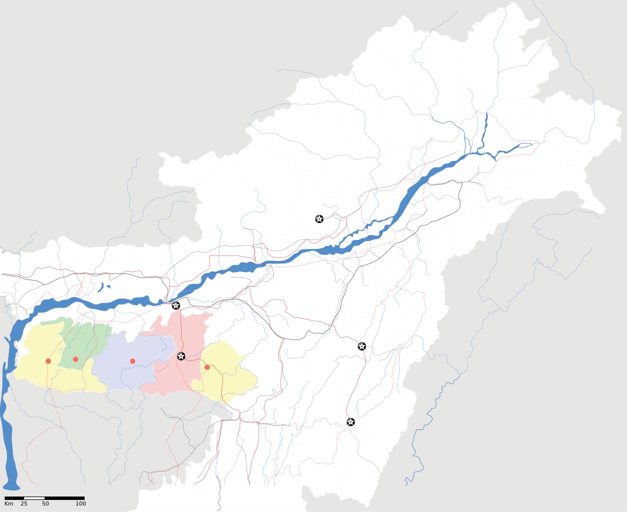
Meghalaya locator Map |
| Description |
Map of w:Meghalaya with road and rail lines. Equirectangular projection. Geographic limits of the map: top=29.49, bottom=23.74, left=89.61, right=97.52. |
| తేదీ | |
| మూలం |
స్వంత కృతి |
| స్రష్ట | |
| అనుమతి (ఈ దస్త్రాన్ని పునర్వినియోగించుకోవడం) |
నేను, ఈ కృతి యొక్క కాపీహక్కుదారుని, దీన్ని ఈ లైసెన్సు క్రింద ఇందుమూలముగా ప్రచురిస్తున్నాను: ఈ దస్త్రం క్రియేటివ్ కామన్స్ Attribution-Share Alike 3.0 Unported లైసెన్సు క్రింద లభ్యం.
|
| Geotemporal data | |
| Date depicted | second half of 20 century, 21 century |
| Georeferencing | If inappropriate please set warp_status = skip to hide. |
| Archival data | |
| గమనికలు | Part of WikiProject India Maps |
ఫైలు చరితం
తేదీ/సమయం ను నొక్కి ఆ సమయాన ఫైలు ఎలా ఉండేదో చూడవచ్చు.
| తేదీ/సమయం | నఖచిత్రం | కొలతలు | వాడుకరి | వ్యాఖ్య | |
|---|---|---|---|---|---|
| ప్రస్తుత | 18:56, 16 ఏప్రిల్ 2007 | | 2,393 × 1,956 (260 KB) | Planemad | {{WikiProject_India_Maps |Title=Meghalaya locator Map |Description=Map of w:Meghalaya with road and rail lines |Source= [http://www.iitg.ernet.in/rcilts/assam_political.jpg IIT Guwahati - Assam Political map] |Date=April 2007 |Author=[[w:user:Planemad |
లింకులు
కింది పేజీలలో ఈ ఫైలుకు లింకులు ఉన్నాయి:
సార్వత్రిక ఫైలు వాడుక
ఈ దస్త్రాన్ని ఈ క్రింది ఇతర వికీలు ఉపయోగిస్తున్నాయి:
- ar.wikipedia.org లో వాడుక
- ast.wikipedia.org లో వాడుక
- as.wikipedia.org లో వాడుక
- ba.wikipedia.org లో వాడుక
- bn.wikipedia.org లో వాడుక
- bs.wikipedia.org లో వాడుక
- ceb.wikipedia.org లో వాడుక
- de.wikipedia.org లో వాడుక
- es.wikipedia.org లో వాడుక
- fa.wikipedia.org లో వాడుక
- gu.wikipedia.org లో వాడుక
- hif.wikipedia.org లో వాడుక
- hi.wikipedia.org లో వాడుక
- hr.wikipedia.org లో వాడుక
- id.wikipedia.org లో వాడుక
- ja.wikipedia.org లో వాడుక
- kbd.wikipedia.org లో వాడుక
- ml.wikipedia.org లో వాడుక
- ms.wikipedia.org లో వాడుక
- new.wikipedia.org లో వాడుక
- nl.wikipedia.org లో వాడుక
- or.wikipedia.org లో వాడుక
- pam.wikipedia.org లో వాడుక
ఈ దస్త్రపు మరింత సార్వత్రిక వాడుకను చూడండి.