దస్త్రం:Map of federal subjects of Russia (2022), disputed Crimea and Donbass.svg
Jump to navigation
Jump to search

ఈ ఫైలు SVG కు చెందిన ఈ మునుజూపు PNG పరిమాణం: 512 × 282 పిక్సెళ్ళు. ఇతర రిజల్యూషన్లు: 320 × 176 పిక్సెళ్ళు | 640 × 353 పిక్సెళ్ళు | 1,024 × 564 పిక్సెళ్ళు | 1,280 × 705 పిక్సెళ్ళు | 2,560 × 1,410 పిక్సెళ్ళు.
అసలు దస్త్రం (SVG ఫైలు, నామమాత్రంగా 512 × 282 పిక్సెళ్ళు, ఫైలు పరిమాణం: 827 KB)
This is a file from the Wikimedia Commons. Information from its description page there is shown below. Commons is a freely licensed media file repository. You can help. |
,_disputed_Crimea_and_Donbass.svg)

|
The boundaries on this map show the de facto situation. This is just one of several different views on the subject (see COM:NPOV). |
సారాంశం
| వివరణ |
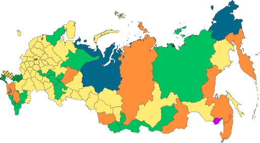
English: Copy of File:Map of federal subjects of Russia (2022).svg with disputed annexed Ukrainian territories indicated with diagonal stripes |
| తేదీ | |
| మూలం |
This file was derived from : Map of federal subjects of Russia 2014, disputed Crimea.svg |
| కర్త | Mzajac, Ltbubbas |
.svg)
లైసెన్సింగ్
| This map is ineligible for copyright and therefore in the public domain, because it consists entirely of information that is common property and contains no original authorship. For more information, see Commons:Threshold of originality § Maps.
|
ఫైలు చరితం
తేదీ/సమయం ను నొక్కి ఆ సమయాన ఫైలు ఎలా ఉండేదో చూడవచ్చు.
| తేదీ/సమయం | నఖచిత్రం | కొలతలు | వాడుకరి | వ్యాఖ్య | |
|---|---|---|---|---|---|
| ప్రస్తుత | 19:48, 4 అక్టోబరు 2022 | | 512 × 282 (827 KB) | Techso01 | Uploaded a work by Mzajac, Ltbubbas from {{derived from|Map of federal subjects of Russia (2014), disputed Crimea.svg}} with UploadWizard |
లింకులు
ఈ ఫైలును వాడుతున్న పేజీలు లేవు.
సార్వత్రిక ఫైలు వాడుక
ఈ దస్త్రాన్ని ఈ క్రింది ఇతర వికీలు ఉపయోగిస్తున్నాయి:
- ab.wikipedia.org లో వాడుక
- ar.wikipedia.org లో వాడుక
- ast.wikipedia.org లో వాడుక
- be.wikipedia.org లో వాడుక
- cs.wikipedia.org లో వాడుక
- de.wikipedia.org లో వాడుక
- en.wikipedia.org లో వాడుక
- es.wikipedia.org లో వాడుక
- fa.wikipedia.org లో వాడుక
- fr.wikipedia.org లో వాడుక
- is.wikipedia.org లో వాడుక
- it.wikipedia.org లో వాడుక
- ja.wikipedia.org లో వాడుక
- ko.wikipedia.org లో వాడుక
- la.wikipedia.org లో వాడుక
- lez.wikipedia.org లో వాడుక
- lld.wikipedia.org లో వాడుక
- lt.wikipedia.org లో వాడుక
- lv.wikipedia.org లో వాడుక
- mi.wikipedia.org లో వాడుక
- oc.wikipedia.org లో వాడుక
- pt.wikipedia.org లో వాడుక
- ru.wikipedia.org లో వాడుక
- sl.wikipedia.org లో వాడుక
- sr.wikipedia.org లో వాడుక
- th.wikipedia.org లో వాడుక
- tly.wikipedia.org లో వాడుక
- tum.wikipedia.org లో వాడుక
- uk.wikipedia.org లో వాడుక
- uz.wikipedia.org లో వాడుక
- vi.wikipedia.org లో వాడుక
- vls.wikipedia.org లో వాడుక
ఈ దస్త్రపు మరింత సార్వత్రిక వాడుకను చూడండి.
,_disputed_Crimea_and_Donbass.svg)
,_disputed_Crimea_and_Donbass.svg)