దస్త్రం:Indian Ocean-CIA WFB Map.png
Jump to navigation
Jump to search
మరింత స్పష్టమైన బొమ్మ లేదు.
Indian_Ocean-CIA_WFB_Map.png (330 × 330 పిక్సెళ్ళు, ఫైలు పరిమాణం: 11 KB, MIME రకం: image/png)
This is a file from the Wikimedia Commons. Information from its description page there is shown below. Commons is a freely licensed media file repository. You can help. |

|
This locator map image could be re-created using vector graphics as an SVG file. This has several advantages; see Commons:Media for cleanup for more information. If an SVG form of this image is available, please upload it and afterwards replace this template with
{{vector version available|new image name}}.
It is recommended to name the SVG file “Indian Ocean-CIA WFB Map.svg”—then the template Vector version available (or Vva) does not need the new image name parameter. |
సారాంశం
| వివరణ |
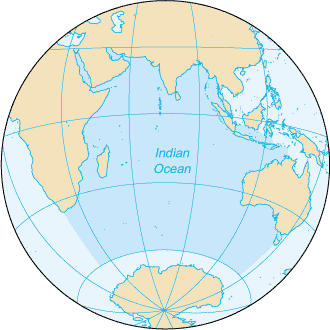
English: Map of The Indian Ocean with English captions. |
|||
| తేదీ | ||||
| మూలం | The World Factbook | |||
| కర్త | United States Central Intelligence Agency | |||
| అనుమతి (ఈ దస్త్రాన్ని పునర్వినియోగించుకోవడం) |
|
|||
| ఇతర కూర్పులు |
|


Derivative works
Derivative works of this file: Samudra Hindia.png
ఫైలు చరితం
తేదీ/సమయం ను నొక్కి ఆ సమయాన ఫైలు ఎలా ఉండేదో చూడవచ్చు.
| తేదీ/సమయం | నఖచిత్రం | కొలతలు | వాడుకరి | వ్యాఖ్య | |
|---|---|---|---|---|---|
| ప్రస్తుత | 09:14, 27 మార్చి 2005 | | 330 × 330 (11 KB) | Wolfman~commonswiki | {{CIA-map}} |
లింకులు
కింది పేజీలలో ఈ ఫైలుకు లింకులు ఉన్నాయి:
సార్వత్రిక ఫైలు వాడుక
ఈ దస్త్రాన్ని ఈ క్రింది ఇతర వికీలు ఉపయోగిస్తున్నాయి:
- am.wikipedia.org లో వాడుక
- ang.wikipedia.org లో వాడుక
- anp.wikipedia.org లో వాడుక
- as.wikipedia.org లో వాడుక
- azb.wikipedia.org లో వాడుక
- ba.wikipedia.org లో వాడుక
- be.wikipedia.org లో వాడుక
- bg.wikipedia.org లో వాడుక
- bh.wikipedia.org లో వాడుక
- bjn.wikipedia.org లో వాడుక
- blk.wikipedia.org లో వాడుక
- cdo.wikipedia.org లో వాడుక
- ckb.wikipedia.org లో వాడుక
- co.wikipedia.org లో వాడుక
- cs.wikipedia.org లో వాడుక
- dty.wikipedia.org లో వాడుక
- el.wikipedia.org లో వాడుక
- en.wikipedia.org లో వాడుక
- en.wikibooks.org లో వాడుక
- en.wikinews.org లో వాడుక
- en.wikisource.org లో వాడుక
- en.wikiversity.org లో వాడుక
- en.wiktionary.org లో వాడుక
- fa.wikipedia.org లో వాడుక
- fo.wikipedia.org లో వాడుక
- gor.wikipedia.org లో వాడుక
- gu.wikipedia.org లో వాడుక
- gv.wikipedia.org లో వాడుక
- hak.wikipedia.org లో వాడుక
- ha.wikipedia.org లో వాడుక
- he.wikipedia.org లో వాడుక
- hi.wikipedia.org లో వాడుక
- hu.wikipedia.org లో వాడుక
- id.wikipedia.org లో వాడుక
ఈ దస్త్రపు మరింత సార్వత్రిక వాడుకను చూడండి.