దస్త్రం:Map of the Arctic region showing the Northeast Passage, the Northern Sea Route and Northwest Passage, and bathymetry.png
Jump to navigation
Jump to search

ఈ మునుజూపు పరిమాణం: 632 × 600 పిక్సెళ్ళు. ఇతర రిజల్యూషన్లు: 253 × 240 పిక్సెళ్ళు | 506 × 480 పిక్సెళ్ళు | 1,003 × 952 పిక్సెళ్ళు.
అసలు దస్త్రం (1,003 × 952 పిక్సెళ్ళు, ఫైలు పరిమాణం: 758 KB, MIME రకం: image/png)
This is a file from the Wikimedia Commons. Information from its description page there is shown below. Commons is a freely licensed media file repository. You can help. |
సారాంశం
| వివరణ |
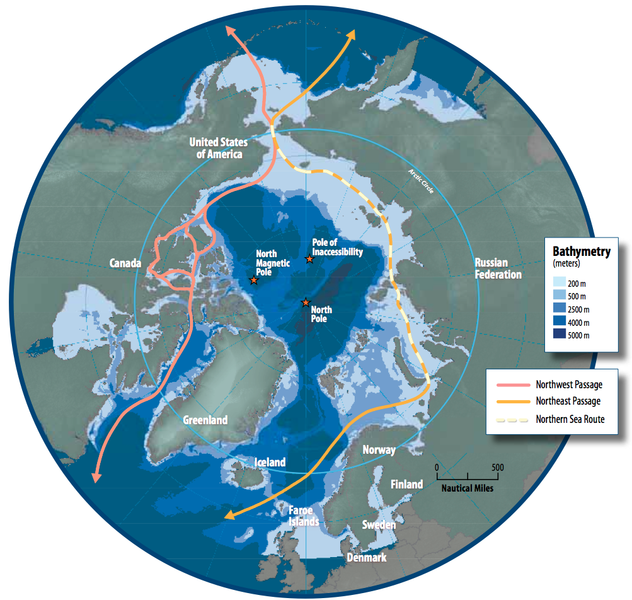
English: Map of the Arctic region showing shipping routes Northeast Passage, Northern Sea Route, and Northwest Passage, and bathymetry |
| తేదీ | |
| మూలం | Arctic Council - Arctic marine shipping assessment - http://www.arctic.noaa.gov/detect/documents/AMSA_2009_Report_2nd_print.pdf |
| కర్త | Susie Harder |
లైసెన్సింగ్
This file is in the public domain because the work was created/published by the Arctic Council, an international organization
|
ఫైలు చరితం
తేదీ/సమయం ను నొక్కి ఆ సమయాన ఫైలు ఎలా ఉండేదో చూడవచ్చు.
| తేదీ/సమయం | నఖచిత్రం | కొలతలు | వాడుకరి | వ్యాఖ్య | |
|---|---|---|---|---|---|
| ప్రస్తుత | 16:46, 19 అక్టోబరు 2014 | | 1,003 × 952 (758 KB) | Al83tito | User created page with UploadWizard |
లింకులు
కింది పేజీలలో ఈ ఫైలుకు లింకులు ఉన్నాయి:
సార్వత్రిక ఫైలు వాడుక
ఈ దస్త్రాన్ని ఈ క్రింది ఇతర వికీలు ఉపయోగిస్తున్నాయి:
- bn.wikipedia.org లో వాడుక
- de.wikipedia.org లో వాడుక
- en.wikipedia.org లో వాడుక
- es.wikipedia.org లో వాడుక
- fa.wikipedia.org లో వాడుక
- fr.wikipedia.org లో వాడుక
- he.wikipedia.org లో వాడుక
- hr.wikipedia.org లో వాడుక
- hu.wikipedia.org లో వాడుక
- id.wikipedia.org లో వాడుక
- it.wikipedia.org లో వాడుక
- ja.wikipedia.org లో వాడుక
- ko.wikipedia.org లో వాడుక
- nl.wikipedia.org లో వాడుక
- pl.wikipedia.org లో వాడుక
- pt.wikipedia.org లో వాడుక
- ru.wikipedia.org లో వాడుక
- sd.wikipedia.org లో వాడుక
- th.wikipedia.org లో వాడుక
- tr.wikipedia.org లో వాడుక