దస్త్రం:Punjab (Pakistan) Districts.svg
Jump to navigation
Jump to search

ఈ ఫైలు SVG కు చెందిన ఈ మునుజూపు PNG పరిమాణం: 505 × 599 పిక్సెళ్ళు. ఇతర రిజల్యూషన్లు: 202 × 240 పిక్సెళ్ళు | 405 × 480 పిక్సెళ్ళు | 647 × 768 పిక్సెళ్ళు | 863 × 1,024 పిక్సెళ్ళు | 1,726 × 2,048 పిక్సెళ్ళు | 843 × 1,000 పిక్సెళ్ళు.
అసలు దస్త్రం (SVG ఫైలు, నామమాత్రంగా 843 × 1,000 పిక్సెళ్ళు, ఫైలు పరిమాణం: 67 KB)
This is a file from the Wikimedia Commons. Information from its description page there is shown below. Commons is a freely licensed media file repository. You can help. |
_Districts.svg)
సారాంశం
| వివరణ |
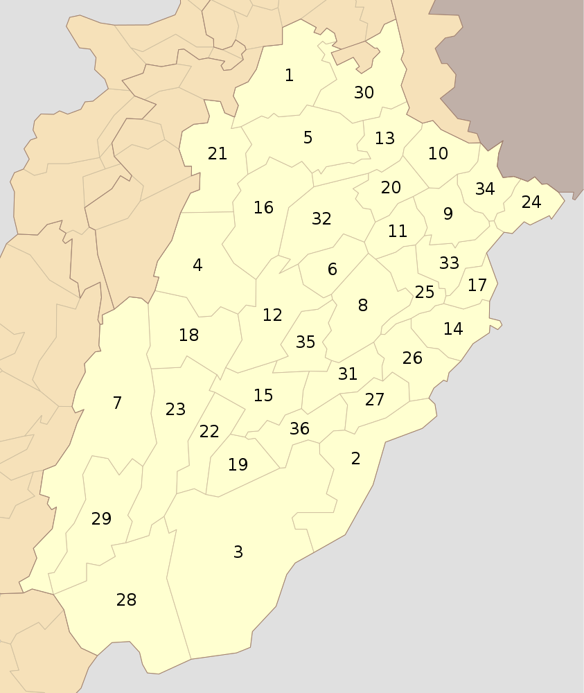
English: Districts of Punjab (Pakistan) as of Oct 2010 |
| తేదీ | |
| మూలం | స్వంత కృతి |
| కర్త | Schajee |
| SVG పెరుగుదల |
లైసెన్సింగ్
| నేను, ఈ కృతి యొక్క కాపీహక్కుదారుని, ఈ కృతిని సార్వజనీనం'గా విడుదల చేస్తున్నాను. ఇది ప్రపంచవ్యాప్తంగా వర్తిస్తుంది. కొన్ని దేశాల్లో ఇది చట్టబద్ధంగా సాధ్యంకాకపోవచ్చు; అయితే: ఈ కృతిని ఎటువంటి షరతులు లేకుండా, అట్టి షరతులు చట్టం వల్ల తప్పనిసరి అయితే తప్ప, ఏ ఉద్దేశానికైనా ఉపయోగించుకునే హక్కును ఎవరికైనా నేను ప్రదానం చేస్తున్నాను. |
ఫైలు చరితం
తేదీ/సమయం ను నొక్కి ఆ సమయాన ఫైలు ఎలా ఉండేదో చూడవచ్చు.
| తేదీ/సమయం | నఖచిత్రం | కొలతలు | వాడుకరి | వ్యాఖ్య | |
|---|---|---|---|---|---|
| ప్రస్తుత | 14:04, 31 జూలై 2016 | | 843 × 1,000 (67 KB) | Furfur | enlarged the numbers, such that they can be read in the preview |
| 21:37, 10 అక్టోబరు 2010 |  | 843 × 1,000 (73 KB) | Schajee | {{Information |Description={{en|1=Districts of Punjab (Pakistan) as of Oct 2010}} |Source={{own}} |Author=Schajee |Date= |Permission= |other_versions= }} Category:Maps of Pakistan Category:Maps of Punjab |
లింకులు
కింది పేజీలలో ఈ ఫైలుకు లింకులు ఉన్నాయి:
సార్వత్రిక ఫైలు వాడుక
ఈ దస్త్రాన్ని ఈ క్రింది ఇతర వికీలు ఉపయోగిస్తున్నాయి:
- be-tarask.wikipedia.org లో వాడుక
- bn.wikipedia.org లో వాడుక
- ব্যবহারকারী:Meghmollar2017/খেলাঘর/পাকিস্তানের জেলা
- লাহোর জেলা
- মিয়ানওয়ালী জেলা
- বাহাওয়ালনগর জেলা
- টেমপ্লেট:পাঞ্জাবের জেলা (পাকিস্তান)
- বাহাওয়ালপুর জেলা
- রহিম ইয়ার খান জেলা
- ডেরা গাজী খান জেলা
- লেয়াহ জেলা
- মুজাফফারগড় জেলা
- রাজনপুর জেলা
- চিনিওট জেলা
- ফয়সালাবাদ জেলা
- ঝং জেলা
- টোবা টেক সিং জেলা
- গুজরানওয়ালা জেলা
- গুজরাত জেলা
- হাফিজাবাদ জেলা
- মান্দি বাহাউদ্দিন জেলা
- নারোওয়াল জেলা
- শিয়ালকোট জেলা
- কসুর জেলা
- খানেওয়াল জেলা
- লোধরান জেলা
- মুলতান জেলা
- বিহারি জেলা
- এটক জেলা
- চকওয়াল জেলা
- ঝিলাম জেলা
- রাওয়ালপিন্ডি জেলা
- ভাক্কার জেলা
- খুশব জেলা
- সারগোদা জেলা
- সাহিওয়াল জেলা
- ওকারা জেলা
- পাকপাতান জেলা
- শেইখুপুরা জেলা
- নানকানা সাহিব জেলা
- de.wikipedia.org లో వాడుక
- en.wikipedia.org లో వాడుక
- en.wikivoyage.org లో వాడుక
- fa.wikipedia.org లో వాడుక
ఈ దస్త్రపు మరింత సార్వత్రిక వాడుకను చూడండి.
_Districts.svg)
_Districts.svg)