దస్త్రం:Exclusive Economic Zones - World.svg
Jump to navigation
Jump to search

ఈ ఫైలు SVG కు చెందిన ఈ మునుజూపు PNG పరిమాణం: 800 × 400 పిక్సెళ్ళు. ఇతర రిజల్యూషన్లు: 320 × 160 పిక్సెళ్ళు | 640 × 320 పిక్సెళ్ళు | 1,024 × 512 పిక్సెళ్ళు | 1,280 × 640 పిక్సెళ్ళు | 2,560 × 1,280 పిక్సెళ్ళు.
అసలు దస్త్రం (SVG ఫైలు, నామమాత్రంగా 800 × 400 పిక్సెళ్ళు, ఫైలు పరిమాణం: 694 KB)
This is a file from the Wikimedia Commons. Information from its description page there is shown below. Commons is a freely licensed media file repository. You can help. |
సారాంశం
| వివరణ |
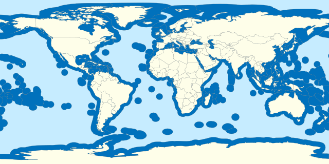
Español: Aguas territoriales del mundo. English: Territorial waters of the world. Français : Z.E.E. de chaque pays du monde. |
| తేదీ | |
| మూలం |
Own work based on: World location map.svg Borders based on VLIZ Maritime boundaries and Internationalwaters.png |
| కర్త | B1mbo |
| SVG పెరుగుదల |
లైసెన్సింగ్
నేను, ఈ కృతి యొక్క కాపీహక్కుదారుని, దీన్ని ఈ లైసెన్సు క్రింద ఇందుమూలముగా ప్రచురిస్తున్నాను:
This file is licensed under the Creative Commons Attribution-ShareAlike 3.0 Chile license.
- ఇలా చేసేందుకు మీకు స్వేచ్ఛ ఉంది:
- పంచుకోడానికి – ఈ కృతిని కాపీ చేసుకోవచ్చు, పంపిణీ చేయవచ్చు, ప్రసారమూ చేయవచ్చు
- రీమిక్స్ చేయడానికి – కృతిని అనుకరించడానికి
- క్రింది షరతులకు లోబడి:
- ఆపాదింపు – సముచితమైన శ్రేయస్సును ఇవ్వాలి, లైసెన్సుకు లింకు ఇవ్వాలి, మార్పులేమైనా చేస్తే వాటిని సూచించాలి. అందుకు సముచితమైన పద్ధతి దేన్నైనా అవలంబించవచ్చు. కానీ మీకూ మీ వాడుకకూ హక్కుదారు అనుమతించారు అనే అర్థం వచ్చేటట్లుగా మాత్రం కాదు.
- share alike – మీరు ఈ కృతిని అనుకరిస్తే, మారిస్తే, లేదా మెరుగుపరిస్తే తత్ఫలిత కృతిని ఇదే లైసెన్సు లేదా దీనికి అనుగుణ్యమైన లైసెన్సు క్రింద మాత్రమే పంపిణీ చేయాలి.

ఫైలు చరితం
తేదీ/సమయం ను నొక్కి ఆ సమయాన ఫైలు ఎలా ఉండేదో చూడవచ్చు.
| తేదీ/సమయం | నఖచిత్రం | కొలతలు | వాడుకరి | వ్యాఖ్య | |
|---|---|---|---|---|---|
| ప్రస్తుత | 09:22, 19 అక్టోబరు 2023 | | 800 × 400 (694 KB) | SyntaxTerror | Added Cyprus, many islands are missing (New Caledonia, Socotra, Jeju, Baleares, Caribean islands, islands in Hudson bay, etc.) |
| 00:37, 1 అక్టోబరు 2020 |  | 800 × 400 (692 KB) | The Image Editor | Reverted to version as of 02:36, 12 May 2020 (UTC) The PNG to SVG made the map look really bad | |
| 20:23, 29 సెప్టెంబరు 2020 |  | 400 × 200 (1.52 MB) | The Image Editor | Cyprus was missing in the map, so I added it. | |
| 02:36, 12 మే 2020 |  | 800 × 400 (692 KB) | Ratherous | Sea of Okhotsk entirely Russian since 2014 | |
| 00:11, 17 ఏప్రిల్ 2015 |  | 800 × 400 (692 KB) | B1mbo | Updating Chile-Peru maritime border | |
| 21:51, 31 అక్టోబరు 2011 |  | 800 × 400 (692 KB) | B1mbo | m | |
| 21:49, 31 అక్టోబరు 2011 |  | 800 × 400 (690 KB) | B1mbo | mm | |
| 21:46, 31 అక్టోబరు 2011 |  | 800 × 400 (691 KB) | B1mbo | m | |
| 21:39, 31 అక్టోబరు 2011 |  | 800 × 400 (691 KB) | B1mbo |
లింకులు
ఈ ఫైలును వాడుతున్న పేజీలు లేవు.
సార్వత్రిక ఫైలు వాడుక
ఈ దస్త్రాన్ని ఈ క్రింది ఇతర వికీలు ఉపయోగిస్తున్నాయి:
- ar.wikipedia.org లో వాడుక
- bg.wikipedia.org లో వాడుక
- cs.wikipedia.org లో వాడుక
- en.wikipedia.org లో వాడుక
- es.wikipedia.org లో వాడుక
- eu.wikipedia.org లో వాడుక
- fa.wikipedia.org లో వాడుక
- fi.wikipedia.org లో వాడుక
- fr.wikipedia.org లో వాడుక
- fr.wikiversity.org లో వాడుక
- he.wikipedia.org లో వాడుక
- hy.wikipedia.org లో వాడుక
- ja.wikipedia.org లో వాడుక
- ko.wikipedia.org లో వాడుక
- ms.wikipedia.org లో వాడుక
- pl.wikipedia.org లో వాడుక
- sk.wikipedia.org లో వాడుక
- ta.wikipedia.org లో వాడుక
- th.wikipedia.org లో వాడుక
- tl.wikipedia.org లో వాడుక
- tr.wikipedia.org లో వాడుక
- vi.wikipedia.org లో వాడుక
- www.wikidata.org లో వాడుక
- zh.wikipedia.org లో వాడుక