దస్త్రం:Zealandia, topographic map.jpg
Jump to navigation
Jump to search

ఈ మునుజూపు పరిమాణం: 529 × 600 పిక్సెళ్ళు. ఇతర రిజల్యూషన్లు: 212 × 240 పిక్సెళ్ళు | 423 × 480 పిక్సెళ్ళు | 678 × 768 పిక్సెళ్ళు | 903 × 1,024 పిక్సెళ్ళు | 1,500 × 1,700 పిక్సెళ్ళు.
అసలు దస్త్రం (1,500 × 1,700 పిక్సెళ్ళు, ఫైలు పరిమాణం: 4.57 MB, MIME రకం: image/jpeg)
This is a file from the Wikimedia Commons. Information from its description page there is shown below. Commons is a freely licensed media file repository. You can help. |
సారాంశం
| వివరణ |
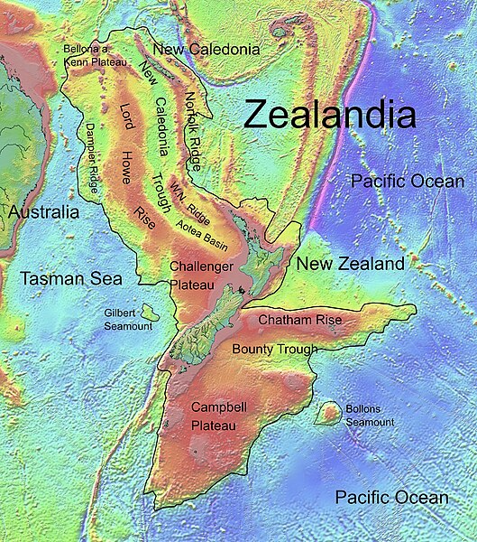
Deutsch: Die topografische Karte von Zealandia basiert auf den Bathymetrie-Daten des Scripps Institution of Oceanography, University of California, San Diego.
Die Umrandung zw. Grenzziehung basiert auf Informationen des Buches: Nick Mortimer; Hamish Campbell (2014) Zealandia - Our Continent Revealed, లండన్: Penguin Books, p. 54 ISBN: 978-0-143-57156-8. English: Topographic map of Zealandia, based on bathymetry data from Scripps Institution of Oceanography, University of California, San Diego.
Boundary is based on information which was given in: Nick Mortimer; Hamish Campbell (2014) Zealandia - Our Continent Revealed, లండన్: Penguin Books, p. 54 ISBN: 978-0-143-57156-8. Français : Carte topographique du continent de Zealandia, basée sur des données bathymétriques du Scripps Institution of Oceanography, Université de Californie, San Diego, États-Unis. La limite du continent est tirée d'informations venant de : « Nick Mortimer; Hamish Campbell (2014) Zealandia - Our Continent Revealed, Londres: Penguin Books, p. 54 ISBN: 978-0-143-57156-8. ». |
| తేదీ | |
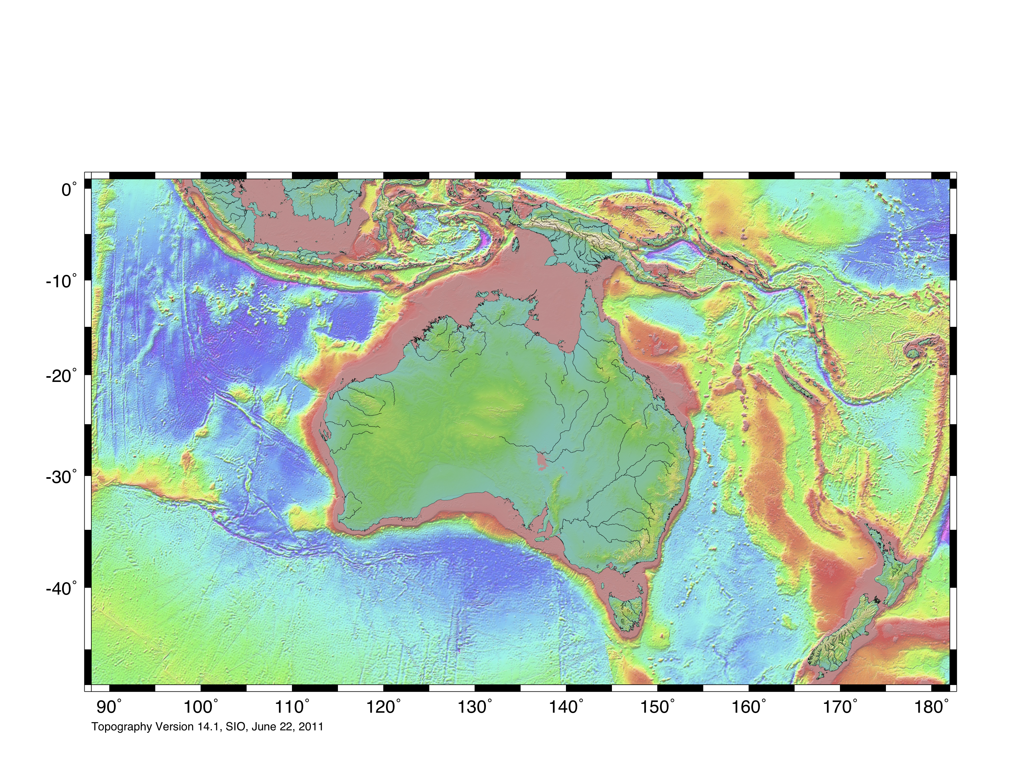
| మూలం | http://topex.ucsd.edu/WWW_html/mar_topo.html; http://topex.ucsd.edu/marine_topo/jpg_images/topo10.jpg; http://topex.ucsd.edu/marine_topo/jpg_images/topo11.jpg; http://topex.ucsd.edu/marine_topo/jpg_images/topo14.jpg; http://topex.ucsd.edu/marine_topo/jpg_images/topo15.jpg |
| కర్త | Ulrich Lange, Bochum, Germany |
| ఇతర కూర్పులు |
 |
There is no copyright on published bathmetry data, (free use)
లైసెన్సింగ్
నేను, ఈ కృతి యొక్క కాపీహక్కుదారుని, దీన్ని ఈ లైసెన్సు క్రింద ఇందుమూలముగా ప్రచురిస్తున్నాను:
| ఈ దస్త్రం క్రియేటివ్ కామన్స్ CC0 వెయివర్ క్రింద లభ్యం. | |
| ఈ కృతితో సంబంధమున్న వ్యక్తి తనకు ప్రపంచవ్యాప్తంగా కాపీహక్కుల చట్టం క్రింద ఈ కృతిపై ఉన్న అన్ని హక్కులని మరియు ఈ కృతిలో తనకి ఉన్న సంబంధిత న్యాయపరమైన హక్కులని, చట్టం అనుమతించిన మేరకు, వదులుకుని ఈ కృతిని కామన్స్కి అంకితమిచ్చారు. CC0 క్రింద ఉన్న కృతులకు ఆపాందింపు అవసరం లేదు. కృతిని ఉటంకించేప్పుడు, కృతికర్త యొక్క ఆమోదాన్ని మీరు అంతర్నిహితంగా సూచించకూడదు.
|
ఫైలు చరితం
తేదీ/సమయం ను నొక్కి ఆ సమయాన ఫైలు ఎలా ఉండేదో చూడవచ్చు.
| తేదీ/సమయం | నఖచిత్రం | కొలతలు | వాడుకరి | వ్యాఖ్య | |
|---|---|---|---|---|---|
| ప్రస్తుత | 16:55, 9 ఫిబ్రవరి 2019 | | 1,500 × 1,700 (4.57 MB) | Ulanwp | spelling of Bollons Seamount corrected |
| 20:43, 21 మార్చి 2017 |  | 1,500 × 1,700 (4.57 MB) | Ulanwp | Geographical Names inserted | |
| 19:59, 20 మార్చి 2017 |  | 1,500 × 1,700 (4.44 MB) | Ulanwp | {{Information |Description ={{en|1=Topographic map of Zealandia, based on bathmetry data from Scripps Institution of Oceanography, University of California, San Diego}} |Source =http://topex.ucsd.edu/WWW_html/mar_topo.html |Author =U... |
లింకులు
కింది పేజీలలో ఈ ఫైలుకు లింకులు ఉన్నాయి:
సార్వత్రిక ఫైలు వాడుక
ఈ దస్త్రాన్ని ఈ క్రింది ఇతర వికీలు ఉపయోగిస్తున్నాయి:
- ar.wikipedia.org లో వాడుక
- ast.wikipedia.org లో వాడుక
- bg.wikipedia.org లో వాడుక
- ca.wikipedia.org లో వాడుక
- ceb.wikipedia.org లో వాడుక
- de.wikipedia.org లో వాడుక
- Lord Howe Rise
- Zealandia
- Gisborne-Erdbeben von 2007
- Geologie Neuseelands
- Geographie Neuseelands
- Chatham Rise
- Campbell Plateau
- Bounty Trough
- Norfolk Ridge
- New Caledonia Trough
- Challenger Plateau
- Geologie der Antarktischen Halbinsel
- Geologie Ostantarktikas
- Vulkanische Provinzen der Antarktischen Halbinsel
- en.wikipedia.org లో వాడుక
- Chatham Rise
- Lord Howe Rise
- South Tasman Rise
- Campbell Plateau
- Meiolania
- Challenger Plateau
- Norfolk Ridge
- Lord Howe Seamount Chain
- Continent
- Submerged continent
- East Tasman Plateau
- Bollons Seamount
- Bounty Trough
- Tasmantid Seamount Chain
- Tasmantid hotspot
- Joseph Gilbert Seamount
- Gascoyne Seamount
- Geology of New Caledonia
- Taupo Bank
- Derwent Hunter Guyot
- Britannia Guyots
- Queensland Guyot
- Geology of Zealandia
- Three Kings Ridge
- es.wikipedia.org లో వాడుక
- eu.wikipedia.org లో వాడుక
- fr.wikipedia.org లో వాడుక
ఈ దస్త్రపు మరింత సార్వత్రిక వాడుకను చూడండి.