మాండలే
Jump to navigation
Jump to search
మాండలే
မန္တလေး | |
|---|---|
 మాండలే డౌన్టౌన్ | |
| దేశం | బర్మా |
| ప్రాంతము | మాండలే ప్రాంతము |
| జిల్లా | మాండలే జిల్లా |
| Government | |
| • మేయర్ | Aung Maung[1] |
| విస్తీర్ణం | |
| • City | 63.26 చ. మై (163.84 కి.మీ2) |
| Elevation | 70 అ. (22 మీ) |
| జనాభా (2010)[3] | |
| • City | 12,34,000 |
| • జనసాంద్రత | 20,000/చ. మై. (7,500/కి.మీ2) |
| • Metro | 1.6 million |
| • Ethnic groups | m:en:Bamar m:en:Burmese Indians m:en:Burmese Chinese షాన్ |
| • Religions | Buddhism Christianity Hinduism ఇస్లాం |
| Time zone | UTC+6:30 (MST) |
| ప్రాంతపు కోడ్(లు) | 2 (mobile: 20,69, 90)[4] |
మాండలే ఒక బర్మా పట్టణం. ఇది రంగూన్ తర్వాత బర్మాలో రెండవ పెద్ద పట్టణం.
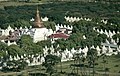
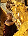
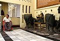
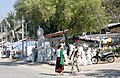
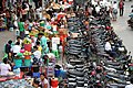
ఛాయాచిత్రాల ప్రదర్శన
[మార్చు]- మాండలే - Mandalay - မန္တလေးမြို့
-
-

-

-
-
-

-
-

-
-


మూలాలు
[మార్చు]- ↑ Thein Sein (28 February 2012). "Mandalay Mayor appointed Republic of the Union of Myanmar". New Light of Myanmar. Government of Myanmar. Archived from the original on 13 నవంబరు 2012. Retrieved 28 February 2012.
- ↑ "Water Purification Plant #8 in Aungmyethazan Township 60% Coomplete". Bi-Weekly Eleven (in Burmese). Eleven Media Group. 2011-04-28.
{{cite journal}}: CS1 maint: unrecognized language (link) - ↑ "United Nations World Urbanization Prospects, 2007 revision". The United Nations Population Division. Archived from the original on 2009-12-23. Retrieved 2009-01-24.
- ↑ "Myanmar Area Codes". Archived from the original on 2009-12-01. Retrieved 2013-06-28.
వర్గాలు:
- Pages with non-numeric formatnum arguments
- CS1 maint: unrecognized language
- క్లుప్త వివరణ ఉన్న వ్యాసములు
- Articles containing Burmese-language text
- Pages using infobox settlement with possible area code list
- Pages using infobox settlement with unknown parameters
- Pages using infobox settlement with no coordinates
- ఆసియా దేశాలు
- మయన్మార్