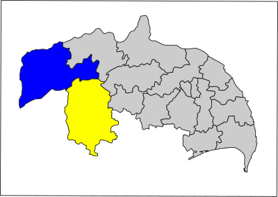
మూస:Location map Guntur District Assembly Constituencies
Jump to navigation
Jump to search
| name | గుంటూరు జిల్లా | |||
|---|---|---|---|---|
| border coordinates | ||||
| 16.9305486708844413 | ||||
| 79.0818128290774354 | ←↕→ | 81.0479362262503145 | ||
| 15.5366371723551140 | ||||
| map center | 16°14′01″N 80°03′54″E / 16.23359292162°N 80.064874527664°E | |||
| image | Guntur District Assembly Constituencies.svg
| |||

| ||||
How to use an alternative map
[మార్చు]This template normally displays the map shown above as image:
- Guntur District Assembly Constituencies.svg.
The AlternativeMap parameter in Template:Location map can be used to display the following image:
Further instructions and examples can be found at Template:Location map#Using Alternative Map.