పెట్రా
Jump to navigation
Jump to search
| Petra | |
|---|---|
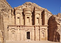
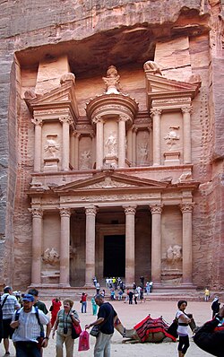 Al Khazneh or The Treasury at Petra | |
| ప్రదేశం | Ma'an Governorate, Jordan |
| భౌగోళికాంశాలు | 30°19′43″N 35°26′31″E / 30.32861°N 35.44194°E |
| ఉన్నతి | 810 మీ. (2,657 అ.) |
| నిర్మాణము | possibly as early as 5th century BC [1] |
| సందర్శన | 580,000 (in 2007) |
| పాలక సంస్థ | Petra Region Authority |
| రకం | Cultural |
| ప్రమాణం | i, iii, iv |
| నియామకం | 1985 (9th session) |
| సూచిక సంఖ్య | 326 |
| State Party | Jordan |
| Region | Arab States |
| Lua error in మాడ్యూల్:Location_map at line 526: Unable to find the specified location map definition: "Module:Location map/data/Jordan" does not exist. | |
పెట్రా జోర్డాన్ దేశంలో గల ఒక చారిత్రాత్మక, అద్భుత నిర్మాణాలకు పేరెన్నికగల నగరం. దీనిని చారిత్రకంగా రఖ్మూ లేదా రఖేమో అని పిలుస్తారు.[2][3] ఇది జబల్ అల్ మద్బా పర్వతాలకు ఆనుకుని ఉంది. మృత సముద్రం నుంచి అకాబా తీరం దాకా వ్యాపించి ఉన్న అరాబా వ్యాలీకి తూర్పు వైపున విస్తరించి ఉంది. ఈ ప్రాంతం చుట్టుపక్కల సా.శ.పూ 7000 నుంచే మానవ నివాసాలు ఉన్నాయి. సా.శ.పూ 4 వ శతాబ్దానికి నబటియన్లు ఇక్కడ రాజధాని ఏర్పాటు చేసుకుని ఉండవచ్చు. పురాతత్వ శాస్త్రజ్ఞులు తవ్వకాల్లో సా.శ.పూ 2 వ శతాబ్దం నుంచి నబటియన్లు ఇక్కడ ఉన్నట్టు ఆధారాలు కనుగొన్నారు.[4] అప్పటికే పెట్రా వారికి రాజధానిగా ఉంది.
చిత్ర మాలిక
[మార్చు]-
Al Khazneh / The Treasury at Petra
-
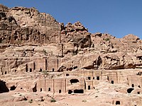
Tombs
-
The Siiq, path to Petra
-
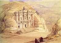
El Deir ("The Monastery")
-
Byzantine mosaic in the Byzantine Church of Petra
-
The end of the Siq, with its dramatic view of Al Khazneh ("The Treasury")
-
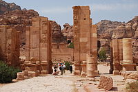
The Hadrian Gate and the Cardo Maximus in Petra
-
Petra is known as the Rose-Red City[5] for the colour of the rocks from which Petra is carved
-
The Great Temple of Petra
-
Ad Deir ("The Monastery") in 1839, by David Roberts
-
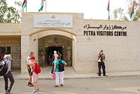
The Petra Visitors Centre in Wadi Musa, the closest town to the historic site
-
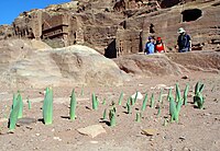
Drimia maritima bulbs in Petra in early December (2010)
-
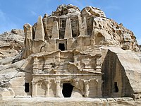
Obelisk Tomb and the Triclinium
-
Street of Façades
-
The Silk Tomb
-
Uneishu Tomb
-
Juniperus phoenicea in Petra
-
Lonely cave
-
Sandstone rocks
-
Main entrance (Al Khazneh)
-
Theatre
-
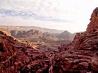
General view
-
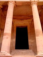
Ancient columns
-
Tourist attraction
మూలాలు
[మార్చు]- ↑ Browning, Iain (1973, 1982), Petra, Chatto & Windus, London, p. 15, ISBN 0-7011-2622-1
- ↑ Stephan G. Schmid and Michel Mouton (2013). Men on the Rocks: The Formation of Nabataean Petra. ISBN 9783832533137. Archived from the original on 18 March 2020. Retrieved 14 November 2019.
- ↑ Shaddel, Mehdy (2017-10-01). "Studia Onomastica Coranica: AL-Raqīm, Caput Nabataeae*". Journal of Semitic Studies (in ఇంగ్లీష్). 62 (2): 303–318. doi:10.1093/jss/fgx022. ISSN 0022-4480. Archived from the original on 2020-12-08. Retrieved 2020-12-08.
- ↑ Mati Milstein. "Petra. The "Lost City" still has secrets to reveal: Thousands of years ago, the now-abandoned city of Petra was thriving". National Geographic. Archived from the original on 20 December 2019. Retrieved 27 December 2019.
- ↑ "The Rose-Red City of Petra". Grisel.net. 2001-04-26. Retrieved 2012-04-17.
బయటి లంకెలు
[మార్చు]వికీమీడియా కామన్స్లో Petra, Jordanకి సంబంధించి దస్త్రాలు ఉన్నాయి.
- Petra In The Early 1800s
- 3D-tour on Petra
- Video on Petra
- Petra Archaeological Park Archived 2020-09-19 at the Wayback Machine
- University of Arkansas Petra Project: https://web.archive.org/web/20131014183648/http://geosciences.uark.edu/217.php
- Smart e Guide, interactive map of Petra
- Biblical Archaeology Society, "Solving the Enigma of Petra and the Nabataeans", Biblical Archaeology Review
- Open Context, "Petra Great Temple Excavations (Archaeological Data)", Open Context Publication of Archaeological Data from the 1993–2006 Brown University Excavations at the Great Temple of Petra, Jordan
- Petra iconicarchive, photo gallery
- Petra – photo gallery
- Petra History and Photo Gallery History with Maps
- Parker, S., R. Talbert, T. Elliott, S. Gillies, S. Gillies, J. Becker. "Places: 697725 (Petra)". Pleiades. <https://web.archive.org/web/20151129094632/http://pleiades.stoa.org/places/697725> [Accessed: March 7, 2012 4:18 pm]
- Pictures on Petra
- Almost 800 pictures with captions, some panoramas




![Petra is known as the Rose-Red City[5] for the colour of the rocks from which Petra is carved](http://upload.wikimedia.org/wikipedia/commons/thumb/1/18/Petra.jpg/200px-Petra.jpg)

