దస్త్రం:Tanzania relief location map.svg
Jump to navigation
Jump to search

ఈ ఫైలు SVG కు చెందిన ఈ మునుజూపు PNG పరిమాణం: 630 × 600 పిక్సెళ్ళు. ఇతర రిజల్యూషన్లు: 252 × 240 పిక్సెళ్ళు | 504 × 480 పిక్సెళ్ళు | 807 × 768 పిక్సెళ్ళు | 1,076 × 1,024 పిక్సెళ్ళు | 2,152 × 2,048 పిక్సెళ్ళు | 3,302 × 3,143 పిక్సెళ్ళు.
అసలు దస్త్రం (SVG ఫైలు, నామమాత్రంగా 3,302 × 3,143 పిక్సెళ్ళు, ఫైలు పరిమాణం: 3.1 MB)
This is a file from the Wikimedia Commons. Information from its description page there is shown below. Commons is a freely licensed media file repository. You can help. |
సారాంశం
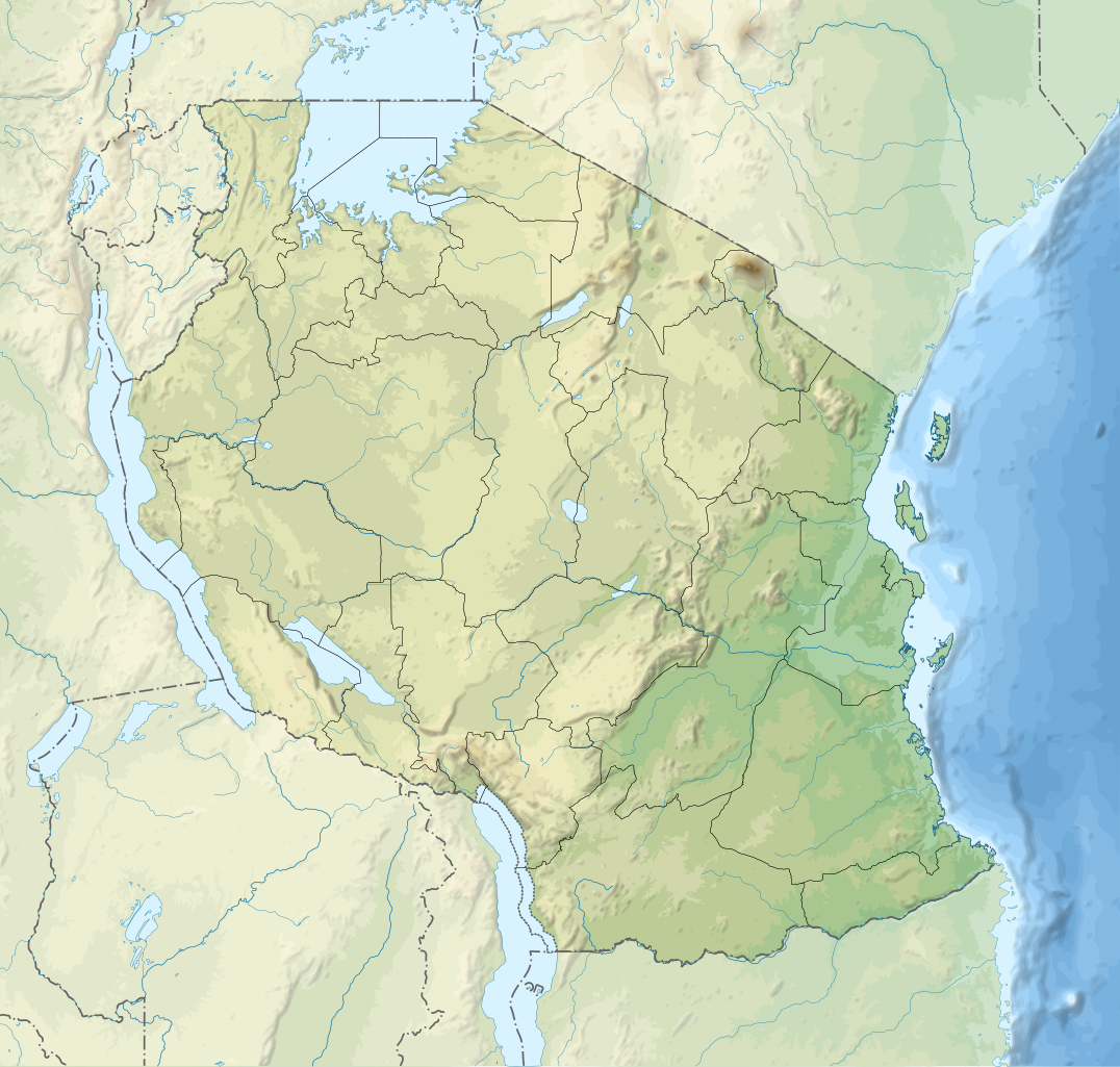
| వివరణ |
English: Relief location map of Tanzania.
Equirectangular projection. 1° N, 28° W, 42° E, -13° S. Center : -6.375, 35 Español: Mapa de georreferenciación de Tanzania. 1° N, 28° O, 42° E, -13° S. Centro : -6.375, 35
Français : Carte de géolocalisation du relief de la Tanzanie. Projection cylindrique équidistante. 1° N, 28° O, 42° E, -13° S. Centre : -6.375, 35 |
||
| తేదీ | (UTC) | ||
| మూలం | Derived from Tanzania_map-fr.svg | ||
| కర్త | Sémhur | ||
| ఇతర కూర్పులు |
[]
| ||
| ఆపాదింపు (required by the license) | © Sémhur / Wikimedia Commons / | ||
| SVG | W3C-validity not checked.
|
||
| Graphic Lab |


| Object location | | View this and other nearby images on: OpenStreetMap |
|---|
లైసెన్సింగ్
నేను, ఈ కృతి యొక్క కాపీహక్కుదారుని, దీన్ని ఇందుమూలముగా ఈ లైసెన్సుల క్రింద ప్రచురిస్తున్నాను:
| కాపీలెఫ్ట్: ఇది స్వేచ్ఛా కృతి; దీన్ని మీరు స్వేచ్ఛా కళ లైసెన్సు నియామాలకు లోబడి పునఃపంపిణీ చేయవచ్చు మరియు/లేదా మార్చుకోవచ్చు. ఈ లైసెన్సు యొక్క ప్రతిని కాపీలెఫ్ట్ అట్టిట్యూడ్ సైటు లోనూ మరియు ఇతర సైట్లలోనూ చూడవచ్చు. |
This file is licensed under the Creative Commons Attribution-Share Alike Attribution-Share Alike 4.0 International, 3.0 Unported, 2.5 Generic, 2.0 Generic and 1.0 Generic license.
- ఇలా చేసేందుకు మీకు స్వేచ్ఛ ఉంది:
- పంచుకోడానికి – ఈ కృతిని కాపీ చేసుకోవచ్చు, పంపిణీ చేయవచ్చు, ప్రసారమూ చేయవచ్చు
- రీమిక్స్ చేయడానికి – కృతిని అనుకరించడానికి
- క్రింది షరతులకు లోబడి:
- ఆపాదింపు – సముచితమైన శ్రేయస్సును ఇవ్వాలి, లైసెన్సుకు లింకు ఇవ్వాలి, మార్పులేమైనా చేస్తే వాటిని సూచించాలి. అందుకు సముచితమైన పద్ధతి దేన్నైనా అవలంబించవచ్చు. కానీ మీకూ మీ వాడుకకూ హక్కుదారు అనుమతించారు అనే అర్థం వచ్చేటట్లుగా మాత్రం కాదు.
- share alike – మీరు ఈ కృతిని అనుకరిస్తే, మారిస్తే, లేదా మెరుగుపరిస్తే తత్ఫలిత కృతిని ఇదే లైసెన్సు లేదా దీనికి అనుగుణ్యమైన లైసెన్సు క్రింద మాత్రమే పంపిణీ చేయాలి.
పైవాటిలో మీకు నచ్చిన లైసెన్సునును ఎంచుకోవచ్చు.
అసలు ఎక్కింపుల చిట్టా
This image is a derivative work of the following images:
- File:Tanzania_map-fr.svg licensed with Cc-by-sa-3.0,2.5,2.0,1.0, GFDL
- 2009-03-20T13:30:18Z Sémhur 3096x3113 (3225659 Bytes) Ol Doinyo Lengaï was misplaced
- 2009-03-20T11:14:35Z Sémhur 3096x3113 (3224368 Bytes) Add location map and few summits.
- 2009-03-19T17:14:13Z Sémhur 3096x3113 (3099209 Bytes) grrr...
- 2009-03-19T17:08:18Z Sémhur 3096x3113 (3099244 Bytes) Oups ! It wasn't the valid one.
- 2009-03-19T17:05:02Z Sémhur 3096x3113 (3122421 Bytes) {{Information |Description={{en|1=Map of [[:en:Tanzania]].}} {{fr|1=Carte de la [[:fr:Tanzanie]].}} {{es|1=Mapa de [[:es:Tanzania]].}} |Source=travail personnel (own work). Sources of data: * Elevations : NASA SRTM3 (public d
Uploaded with derivativeFX
ఫైలు చరితం
తేదీ/సమయం ను నొక్కి ఆ సమయాన ఫైలు ఎలా ఉండేదో చూడవచ్చు.
| తేదీ/సమయం | నఖచిత్రం | కొలతలు | వాడుకరి | వ్యాఖ్య | |
|---|---|---|---|---|---|
| ప్రస్తుత | 20:32, 3 మార్చి 2020 | | 3,302 × 3,143 (3.1 MB) | Sémhur | Modifying Tanzanian border claim (from https://www.nbs.go.tz/index.php/en/census-surveys/gis/385-2012-phc-shapefiles-level-one-and-two) |
| 20:18, 28 జూన్ 2017 |  | 3,302 × 3,143 (3.09 MB) | Sémhur | Update with Songwe region | |
| 14:11, 28 డిసెంబరు 2013 |  | 3,096 × 2,947 (3.1 MB) | Sémhur | Updated with the four new regions | |
| 15:17, 3 మే 2009 |  | 3,096 × 2,947 (3.55 MB) | Sémhur | Adding border between Arusha and Manyara | |
| 18:58, 1 మే 2009 |  | 3,096 × 2,947 (3.54 MB) | Sémhur | {{int:summary}} {{Information |Description={{en|1=Relief location map of en:Tanzania.}} {{fr|1=Carte de géolocalisation du relief de la fr:Tanzanie.}} {{es|1=Mapa de georreferenciación de es:Tanzania.}} Equirectangular projection. 0.25� |
లింకులు
కింది పేజీలలో ఈ ఫైలుకు లింకులు ఉన్నాయి:
సార్వత్రిక ఫైలు వాడుక
ఈ దస్త్రాన్ని ఈ క్రింది ఇతర వికీలు ఉపయోగిస్తున్నాయి:
- af.wikipedia.org లో వాడుక
- als.wikipedia.org లో వాడుక
- ar.wikipedia.org లో వాడుక
- ast.wikipedia.org లో వాడుక
- as.wikipedia.org లో వాడుక
- avk.wikipedia.org లో వాడుక
- av.wikipedia.org లో వాడుక
- azb.wikipedia.org లో వాడుక
- az.wikipedia.org లో వాడుక
- ban.wikipedia.org లో వాడుక
- ba.wikipedia.org లో వాడుక
ఈ దస్త్రపు మరింత సార్వత్రిక వాడుకను చూడండి.