దస్త్రం:Winterthur Battle 1799.svg
Jump to navigation
Jump to search

ఈ ఫైలు SVG కు చెందిన ఈ మునుజూపు PNG పరిమాణం: 506 × 599 పిక్సెళ్ళు. ఇతర రిజల్యూషన్లు: 203 × 240 పిక్సెళ్ళు | 405 × 480 పిక్సెళ్ళు | 648 × 768 పిక్సెళ్ళు | 864 × 1,024 పిక్సెళ్ళు | 1,729 × 2,048 పిక్సెళ్ళు | 845 × 1,001 పిక్సెళ్ళు.
అసలు దస్త్రం (SVG ఫైలు, నామమాత్రంగా 845 × 1,001 పిక్సెళ్ళు, ఫైలు పరిమాణం: 426 KB)
This is a file from the Wikimedia Commons. Information from its description page there is shown below. Commons is a freely licensed media file repository. You can help. |
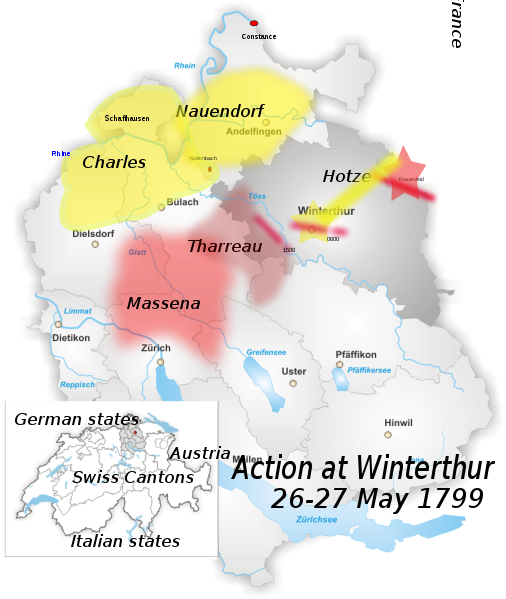
| వివరణ | District of Winterthur Map drawn by Tschubby |
| తేదీ | (UTC) |
| మూలం |
Own work using:
|
| కర్త |
|
| This is a retouched picture, which means that it has been digitally altered from its original version. Modifications: added location of battle outside Winterthur, May 1799. The original can be viewed here: Karte Bezirk Winterthur.png:
|
నేను, ఈ కృతి యొక్క కాపీహక్కుదారుని, దీన్ని ఇందుమూలముగా ఈ లైసెన్సుల క్రింద ప్రచురిస్తున్నాను:
| ఈ దస్త్రం క్రియేటివ్ కామన్స్ Attribution-Share Alike 3.0 Unported లైసెన్సు క్రింద లభ్యం. | ||
| ||
| GFDL లైసెన్సు తాజాకరణలో భాగంగా ఈ దస్త్రానికి ఈ లైసెన్సింగు ట్యాగుని చేర్చారు. |

|
ఈ కృతి యొక్క కర్తనైన నేను, ఇక నుండీ ఈ కృతిని కాపీ చేసుకోవడానికి, పంచి పెట్టడానికి మరియు/లేదా మార్పులు-చేర్పులు చేసుకోవడానికి GFDL, లైసెన్సు వెర్షను 1.2 లేదా దాని తరువాత స్వేచ్చా సాఫ్టువేరు ఫౌండేషను విడుదలచేసే ఏ GFDL లైసెన్సు ద్వారా నయినా అనుమతి ఇస్తున్నాను; ఈ కృతిలో మార్చకూడని బాగాలు లేవు, Front-Cover పాఠం లేదు, Back-Cover పాఠం లేదు. ఈ లైసెన్సు యొక్క పత్రం నకలును "జిఎన్యూ ఉచిత డాక్యుమెంటేషను లైసెన్సు" అని పిలుస్తున్న విభాగంలో ఉంది. |
పైవాటిలో మీకు నచ్చిన లైసెన్సునును ఎంచుకోవచ్చు.
అసలు ఎక్కింపుల చిట్టా
This image is a derivative work of the following images:
- File:Karte_Bezirk_Winterthur.png licensed with Cc-by-sa-3.0-migrated, GFDL
- 2005-06-15T18:08:08Z Tschubby 826x1001 (259741 Bytes) District of Winterthur Map drawn by [[:de:Benutzer:Tschubby|Tschubby]] [[Category:Maps of Canton of Zurich|Winterthur]] {{GFDL}}
Uploaded with derivativeFX
ఫైలు చరితం
తేదీ/సమయం ను నొక్కి ఆ సమయాన ఫైలు ఎలా ఉండేదో చూడవచ్చు.
| తేదీ/సమయం | నఖచిత్రం | కొలతలు | వాడుకరి | వ్యాఖ్య | |
|---|---|---|---|---|---|
| ప్రస్తుత | 22:00, 3 ఫిబ్రవరి 2010 | | 845 × 1,001 (426 KB) | Auntieruth55 | fix size. |
| 21:51, 3 ఫిబ్రవరి 2010 |  | 765 × 1,260 (425 KB) | Auntieruth55 | added location map, geographic info, etc. | |
| 19:46, 3 ఫిబ్రవరి 2010 |  | 765 × 1,260 (365 KB) | Auntieruth55 | Reverted to version as of 19:43, 3 February 2010 | |
| 19:45, 3 ఫిబ్రవరి 2010 |  | 765 × 1,260 (365 KB) | Auntieruth55 | added location map | |
| 19:43, 3 ఫిబ్రవరి 2010 |  | 765 × 1,260 (365 KB) | Auntieruth55 | Clarified location, added location map, additional markers, changed illustration of movements. | |
| 10:41, 13 జనవరి 2010 |  | 826 × 1,001 (354 KB) | Fundriver | Reverted to version as of 10:34, 13 January 2010 | |
| 10:41, 13 జనవరి 2010 |  | 826 × 1,001 (354 KB) | Fundriver | ... | |
| 10:34, 13 జనవరి 2010 |  | 826 × 1,001 (354 KB) | Fundriver | "Schaffhausen" erased (this is a map of the canton of Zurich). | |
| 03:26, 29 డిసెంబరు 2009 |  | 826 × 1,001 (355 KB) | Auntieruth55 | {{Information |Description=District of Winterthur Map drawn by Tschubby |Source=*File:Karte_Bezirk_Winterthur.png |Date=2009-12-29 03:22 (UTC) |Author=*File:Karte_Bezirk_Winterthur.png: Tschubby *de |
లింకులు
కింది పేజీలలో ఈ ఫైలుకు లింకులు ఉన్నాయి:
సార్వత్రిక ఫైలు వాడుక
ఈ దస్త్రాన్ని ఈ క్రింది ఇతర వికీలు ఉపయోగిస్తున్నాయి:
- en.wikipedia.org లో వాడుక
- es.wikipedia.org లో వాడుక
- fa.wikipedia.org లో వాడుక
- hr.wikipedia.org లో వాడుక
- id.wikipedia.org లో వాడుక
- uz.wikipedia.org లో వాడుక
- zh.wikipedia.org లో వాడుక