దస్త్రం:Telangana locator map.svg

అసలు దస్త్రం (SVG ఫైలు, నామమాత్రంగా 537 × 508 పిక్సెళ్ళు, ఫైలు పరిమాణం: 1.82 MB)
This is a file from the Wikimedia Commons. Information from its description page there is shown below. Commons is a freely licensed media file repository. You can help. |
సారాంశం
| వివరణ |
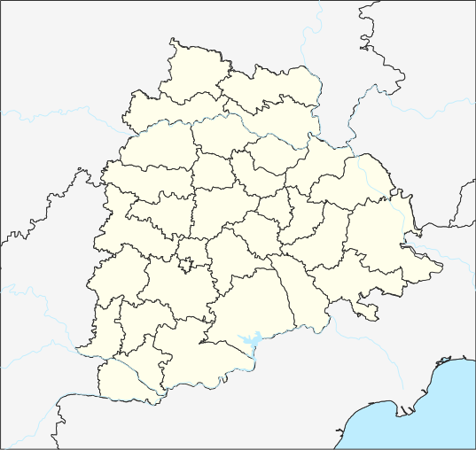
English: Telangana place locator తెలుగు: తెలంగాణ ప్రదేశ సూచికా పటము |
| తేదీ | |
| మూలం |
స్వంత కృతి, File updated to reflect border changes of Telangana. Projection: Equi Rectangular Plate Carree for TG Extent: -180.00, -90.00, 180.00, 90.00 Proj4: +proj=eqc +lat_ts=0 +lat_0=17.840669 +lon_0=79.048467E +x_0=0 +y_0=0 +datum=WGS84 +units=m +no_defs Extents Top 20.334882 Bottom: 15.346458 Left: 76.408599 Right:81.688339 Interior District borders are raster from http://tracgis.telangana.gov.in/districtformation/districtformation/default.aspx Processed using QGIS 3.6 and Inkscape 0.92 on Ubuntu 18.04 For the template used for locating, please see https://te.wikipedia.org/wiki/Template:Telangana_locator_map |
| కర్త | The original uploader was Arjunaraoc at తెలుగు వికీపీడియా. |
| SVG పెరుగుదల |
లైసెన్సింగ్
- ఇలా చేసేందుకు మీకు స్వేచ్ఛ ఉంది:
- పంచుకోడానికి – ఈ కృతిని కాపీ చేసుకోవచ్చు, పంపిణీ చేయవచ్చు, ప్రసారమూ చేయవచ్చు
- రీమిక్స్ చేయడానికి – కృతిని అనుకరించడానికి
- క్రింది షరతులకు లోబడి:
- ఆపాదింపు – సముచితమైన శ్రేయస్సును ఇవ్వాలి, లైసెన్సుకు లింకు ఇవ్వాలి, మార్పులేమైనా చేస్తే వాటిని సూచించాలి. అందుకు సముచితమైన పద్ధతి దేన్నైనా అవలంబించవచ్చు. కానీ మీకూ మీ వాడుకకూ హక్కుదారు అనుమతించారు అనే అర్థం వచ్చేటట్లుగా మాత్రం కాదు.
- share alike – మీరు ఈ కృతిని అనుకరిస్తే, మారిస్తే, లేదా మెరుగుపరిస్తే తత్ఫలిత కృతిని ఇదే లైసెన్సు లేదా దీనికి అనుగుణ్యమైన లైసెన్సు క్రింద మాత్రమే పంపిణీ చేయాలి.
అసలు ఎక్కింపుల చిట్టా
| తేదీ/సమయం | కొలతలు | వాడుకరి | వ్యాఖ్య |
|---|---|---|---|
| 2015-05-05 05:53 | 512×450× (581780 bytes) | Arjunaraoc | Equi rectangular projection of Telangana based on 1) India State and District maps from http://mnre.gov.in/sec/solar-assmnt.htm, [http://mnre.gov.in/copyright-policy copyright policy free for any use with attribution] accessed 2015-03-19) 3)River shape... |
| 2015-03-18 11:34 | 1070×740× (434459 bytes) | Arjunaraoc | [[వికీపీడియా:ఫైల్_ఎక్కింపు_విజర్డు|ఫైల్ ఎక్కింపు విజర్డు-]] ముద్రితమైన ఉచిత మూలంనుండి ఒక ఫైల్ |
ఫైలు చరితం
తేదీ/సమయం ను నొక్కి ఆ సమయాన ఫైలు ఎలా ఉండేదో చూడవచ్చు.
| తేదీ/సమయం | నఖచిత్రం | కొలతలు | వాడుకరి | వ్యాఖ్య | |
|---|---|---|---|---|---|
| ప్రస్తుత | 05:16, 6 జూలై 2020 | | 537 × 508 (1.82 MB) | Arjunaraoc | Reverted to version as of 11:00, 17 April 2019 (UTC) |
| 05:41, 28 జూన్ 2020 |  | 443 × 443 (227 KB) | C1MM | Fixed Krishna river delta | |
| 19:49, 3 జూన్ 2020 |  | 443 × 443 (227 KB) | C1MM | Increased district boundary size, fixed unjoined district boundary | |
| 03:49, 5 మే 2020 |  | 443 × 443 (229 KB) | C1MM | Fixed colors | |
| 19:10, 22 ఏప్రిల్ 2020 |  | 443 × 443 (229 KB) | C1MM | Fixed border colors | |
| 17:10, 16 ఏప్రిల్ 2020 |  | 443 × 443 (229 KB) | C1MM | Changed colors and boundaries to be smaller | |
| 22:04, 14 ఏప్రిల్ 2020 |  | 537 × 508 (242 KB) | C1MM | Made lake standard | |
| 05:44, 12 ఏప్రిల్ 2020 |  | 537 × 508 (242 KB) | C1MM | Changed district boundaries and re-did layering | |
| 14:34, 22 మార్చి 2020 |  | 537 × 508 (1.81 MB) | C1MM | Added standard colors and made borders prominent | |
| 11:00, 17 ఏప్రిల్ 2019 |  | 537 × 508 (1.82 MB) | Arjunaraoc | Updated with Telangana districts as vector layer |
లింకులు
కింది పేజీలలో ఈ ఫైలుకు లింకులు ఉన్నాయి:
- ఆదిలాబాద్ జిల్లా
- ఇలేగాం
- ఖమ్మం జిల్లా
- గంగదేవిపల్లి
- తిప్పడంపల్లి కోట
- నల్గొండ జిల్లా
- నిజామాబాదు జిల్లా
- మెదక్ జిల్లా
- రంగారెడ్డి జిల్లా
- సికింద్రాబాద్
- హనుమకొండ జిల్లా
- హైదరాబాదు జిల్లా
- వాడుకరి:Ch Maheswara Raju/సమాచారపెట్టెలు
- వాడుకరి:K.Venkataramana/సమాచారపెట్టెలు
- వాడుకరి:వైజాసత్య/ఇసుకపెట్టె4
- వాడుకరి:వైజాసత్య/ఇసుకపెట్టె4/doc
- వికీపీడియా చర్చ:వికీప్రాజెక్టు/పటములు
- మూస:Location map Telangana
- మూస:Telangana locator map
- మూస:భారత స్థల సమాచారపెట్టె
- మూస:భారత స్థల సమాచారపెట్టె/doc
సార్వత్రిక ఫైలు వాడుక
ఈ దస్త్రాన్ని ఈ క్రింది ఇతర వికీలు ఉపయోగిస్తున్నాయి:
- azb.wikipedia.org లో వాడుక
- حئیدرآباد (هیندوستان)
- علیآباد، رنقا ردی
- عبداللهپور
- عالمپور، محبوبنقار
- معینآباد، مندال
- ونوقوپالپورام
- وانام واری کریشناپورام
- ساتیانارایاناپورام
- ساروپالی, نالقوندا دیستریکت
- ساروارام
- سارانقاپور, جاقتیال دیستریکت
- مدارام
- سانقام, وارانقال دیستریکت
- کالشوارام
- مارور, نالقوندا دیستریکت
- ونکپالی
- ماریقودم
- ماریقودا
- مارپال
- مارکوک, تلانقانا
- ماریپدا
- ولولا (هیندوستان)
- کایسارام
- ولماکان
- ولقاتور
- ولپور (هیندوستان)
- واسانتاپورام
- وارشاکوندا
- سایداپور
- مانواریپامپو
- کادتال
- موست آباد
- کاداورقو
- شامش آباد
- سولیپور
- کاداپارتی
- رودرارام
- مانقاپت
- مانقالپالی, نالقوندا دیستریکت
- مانقالاقودم
- کئی. آر. پورام (تلانقانا)
- جوکال, ایندیا
- ماندالاپورام
- آنانتارام, نالقوندا ماندال
- آنانتارام, مداک دیستریکت
- آنانتارام, شامیرپت ماندال
- آنانتارام, بونجیر ماندال
- رمیدیچرلا
- آناجپور
- جینارام
ఈ దస్త్రపు మరింత సార్వత్రిక వాడుకను చూడండి.