బెంగాల్
Jump to navigation
Jump to search
| బెంగాల్ | |
| Largestcity | కోల్కతా[1] 23°25′N 90°13′E / 23.42°N 90.22°E |
| Mainlanguage | బెంగాలీ |
| Area | 232,752km² |
| Population (2001) | 209,468,404 |
| సాంద్రత | 951.3/km² |
| Infant mortality rate | 55.91 per 1000 live births[2][3] |
| Websites | bangladesh.gov.bd and wbgov.com |

బెంగాల్ (ఆంగ్లం: Bengal) (బెంగాలీ: বঙ্গ బంగో, বাংলা బాంగ్లా, বঙ্গদেশ బోంగ్లాదేష్ లేదా বাংলাদেশ బంగ్లాదేశ్), ఈశాన్య భారతదేశంలోని ఒక చారిత్రక, భౌగోళిక ప్రదేశం. ఈ రోజు ఇది భాజ్యమై బంగ్లాదేశ్ (స్వతంత్ర రాజ్యం), పశ్చిమ బెంగాల్ (భారతదేశంలోని ఒక రాష్ట్రం) పేరుతో ఉంది. ఈ విభజన భారత్-పాకిస్తాన్ విభజన సమయంలో జరిగింది. నేటి బంగ్లాదేశ్ ఆనాటి తూర్పు బెంగాల్ గా ఉంది. ఈ బెంగాల్ ప్రాంతం నుండి అనేకమంది నటీమణులు సినిమారంగంలో రాణించారు.
ఇవీ చూడండి[మార్చు]
మూలాలు[మార్చు]
- ↑ The Kolkata metropolitan area has a population of over 14 million, making it the largest urban agglomeration in Bengal.
- ↑ "West Bengal - Human development fact sheet" (PDF). United Nations Development Programme. 2001. Archived from the original on 2003-04-12. Retrieved 2013-08-19.
{{cite web}}: CS1 maint: bot: original URL status unknown (link) - ↑ "The World Factbook - Bangladesh". CIA World Factbook. 2001. Archived from the original (HTML) on 2009-05-13. Retrieved 2007-03-01.
బయటి లింకులు[మార్చు]
- Baxter, C (1997), Bangladesh, From a Nation to a State, Westview Press, ISBN 185984121X
- Bennett, A & Hindle, J (1996), London Review of Books: An Anthology, Verso, ISBN 185984121X
- 24°00′N 88°00′E / 24.000°N 88.000°E
- Banglapedia- specialised site
- www.hostkingdom.net- List of rulers of Bengal
- WorldStatesmen- here India
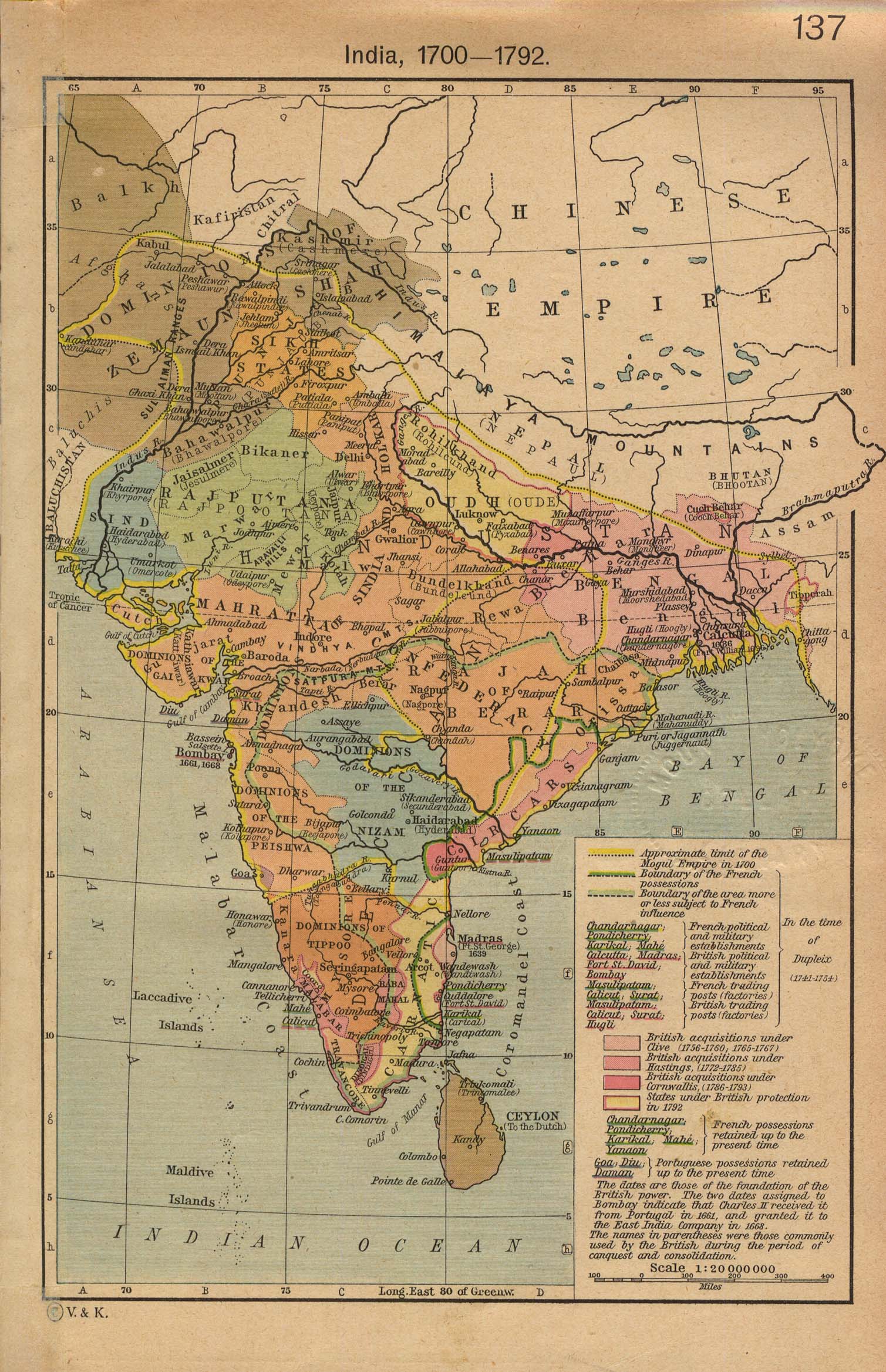
- India from The Historical Atlas by William R. Shepherd, 1923
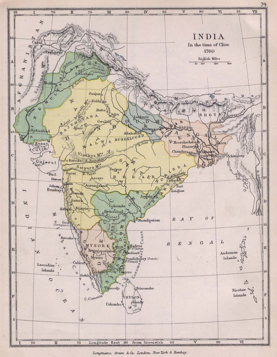
- India 1760 from The Public Schools Historical Atlas edited by C. Colbeck. Longmans, Green, and Co. 1905 Archived 2008-08-19 at the Wayback Machine
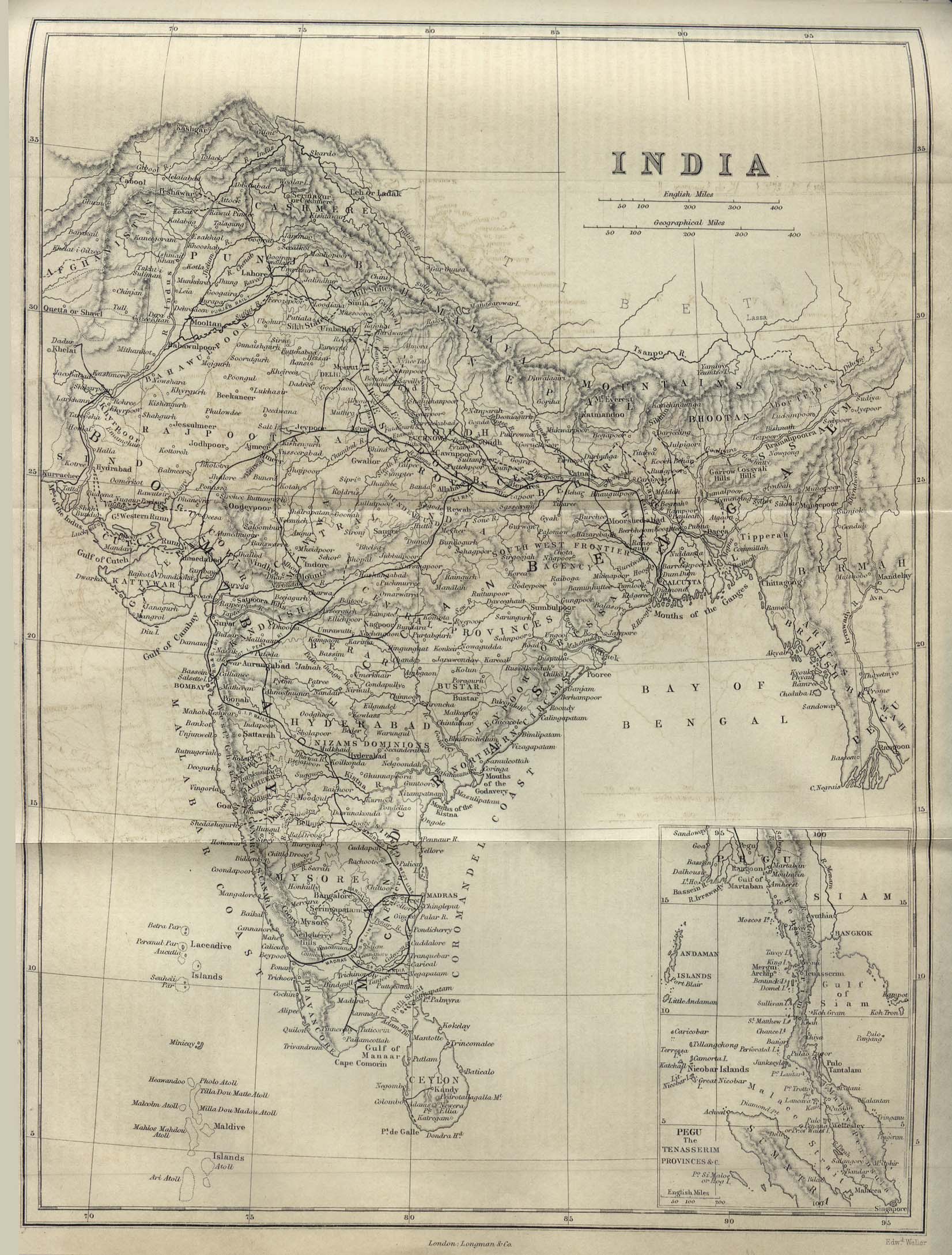
- India 1882 from A Dictionary Practical, Theoretical, and Historical of Commerce and Commercial Navigation by J.R. M'Culloch. Longmans, Green and Co. London, 1882
- Art and artists of Bengal