దస్త్రం:India Kerala location map.svg

అసలు దస్త్రం (SVG ఫైలు, నామమాత్రంగా 874 × 1,274 పిక్సెళ్ళు, ఫైలు పరిమాణం: 350 KB)
This is a file from the Wikimedia Commons. Information from its description page there is shown below. Commons is a freely licensed media file repository. You can help. |
సారాంశం
| వివరణ |
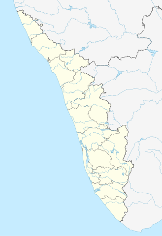
Quadratische Plattkarte, N-S-Streckung 102 %. Geographische Begrenzung der Karte:
Equirectangular projection, N/S stretching 102 %. Geographic limits of the map:
|
|
| తేదీ | ||
| మూలం |
స్వంత కృతి, using
|
|
| కర్త | NordNordWest | |
| అనుమతి (ఈ దస్త్రాన్ని పునర్వినియోగించుకోవడం) |
ఈ దస్త్రం క్రియేటివ్ కామన్స్ ఆపాదింపు-యథాతథ పంచుకోలు 3.0 జర్మనీ లైసెన్సు క్రింద లభ్యం.
 ఈ దస్త్రం క్రియేటివ్ కామన్స్ Attribution-Share Alike 3.0 Unported లైసెన్సు క్రింద లభ్యం.
|


|
This map has been made or improved in the German Kartenwerkstatt (Map Lab). You can propose maps to improve as well.
|
ఫైలు చరితం
తేదీ/సమయం ను నొక్కి ఆ సమయాన ఫైలు ఎలా ఉండేదో చూడవచ్చు.
| తేదీ/సమయం | నఖచిత్రం | కొలతలు | వాడుకరి | వ్యాఖ్య | |
|---|---|---|---|---|---|
| ప్రస్తుత | 16:13, 10 జూన్ 2023 | | 874 × 1,274 (350 KB) | C1MM | c boundaries |
| 16:04, 10 జూన్ 2023 |  | 874 × 1,274 (351 KB) | C1MM | c bounds | |
| 14:41, 22 ఆగస్టు 2021 |  | 775 × 1,129 (394 KB) | C1MM | Corrected rivers and dist boundaries | |
| 18:17, 4 మే 2012 |  | 827 × 1,205 (135 KB) | NordNordWest | upd | |
| 09:30, 11 మార్చి 2011 |  | 827 × 1,205 (132 KB) | NordNordWest | =={{int:filedesc}}== {{Information |Description= {{de|Positionskarte von Kerala, Indien}} Quadratische Plattkarte, N-S-Streckung 102 %. Geographische Begrenzung der Karte: * N: 13.0° N * S: 8.0° N * W: 74.5° O * O: 78.0° |
లింకులు
కింది పేజీలలో ఈ ఫైలుకు లింకులు ఉన్నాయి:
- అట్టుకల్ భగవతి క్షేత్రం
- ఎరవికులం జాతీయ ఉద్యానవనం
- ఎర్నాకులం
- ఎర్నాకుళం జిల్లా
- కక్కనాడ్ (కొచ్చి)
- కన్నూర్ (కేరళ)
- కల్పెట్టా
- కాసర్గోడ్
- కొచ్చి
- కొట్టాయం
- కొట్టాయం జిల్లా
- కొల్లాం
- కోజికోడ్
- గురువాయూరు
- చొట్టనిక్కర
- తిరుచ్చెంకున్నూర్
- తిరునావాయ్
- తిరుప్పులియూర్
- తిరుమూళక్కళమ్
- తిరువణ్ వండూరు
- తిరువనంతపురం
- తిరువాఱన్ విళై
- తిరువిత్తువక్కోడు
- తెన్మల
- త్రిక్కకర వామనమూర్తి ఆలయం (తమిళనాడు)
- త్రిస్సూర్
- నెల్లియంపాటీ
- పజవంగడి వినాయక దేవాలయం
- పతనంతిట్ట
- పయ్యనూర్ తాలూకా
- పాలక్కాడ్
- పుట్టింగళ్ దేవాలయ అగ్నిప్రమాదం
- పైనావు (కేరళ)
- మంజేశ్వర్
- మన్నార్కాడ్
- మలప్పురం
- మాహె జిల్లా
- మాహె
- మున్నార్
- లులు మాల్
- మూస:Location map India Kerala
- మాడ్యూల్:Location map/data/India Kerala
- మాడ్యూల్:Location map/data/India Kerala/doc
సార్వత్రిక ఫైలు వాడుక
ఈ దస్త్రాన్ని ఈ క్రింది ఇతర వికీలు ఉపయోగిస్తున్నాయి:
- ar.wikipedia.org లో వాడుక
- azb.wikipedia.org లో వాడుక
- باتی چاتالور
- باتی پودوسری
- پیدیکاپارامبو
- پیداوور
- وایاتوپوژا
- وئیلور
- پرووانتانام
- پرووالور
- پرووا (هیندوستان)
- پرونا (هیندوستان)
- پرونیلام
- واوانور
- پرونقوژی
- وانیمال
- وانییامبالام
- ونیکود
- ونجینیسری
- ونقانور
- سارکارا-چیرایینکیژو
- سانتانپارا
- ماژووانور
- ماژوکیر
- کالکونتال
- کالیکاو
- ماترا (هیندوستان)
- ماتیلاکام
- ماتامبا
- کالایاپورام
- کالاتوکاداوو
- کالانجور
- ونقانلور
- ونقولا
- ماروتا, ایندیا
- کالامپالا
- ونقارا, مالاپورام دیستریکت
- ونکیتانقو
- کالاکتی
- واندیتاوالام
- واندانمدو
- واندانپاتال
- وانداماتوم
- وانداژی-یی
- وانداژی-ی
- ونجارامودو
- ونپاکال
- کاکور (هیندوستان)
- ماریاناد
- کاکولیسری
- کاکودی
ఈ దస్త్రపు మరింత సార్వత్రిక వాడుకను చూడండి.