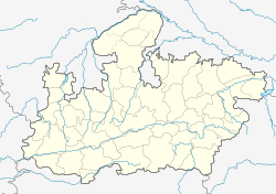
షాజాపూర్
Jump to navigation
Jump to search
షాజాపూర్ | |
|---|---|
పట్టణం | |
| Coordinates: 23°26′N 76°16′E / 23.43°N 76.27°E | |
| దేశం | |
| రాష్త్రం | మధ్యప్రదేశ్ |
| జిల్లా | షాజ్ పూర్ |
షాజాపూర్ మధ్యప్రదేశ్ రాష్ట్రం మాళ్వా ప్రాంతంలోని పట్టణం. ఇది షాజాపూర్ జిల్లాకు ముఖ్యపట్టణం.
భౌగోళికం
[మార్చు]షాజాపూర్ 23°26′N 76°16′E / 23.43°N 76.27°E వద్ద, [1] సముద్ర మట్టం నుండి 443 మీటర్ల ఎత్తున ఉంది.
శీతోష్ణస్థితి
[మార్చు]| శీతోష్ణస్థితి డేటా - Shajapur (1981–2010, extremes 1969–2012) | |||||||||||||
|---|---|---|---|---|---|---|---|---|---|---|---|---|---|
| నెల | జన | ఫిబ్ర | మార్చి | ఏప్రి | మే | జూన్ | జూలై | ఆగ | సెప్టెం | అక్టో | నవం | డిసెం | సంవత్సరం |
| అత్యధిక రికార్డు °C (°F) | 33.6 (92.5) |
38.3 (100.9) |
42.1 (107.8) |
45.6 (114.1) |
47.2 (117.0) |
46.1 (115.0) |
40.7 (105.3) |
39.1 (102.4) |
39.8 (103.6) |
39.0 (102.2) |
36.1 (97.0) |
32.7 (90.9) |
47.2 (117.0) |
| సగటు అధిక °C (°F) | 26.1 (79.0) |
29.1 (84.4) |
34.6 (94.3) |
39.3 (102.7) |
41.4 (106.5) |
38.1 (100.6) |
32.0 (89.6) |
29.7 (85.5) |
32.0 (89.6) |
33.6 (92.5) |
30.5 (86.9) |
27.3 (81.1) |
32.8 (91.0) |
| సగటు అల్ప °C (°F) | 8.8 (47.8) |
10.7 (51.3) |
15.7 (60.3) |
21.6 (70.9) |
26.2 (79.2) |
25.8 (78.4) |
23.9 (75.0) |
23.1 (73.6) |
22.2 (72.0) |
17.8 (64.0) |
12.4 (54.3) |
9.2 (48.6) |
18.1 (64.6) |
| అత్యల్ప రికార్డు °C (°F) | −0.5 (31.1) |
1.5 (34.7) |
5.1 (41.2) |
9.3 (48.7) |
17.8 (64.0) |
20.3 (68.5) |
19.6 (67.3) |
20.0 (68.0) |
12.1 (53.8) |
9.5 (49.1) |
3.3 (37.9) |
2.1 (35.8) |
−0.5 (31.1) |
| సగటు వర్షపాతం mm (inches) | 8.0 (0.31) |
4.2 (0.17) |
1.6 (0.06) |
3.0 (0.12) |
11.4 (0.45) |
95.1 (3.74) |
239.4 (9.43) |
318.3 (12.53) |
126.8 (4.99) |
24.9 (0.98) |
10.6 (0.42) |
4.5 (0.18) |
847.7 (33.37) |
| సగటు వర్షపాతపు రోజులు | 0.6 | 0.3 | 0.3 | 0.5 | 1.1 | 4.8 | 9.3 | 10.6 | 6.0 | 1.6 | 0.7 | 0.4 | 36.3 |
| సగటు సాపేక్ష ఆర్ద్రత (%) (at 17:30 IST) | 43 | 33 | 24 | 18 | 22 | 43 | 67 | 76 | 65 | 43 | 43 | 46 | 43 |
| Source: India Meteorological Department[2][3] | |||||||||||||
జనాభా
[మార్చు]2011 జనగణన ప్రకారం,[4] షాజాపూర్ జిల్లాలో 1,290,685 జనాభా ఉండగా, 669,852 మంది పురుషులు, 620,833 మంది మహిళలు ఉన్నారు.
మూలాలు
[మార్చు]- ↑ Falling Rain Genomics, Inc - Shajapur
- ↑ "Station: Shajapur Climatological Table 1981–2010" (PDF). Climatological Normals 1981–2010. India Meteorological Department. January 2015. pp. 695–696. Archived from the original (PDF) on 5 February 2020. Retrieved 6 January 2021.
- ↑ "Extremes of Temperature & Rainfall for Indian Stations (Up to 2012)" (PDF). India Meteorological Department. December 2016. p. M130. Archived from the original (PDF) on 5 February 2020. Retrieved 6 January 2021.
- ↑ "Census of India 2001: Data from the 2001 Census, including cities, villages and towns (Provisional)". Census Commission of India. Archived from the original on 2004-06-16. Retrieved 2008-11-01.

