జమ్మూ కాశ్మీరు (కేంద్రపాలిత ప్రాంతం)
జమ్మూ కాశ్మీరు | |
|---|---|
 జమ్మూ, కాశ్మీర్ ఇంటరాక్టివ్ మ్యాప్ | |
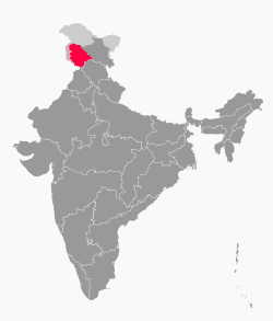 వివాదాస్పద భూభాగాలతో జమ్మూ కాశ్మీర్ | |
| Coordinates: 33°5′24″N 74°47′24″E / 33.09000°N 74.79000°E | |
| పరిపాలన రాష్ట్రం | భారతదేశం |
| కేంద్రపాలిత ప్రాంతం | 2019 అక్టోబరు 19 |
| రాజధాని నగరం | శ్రీనగర్ (మే-అక్టోబరు) జమ్మూ (నవంబరు-ఏప్రిల్)[4] |
| జిల్లాలు | 20 |
| Government | |
| • Body | జమ్మూ కాశ్మీర్ ప్రభుత్వం |
| • లెఫ్టినెంట్ గవర్నర్ | మనోజ్ సిన్హా |
| • National Parliament | Parliament of India : Lok Sabha (5) |
| • High Court | High Court of Jammu and Kashmir and Ladakh |
| విస్తీర్ణం | |
| • Total | 42,241 కి.మీ2 (16,309 చ. మై) |
| Highest elevation [5] (నన్ కున్ పీక్) | 7,135 మీ (23,409 అ.) |
| Lowest elevation | 247 మీ (810 అ.) |
| జనాభా (2011)[6] | |
| • Total | 1,22,67,013 |
| • జనసాంద్రత | 290/కి.మీ2 (750/చ. మై.) |
| భాష | |
| • అధికార | కాశ్మీరి, డోగ్రి, ఉర్దు, హిందీ, ఇంగ్లీష్[7][8] |
| • Spoken | Kashmiri, Gojri, Pahari, Punjabi, Bhadarwahi, Sarazi, Khowar, Shina, Burushaski, Bateri[16] |
| Time zone | UTC+05:30 (IST) |
| ISO 3166 code | IN-JK |
| Vehicle registration | JK |
| HDI (2018) | |
జమ్మూ కాశ్మీర్ [b] అనేది భారతప్రభుత్వంచే పరిపాలించబడే కేంద్రపాలిత ప్రాంతం.[1] ఇది కాశ్మీర్ దక్షిణభాగంలో పెద్ద ప్రాంతంతో ఉంది. ఇది 1947 నుండి భారతదేశం, పాకిస్తాన్ల మధ్య, 1959 నుండి భారతదేశం, చైనా మధ్య వివాదానికి సంబంధించిన అంశంతో ముడిపడి ఉంది.[3] జమ్మూ కాశ్మీర్ను పాకిస్థానీ ఆధీనంలో ఉన్న ఆజాద్ కాశ్మీర్, పశ్చిమ, ఉత్తరాన గిల్గిత్-బాల్టిస్తాన్ నుండి నియంత్రణ రేఖ వేరు చేస్తుంది. ఇది భారతదేశంలోని హిమాచల్ ప్రదేశ్, పంజాబ్ రాష్ట్రాలకు ఉత్తరాన లడఖ్కు, పశ్చిమాన కేంద్రపాలిత ప్రాంతంగా భారతప్రభుత్వంచే నిర్వహించబడుతుంది.
జమ్మూ కాశ్మీర్ కేంద్రపాలిత ప్రాంతం ఏర్పాటుకు సంబంధించిన నిబంధనలు జమ్మూ కాశ్మీర్ పునర్వ్యవస్థీకరణ చట్టం, 2019 లో ఉన్నాయి. దీనిని 2019 ఆగస్టులో భారత పార్లమెంటు ఉభయ సభలు ఆమోదించాయి. ఈ చట్టం పూర్వపు జమ్మూ కాశ్మీర్ రాష్ట్రాన్ని రెండు కేంద్రపాలిత ప్రాంతాలుగా పునర్య్వస్థీకరించింది. ఒకటి జమ్మూ కాశ్మీర్, లడఖ్. ఇది 2019 అక్టోబరు 31 నుండి అమలులోకి వచ్చింది. [18]
పరిభాష
[మార్చు]జమ్మూ కాశ్మీర్ను తిరిగి రెండు ప్రాంతాలుగా విభజించి, జమ్మూ ప్రాంతం, కాశ్మీర్ లోయ అనే రెండు పేర్లు పెట్టారు. భారత ప్రభుత్వం జమ్మూ కాశ్మీర్ పునర్వ్యవస్థీకరణ చట్టం-2019 ప్రకారం, కాశ్మీర్ ప్రాంతం భారత నియంత్రణలో ఉన్న ప్రాంతాన్ని "పాకిస్తాన్-ఆక్రమిత కాశ్మీర్" (POK) అని పిలువబడే పాకిస్తాన్ నియంత్రణలో ఉన్న భూభాగాన్ని కలిగి ఉంటుంది. [19] [20] పాకిస్తాన్ భారత నియంత్రణలో ఉన్న భూభాగాన్ని "భారత-ఆక్రమిత కాశ్మీర్" (IOK) లేదా "ఇండియన్-ఆధీనంలో ఉన్న కాశ్మీర్" (IHK)లో భాగంగా పరిగణిస్తుంది.[21] [22] తటస్థ మూలాలుగా ప్రాంతాలను గుర్తించడానికి "భారత-పరిపాలన కాశ్మీర్"/"పాకిస్తాన్- పరిపాలిత కాశ్మీర్" , "భారత-నియంత్రిత కాశ్మీర్"/"పాకిస్తాన్-నియంత్రిత కాశ్మీర్". [23]
చరిత్ర
[మార్చు]భారత రాజ్యాంగంలోని ఆర్టికల్ 370 ద్వారా జమ్మూ కాశ్మీర్ రాష్ట్రానికి ప్రత్యేక హోదా కల్పించబడింది. భారతదేశంలోని ఇతర రాష్ట్రాలకు భిన్నంగా, జమ్మూ కాశ్మీర్ దాని స్వంత రాజ్యాంగం, జెండా, పరిపాలనా స్వయంప్రతిపత్తిని కలిగి ఉంది.[24] భారత రాజ్యాంగంలోని ఆర్టికల్ 35A ప్రకారం ఇతర రాష్ట్రాలకు చెందిన భారతీయ పౌరులు జమ్మూ కాశ్మీర్లో భూమి లేదా ఆస్తిని కొనుగోలు చేయడానికి అనుమతిలేదు. [25]
జమ్మూ కాశ్మీర్లో మూడు విభిన్న ప్రాంతాలు ఉన్నాయి. హిందూ-మెజారిటీ ఉన్న జమ్మూ ప్రాంతం, ముస్లిం-మెజారిటీ ఉన్న కాశ్మీర్ లోయ, బౌద్ధుల ఆధిపత్యం ఉన్న లడఖ్. [26] కాశ్మీరీ లోయలో అశాంతి, హింస నిత్యం కొనసాగేది. 1987లో వివాదాస్పద రాష్ట్ర ఎన్నికల తరువాత, స్వయంప్రతిపత్తి , హక్కులపై నిరసనగా తిరుగుబాటు కొనసాగింది.[26] [27]
భారతీయ జనతా పార్టీ (బిజెపి) 2014 భారత సార్వత్రిక ఎన్నికలలో అధికారంలోకి వచ్చింది. ఐదు సంవత్సరాల తరువాత జమ్మూ కాశ్మీర్ను ఇతర రాష్ట్రాలతో సమాన హోదాకు తీసుకురావడానికి భారత రాజ్యాంగం లోని ఆర్టికల్ 370 రద్దుచేయటానికి, వారి 2019 ఎన్నికల మ్యానిఫెస్టోలో చేర్చింది.[26]
ఆర్టికల్ 370ని రద్దు చేయాలనే తీర్మానాన్ని భారత పార్లమెంటు ఉభయ సభలు 2019 ఆగస్టులో ఆమోదించాయి. అదే సమయంలో పునర్వ్యవస్థీకరణ చట్టం కూడా ఆమోదం పొందింది. ఇది రాష్ట్రాన్ని జమ్మూ కాశ్మీర్, లడఖ్ [28] అనే రెండు కేంద్రపాలిత ప్రాంతాలుగా పునర్నిర్మించింది, [29] అయితే ఆర్టికల్ 35A కూడా 1954 నాటి రాష్ట్రపతి ఉత్తర్వులను సస్పెండ్ చేయడం ద్వారా రద్దు చేయబడింది. పునర్వ్యవస్థీకరణ చట్టం- 2019 అక్టోబరు 31 నుండి అమల్లోకి వచ్చింది [18]
2019 సెప్టెంబరులో, ఇద్దరు మాజీ ముఖ్యమంత్రులు, వందలాది మంది ఇతర రాజకీయ నాయకులతో సహా దాదాపు 4,000 మందిని కాశ్మీర్లో భారత అధికారులు అరెస్టు చేశారు.[30] రాష్టంలో లాక్ డౌన్ విధించారు. కమ్యూనికేషన్, ఇంటర్నెట్ సేవలు నిలిపివేయబడ్డాయి. [31]
2023 డిసెంబరు 11న భారత సర్వోన్నత న్యాయస్థానం ఆర్టికల్స్ 370, 35A రద్దును ఏకగ్రీవంగా సమర్థించింది. అదే సమయంలో జమ్మూ, కాశ్మీర్ రాష్ట్ర హోదాను పునరుద్ధరించాలని, 2024 సెప్టెంబరు లోపు శాసనసభ ఎన్నికలను నిర్వహించాలని కేంద్రప్రభుత్వాన్ని ఆదేశించింది.[32] [33]
భౌగోళిక శాస్త్రం
[మార్చు]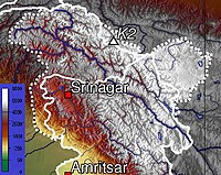
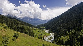
కాశ్మీర్ లోయ, తావిలోయ, చెనాబ్ లోయ, పూంచ్ లోయ, సింధ్ లోయ, లిడ్డర్ లోయ వంటి అనేక లోయలకు జమ్మూ కాశ్మీర్ నిలయం.[34] కాశ్మీర్ లోయ 100 కిమీ (62 మైళ్లు) వెడల్పు, 15,520.3 కి.మీ2 (5,992.4 చ. మై.) విస్తీర్ణంలో ఉంది. [35] హిమాలయాలు కాశ్మీర్ లోయను టిబెటన్ పీఠభూమి నుండి విభజించగా, పశ్చిమ, దక్షిణ లోయలను చుట్టుముట్టే పీర్ పంజాల్ శ్రేణి దీనిని ఇండో-గంగా మైదానం పంజాబ్ మైదానం నుండి వేరుచేస్తుంది.[36] లోయ ఈశాన్య సమీపవైపు హిమాలయాల ప్రధానశ్రేణి నడుస్తుంది.[37] ఈ లోయ సముద్ర మట్టానికి సగటున 1,850 మీటర్లు (6,070 అడుగులు) ఎత్తులో ఉంది, కానీ చుట్టుపక్కల ఉన్న పీర్ పంజాల్ శ్రేణి సగటున 10,000 అడుగుల (3,000 మీటర్లు) ఎత్తులో ఉంటుంది.[35][38] కాశ్మీర్ లోయ గుండా ప్రవహించే ప్రధాన హిమాలయ నది జీలం నది. దక్షిణ జమ్మూ ప్రాంతం ఎక్కువగా పర్వతప్రాంతంగా ఉంటుంది. శివాలిక్, మధ్య గొప్ప హిమాలయాలు ఆగ్నేయ-వాయువ్య దిశలో ఒకదానికొకటి సమాంతరంగా ఉన్నాయి. ఒక ఇరుకైన నైరుతి పట్టీ సారవంతమైన మైదానాలను కలిగి ఉంటుంది. చెనాబ్, తావి, రావి నదులు జమ్మూ ప్రాంతం గుండా ప్రవహించే ముఖ్యమైన నదులు.[39]

వాతావరణం
[మార్చు]జమ్మూ కాశ్మీర్ వాతావరణం ఎత్తును బట్టి, ప్రాంతాలను బట్టి మారుతూ ఉంటుంది. దక్షిణ, నైరుతి ప్రాంతాలలో వేసవివేడి, చల్లని శీతాకాలాలతో ఉప ఉష్ణమండల వాతావరణం ఉంటుంది.ఈ ప్రాంతంలో వర్షాకాలంలో ఎక్కువ వర్షపాతం నమోదవుతుంది. తూర్పు, ఉత్తర ప్రాంతాలలో వేసవి కాలం సాధారణంగా ఆహ్లాదకరంగా ఉంటుంది. కాశ్మీర్ లోయ వంటి పీర్ పంజాల్ నది ప్రవాహం వైపు ఉన్న ప్రాంతాలలో రుతుపవనాల ప్రభావం తగ్గుతుంది. పశ్చిమాన వాతావరణ అల్లర్ల కారణంగా వసంత ఋతువులో ఎక్కువ వర్షపాతం సంభవిస్తుంది. శీతాకాలాలు చల్లగా ఉంటాయి. ఉష్ణోగ్రతలు సున్నా కంటే తక్కువ స్థాయికి చేరుకుంటాయి. లోయ పర్వత ప్రాంతాలలో మంచు కురవడం సర్వసాధారణం.
పరిపాలనా విభాగాలు
[మార్చు]జమ్మూ కాశ్మీర్ కేంద్రపాలిత ప్రాంతంలో జమ్మూ డివిజన్, కాశ్మీర్ డివిజన్ అనే రెండు విభాగాలు ఉన్నాయి. దీనిని 20 జిల్లాలుగా విభజించబడింది.[40]

| విభజన | పేరు | ప్రధాన కార్యాలయం | విస్తీర్ణం (కిమీ2) |
విస్తీర్ణం (చ,మైళ్లు) |
గ్రామీణ ప్రాంతం (కి.మీ2) |
పట్టణ ప్రాంతం (కి.మీ2) |
మూలం |
|---|---|---|---|---|---|---|---|
| జమ్మూ | కథువా జిల్లా | కథువా | 2,502 | 966 | 2458.84 | 43.16 | [41] |
| జమ్మూ జిల్లా | జమ్మూ | 2,342 | 904 | 2089.87 | 252.13 | [42] | |
| సంబా జిల్లా | సంబా | 904 | 349 | 865.24 | 38.76 | [43] | |
| ఉధంపూర్ జిల్లా | ఉధంపూర్ | 2,637 | 1,018 | 2593.28 | 43.72 | [44] | |
| రియాసీ జిల్లా | రియాసీ | 1,719 | 664 | 1679.99 | 39.01 | [45] | |
| రాజౌరీ జిల్లా | రాజౌరీ | 2,630 | 1,015 | 2608.11 | 21.89 | [46] | |
| పూంచ్ జిల్లా | పూంచ్ | 1,674 | 646 | 1649.92 | 24.08 | [47] | |
| దోడా జిల్లా | దోడా | 8,912 | 3,441 | 8892.25 | 19.75 | [48] | |
| రంబాన్ జిల్లా | రంబాన్ | 1,329 | 513 | 1313.92 | 15.08 | [49] | |
| కిష్త్వార్ జిల్లా | కిష్త్వార్ | 1,644 | 635 | 1643.37 | 0.63 | [50] | |
| విభాగ మొత్తం | 26,293 | 10,151 | 25794.95 | 498.05 | |||
| Kashmir | అనంతనాగ్ జిల్లా | అనంతనాగ్ | 3,574 | 1,380 | 3475.76 | 98.24 | [51] |
| కుల్గాం జిల్లా | కుల్గాం | 410 | 158 | 360.20 | 49.80 | [52] | |
| పుల్వామా జిల్లా | పుల్వామా | 1,086 | 419 | 1047.45 | 38.55 | [53] | |
| షోపియన్ జిల్లా | షోపియన్ | 312 | 120 | 306.56 | 5.44 | [54] | |
| బుద్గాం జిల్లా | బుద్గాం | 1,361 | 525 | 1311.95 | 49.05 | [55] | |
| శ్రీనగర్ జిల్లా | శ్రీనగర్ | 1,979 | 764 | 1684.42 | 294.53 | [56] | |
| గందర్బల్ జిల్లా | గందర్బల్ | 259 | 100 | 233.60 | 25.40 | [57] | |
| బండిపోరా జిల్లా | బండిపోరా | 345 | 133 | 295.37 | 49.63 | [58] | |
| బారాముల్లా జిల్లా | బారాముల్లా | 4,243 | 1,638 | 4179.44 | 63.56 | [59] | |
| కుప్వారా జిల్లా | కుప్వారా | 2,379 | 919 | 2331.66 | 47.34 | [60] | |
| విభాగ మొత్తం | 15,948 | 6,156 | 15226.41 | 721.54 | |||
రవాణా
[మార్చు]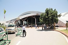
వాయుమార్గం
[మార్చు]జమ్మూ కాశ్మీర్ భూభాగంలోని రెండు రాజధానులలో రెండు ప్రధాన విమానాశ్రయాలు ఉన్నాయి. జమ్మూలోని జమ్మూ విమానాశ్రయం, శ్రీనగర్లోని శ్రీనగర్ విమానాశ్రయం. ఇది భూభాగంలోని ఏకైక అంతర్జాతీయ విమానాశ్రయం. ఈ విమానాశ్రయాలకు ఢిల్లీ, ముంబై, బెంగళూరు, చండీగఢ్, దేశంలోని ఇతర ప్రధాన నగరాలకు క్రమం తప్పకుండా విమానాలు ఉన్నాయి.
రైలు మార్గం
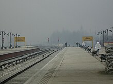
[మార్చు]ఉత్తర రైల్వే నిర్మాణంలో ఉన్న జమ్మూ-బారాముల్లా మార్గం ఈ భూభాగంలో ఉన్న ఏకైక రైల్వే మార్గం. ఇది పూర్తయిన తర్వాత, ఈ మార్గం జమ్మూ కాశ్మీర్లోని రెండు ప్రాంతాలను కలుపుతుంది. దేశంలోని ఇతర ప్రాంతాల నుండి కాశ్మీర్ లోయకు రైలు మార్గాన్ని కూడా అందిస్తుంది.
రోడ్డు మార్గం
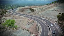
[మార్చు]జమ్మూ-శ్రీనగర్ జాతీయ రహదారి, ఎన్.హెచ్ 44 లోని ఒక విభాగం, రెండు రాజధానులను రహదారి ద్వారా కలిపే భూభాగంలోని ప్రధాన రహదారి. జాతీయ రహదారులు 1, 144,144ఎ, 444, 501, 701, 701ఎ ఈ భూభాగంలోని ఇతర జాతీయ రహదారులు.
జనాభా గణాంకాలు
[మార్చు]2011 భారత జనాభా లెక్కల ప్రకారం, జమ్మూ కాశ్మీర్ మొత్తం జనాభా 1,22,67,013. లింగ నిష్పత్తి 1000 మంది పురుషులకు 889 మంది మహిళలు. జనాభాలో సుమారు 9,24,485 (7.54%) షెడ్యూల్డ్ కులాలకు చెందినవారు ఉండగా, 12,75,106 (10.39%) మంది షెడ్యూల్డ్ తెగలకు చెందినవారు ఉన్నారు, ప్రధానంగా గుజ్జర్, బకర్వాల్, గడ్డీస్. ఎస్సీలు ఎక్కువగా జమ్మూ ప్రాంతంలో కేంద్రీకృతమై ఉన్నారు. ఈ ప్రాంతంలో మైనారిటీ క్రైస్తవ సమాజం కూడా ఉంది.2011 జనాభా లెక్కల ప్రకారం, జమ్మూ కాశ్మీర్లో అక్షరాస్యత రేటు 67.17% ఉండగా , పురుషుల అక్షరాస్యత 75% ఉంది. స్త్రీల అక్షరాస్యత 56.43% గా ఉంది.
మతాలు
[మార్చు]జమ్మూ కాశ్మీర్ జనాభాలో ముస్లింలు అధిక సంఖ్యలో ఉండగా, పెద్ద సంఖ్యలో హిందూ మైనారిటీలు ఉన్నారు.[61] కాశ్మీర్ విభాగంలో ప్రధానంగా ముస్లింలు (96.41%), చిన్న హిందూ (2.45%), సిక్కు (0.81%) జనాభా ఉన్నారు. ఇస్లామిక్ తీవ్రవాదులు బలవంతంగా స్థానభ్రంశం చేసిన తరువాత 808 కాశ్మీరీ హిందూ పండిట్ కుటుంబాలు మాత్రమే లోయలో మిగిలి ఉన్నాయి.[62] షియాలు ఎక్కువగా బుద్గాం జిల్లా కేంద్రీకృతమై ఉన్నారు. ఇక్కడ వారు జనాభాలో 30-40% మంది ఉన్నారు.[63][64]
జమ్మూ విభాగంలో ప్రధానంగా హిందువులు (66%), గణనీయమైన ముస్లిం జనాభా (30%) ఉన్నారు. రాజౌరీ (63% పూంచ్ (90% దోడా (54% కిష్త్వార్ (58%), రాంబన్ (71%) జమ్మూ జిల్లాల్లో ముస్లింలు మెజారిటీగా ఉండగా, కథువా జిల్లాలో (88% సంబా (86% జమ్మూ (84%), ఉధంపూర్ (88%) జిల్లాల్లో హిందువులు మెజారిటీలో ఉన్నారు. రియాసి జిల్లాలో హిందువులు, ముస్లింలు దాదాపు సమాన సంఖ్యలో ఉన్నారు.[65] పొరుగున ఉన్న కాశ్మీరీల (ప్రధానంగా ముస్లిం విశ్వాసం ఉన్నవారు) నుండి సాంస్కృతిక, భాషా, మతపరమైన వ్యత్యాసాల ఆధారంగా భూభాగాన్ని విభజించిన తరువాత డోగ్రాలు, హిందూ-మెజారిటీ జమ్మూ ప్రాంతంలోని వివిధ సంస్థలు ప్రత్యేక రాష్ట్రం కావాలని ఆందోళన చేశాయి.[66][67][68]
ప్రజలు ఎక్కువగా మాట్లాడే కాశ్మీరీ భాష, ఇది ప్రధానంగా కాశ్మీర్ లోయలో, చెనాబ్ లోయ ఎగువ ప్రాంతాలలో మాట్లాడతారు. జమ్మూ నగరంలో గణనీయమైన సంఖ్యలో మాట్లాడేవారు ఉన్నారు. పంజాబీ, పహారీ భాషలకు సంబంధించిన డోగ్రీ జమ్మూ విభాగంలోని మైదాన ప్రాంతాలతో పాటు కొండలలోని కొన్ని ప్రాంతాలలో మాట్లాడతారు. కొండ ప్రజలు అనేక భాషలు మాట్లాడతారు. పాకిస్తాన్ పాలిత కాశ్మీర్ సరిహద్దులో ఉన్న పీర్ పంజాల్ శ్రేణిలో, ప్రధాన భాష పహారీ-పోత్వారీ. ఇది పంజాబీ పాశ్చాత్య రకం, అలాగే గోజ్రీ, ఇది గుజ్జర్ తెగ భాష. జమ్మూ విభాగంలోని తూర్పు కొండలలో సిరాజీ, భదేర్వాహి వంటి వివిధ పశ్చిమ పహారీ భాషలు మాట్లాడతారు. ఇవి పశ్చిమ హిమాచల్ ప్రదేశ్ మాండలికాలతో విలీనం అవుతాయి.[69] ఉర్దూ కూడా విస్తృతంగా అర్థం చేసుకుంటారు. కొంతమంది మాట్లాడతారు.
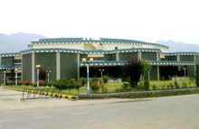
శ్రీనగర్లో ఉన్న కాశ్మీర్ విశ్వవిద్యాలయం ఈ భూభాగంలోని ప్రధాన విశ్వవిద్యాలయం. ఇతర విశ్వవిద్యాలయాలలో జమ్మూ విశ్వవిద్యాలయం, షేర్-ఎ-కాశ్మీర్ యూనివర్శిటీ ఆఫ్ అగ్రికల్చరల్ సైన్సెస్ అండ్ టెక్నాలజీ ఆఫ్ కాశ్మీర్, శ్రీ మాతా వైష్ణో దేవి విశ్వవిద్యాలయం,ఇస్లామిక్ యూనివర్శిటీ అఫ్ సైన్స్ అండ్ టెక్నాలజీ మొదలైనవి ఉన్నాయి.వైద్య కళాశాలలలో శ్రీనగర్లోని స్కిమ్స్, ప్రభుత్వ వైద్య కళాశాల, జమ్మూలోని విజయపురలో ఆల్ ఇండియా ఇన్స్టిట్యూట్ ఆఫ్ మెడికల్ సైన్సెస్ ఉన్నాయి.
ప్రభుత్వం, రాజకీయాలు
[మార్చు]భారత రాజ్యాంగం ఆర్టికల్ 239 నిబంధనల ప్రకారం జమ్మూ కాశ్మీర్ కేంద్రపాలిత ప్రాంతంగా నిర్వహించబడుతుంది. పుదుచ్చేరి కేంద్రపాలిత ప్రాంతంకోసం మొదట రూపొందించిన ఆర్టికల్ 239ఎ, జమ్మూ కాశ్మీరుకు కూడా వర్తిస్తుంది.[70]
కార్యనిర్వాహక శాఖ
[మార్చు]జమ్మూ కశ్మిర్ పరిపాలన నిర్వహణ భారత రాష్ట్రపతి నియమించిన లెఫ్టినెంట్ గవర్నర్ నేత్రత్వంలో సాగుతుంది.[70] ముఖ్యమంత్రి నేతృత్వంలోని మంత్రుల మండలిని శాసనసభ సభ్యత్వం నుండి లెఫ్టినెంట్ గవర్నరు నియమిస్తారు. శాసనసభ అధికార పరిధిలోని విషయాలలో విధులను నిర్వర్తించడంలో లెఫ్టినెంట్ గవర్నరుకు సలహా ఇవ్వడం వారి పాత్రగా ఉంటుంది. ఇతర విషయాలలో, లెఫ్టినెంట్ గవర్నరు తన సొంత సామర్థ్యంలో వ్యవహరించే అధికారం కలిగి ఉంటారు.[70]
శాసన శాఖ
[మార్చు]ప్రభుత్వ శాసనశాఖ ఏకసభ శాసనసభ. దీని పదవీకాలం ఐదు సంవత్సరాలు. భారత రాజ్యాంగం రాష్ట్ర జాబితా "ప్రజా క్రమం", "పోలీసు" మినహా ఏదైనా విషయాలకు శాసనసభ చట్టాలను రూపొందించవచ్చు. ఇవి భారత కేంద్ర ప్రభుత్వంచే సంరక్షించబడతాయి. శాసనసభ చట్టాల మాదిరిగానే శక్తిని కలిగి ఉన్న ఆర్డినెన్సులను ప్రకటించే అధికారం లెఫ్టినెంట్ గవర్నరుకు ఉంది.[70]
న్యాయ శాఖ
[మార్చు]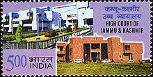
ఈ కేంద్రపాలిత ప్రాంతం జమ్మూ కాశ్మీర్ హైకోర్టు పరిధిలోకి వస్తుంది. ఇది లడఖ్కు కూడా ఇదే హైకోర్టుగా పనిచేస్తుంది.[70] పోలీసు సేవలను జమ్మూ కాశ్మీర్ పోలీసులు అందిస్తారు.[71]
పార్టీలు
[మార్చు]ఈ ప్రాంతంలో క్రియాశీలకంగా ఉన్న ప్రధాన రాజకీయ పార్టీలు
- జమ్మూ కాశ్మీర్ నేషనల్ కాన్ఫరెన్స్ (అధ్యక్షుడుః ఫరూక్ అబ్దుల్లా)
- జమ్మూ & కాశ్మీరు పీపుల్స్ డెమోక్రటిక్ పార్టీ (అధ్యక్షుడుః మెహబూబా ముఫ్తీ)
- భారతీయ జనతా పార్టీ (రాష్ట్ర అధ్యక్షుడుః రవీందర్ రైనా)
- భారత జాతీయ కాంగ్రెస్ (రాష్ట్ర అధ్యక్షుడు;గులాం అహ్మద్ మీర్)
- జమ్మూ & కశ్మీర్ పీపుల్స్ కాన్ఫరెన్స్ (అధ్యక్షః సజ్జద్ గని లోన్)
ఈ ప్రాంతంలోఉనికిలో ఉన్న ఇతరపార్టీలలో కమ్యూనిస్టు పార్టీ ఆఫ్ ఇండియా (మార్క్సిస్ట్), జమ్మూ కాశ్మీర్ నేషనల్ పాంథర్స్ పార్టీ, జమ్మూ కాశ్మీరు అప్నీ పార్టీ (ప్రెసిడెంట్ః అల్తాఫ్ బుఖారీ) ఉన్నాయి.
భారత పార్లమెంటులో జమ్మూ కాశ్మీర్
[మార్చు]జమ్మూ కాశ్మీర్ భారత పార్లమెంటు దిగువసభకు ఐదుగురు సభ్యులను (ఎంపీలు), ఎగువసభకు (రాజ్యసభ) నలుగురు సభ్యులను పంపుతుంది.
- జమ్మూ కాశ్మీర్ లోని లోక్సభ నియోజకవర్గాలు
| నియోజకవర్గం సంఖ్య |
నియోజకవర్గం | ఎస్సీ/ఎస్టీ/నాన్-రిజర్వేషన్ |
|---|---|---|
| 1 | బారాముల్లా | ఏమీ లేదు. |
| 2 | శ్రీనగర్ | ఏమీ లేదు. |
| 3 | అనంతనాగ్-రాజౌరి | ఏమీ లేదు. |
| 4 | ఉధంపూర్ | ఏమీ లేదు. |
| 5 | జమ్మూ | ఏమీ లేదు. |
ఆర్థిక వ్యవస్థ
[మార్చు]
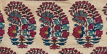
కాశ్మీర్ లోయ సెరికల్చర్, చల్లటి నీటి చేపల పెంపకానికి ప్రసిద్ధి చెందింది.[72] కాశ్మీర్ విల్లో అని పిలువబడే అధిక-నాణ్యత గల క్రికెట్ బ్యాట్లను తయారు చేయడానికి కాశ్మీర్ కలపను ఉపయోగిస్తారు.[73] జమ్మూ కాశ్మీర్ నుండి ప్రధాన వ్యవసాయ ఎగుమతులలో ఆపిల్, బేరి, చెర్రీ, ప్లం, కుంకుమపువ్వు, అక్రోట్లు ఉన్నాయి.[74] సాంప్రదాయ కాశ్మీరీ హస్తకళల పరిశ్రమలో సుమారు 3 లక్షల 40 వేల మంది చేతివృత్తులవారు పెద్ద సంఖ్యలో పనిచేస్తున్నారు, ఎగుమతి వస్తువులను ఉత్పత్తి చేసే అవకాశం ఉంది.[75] చిన్న తరహా కుటీర పరిశ్రమలలో తివాచీ నేత, పట్టులు, శాలువలు, బుట్టలు, కుండలు, రాగి, వెండి వస్తువులు, కాగితం-మాచే వాల్నట్ కలప ఉన్నాయి.[75] ఆర్థిక వ్యవస్థలో ఉద్యానవన రంగం తదుపరి అతిపెద్ద ఆదాయ వనరు. జమ్మూ కాశ్మీర్ ఉష్ణోగ్రత పూల పెంపకానికి సరిపోతుంది. వివిధ జాతుల వృక్షజాలానికి మద్దతు ఇస్తుంది.[75]
జమ్మూ కాశ్మీర్లో 500 కంటే ఎక్కువ ఖనిజ బ్లాకులు ఉన్నాయి. వాటిలో 261 కాశ్మీర్ విభాగంలోనే ఉన్నాయి. [76] కిష్త్వార్ను 'నీలమణి, కుంకుమపువ్వు'గా పిలుస్తారు. [77] కలప, మూలికలు, ఔషధ పొదలు, పుట్టగొడుగులు, చిల్గోజా, బ్లాక్ జీరా, కుంకుమపువ్వు వంటి ఆహారపదార్థాలు అడవులలో అందుబాటులో ఉన్నాయి. [78] మచైల్, పద్దర్లోని నీలమణి రిజర్వ్ గనులు ఖనిజ సంపదకు మూలం. [78] భారతదేశంలో పెద్ద మొత్తంలో బోరాక్స్, నీలమణి వనరులను కలిగి ఉన్న ఏకైక పరిపాలనా విభాగం జమ్మూ కాశ్మీర్. [76] ఇది భారతదేశంలో 36 శాతం గ్రాఫైట్, 21 శాతం మార్బుల్, 14 శాతం జిప్సం కలిగి ఉంది.[76] బొగ్గు, సున్నపురాయి, మాగ్నసైట్ కేంద్రపాలిత ప్రాంతంలోని వివిధ జిల్లాల్లో చెల్లాచెదురుగా కనిపిస్తాయి. [76]
ఇతర ముఖ్యమైన ఖనిజాలు బాక్సైట్, బాల్ క్లే, రాజౌరీలోని ఉధంపూర్ బెంటోనైట్ లోని చైనా బంకమట్టి, బారాముల్లా లిగ్నైట్ లోని ఉధంపూర్ గ్రాఫైట్, కుప్వారా క్వార్ట్జ్ని పాలరాయి, అనంతనాగ్, దోడా, ఉధంపూర్లలో సిలికా ఇసుక, అనంతనాగ్లోని క్వార్ట్జ్.[76] అదనంగా, మాగ్నెటైట్, డోలోమైట్, ఇంధన ఖనిజాలు, అలంకార భవన రాళ్ళు, రాళ్లపలకలు, రత్నాలు వంటి ఖనిజాల ఉనికిని భూగర్భ శాస్త్రం, గనుల శాఖ నిర్ణయించింది. ఇవన్నీ అనేక ఉత్పత్తులు, కర్మాగారాలలో వాణిజ్య, పారిశ్రామిక ఉపయోగాలతో కూడిన పదార్థాలు.[76]
జమ్మూ కాశ్మీర్లో ఆపిల్ పరిశ్రమ గణనీయమైన ఉపాధివనరుగా ఉంది.ఇది అత్యధిక సంఖ్యలో ఉద్యోగాలను సృష్టిస్తుంది.ఇది హెక్టారుకు సుమారు 400 మానవరోజుల పనిని అందిస్తుంది.ఇది 35 లక్షల మంది శ్రామికశక్తికి మద్దతు ఇస్తుంది.అంతేకాకుండా, ఇది స్థూల రాష్ట్ర దేశీయ ఉత్పత్తికి (జిఎస్డిపి) సుమారు 10 శాతానికి దోహదం చేస్తుంది. 2020-2021 సంవత్సరంలో, కాశ్మీర్లో ఆపిల్ ఉత్పత్తి 1,695,000.00 మెట్రిక్ టన్నులుగా నివేదించబడింది, జమ్మూ డివిజన్లో ఇది 24,415.69 మెట్రిక్ టన్నులు లభిస్తుంది. మొత్తం కేంద్రపాలిత ప్రాంతమైన జమ్మూ కాశ్మీర్లో మొత్తం ఆపిల్ ఉత్పత్తి 1,719,415.69 మెట్రిక్ టన్నులు. ముఖ్యంగా, కాశ్మీర్ లోయ ఈ సంఖ్యలకు ప్రధాన దోహదకారి. ఇది భారతదేశ మొత్తం ఆపిల్ ఉత్పత్తిలో 75 శాతం వాటాను కలిగి ఉంది. సంవత్సరానికి 18 లక్షల మెట్రిక్ టన్నుల ఆపిల్సును ఎగుమతి చేస్తుంది.[79]
మీడియా
[మార్చు]
జమ్మూ కాశ్మీర్లోని ప్రధాన పత్రికలలో గ్రేటర్ కాశ్మీర్, రైజింగ్ కాశ్మీర్, కాశ్మీర్ టైమ్స్, డైలీ ఎక్సెల్సియర్,ఎలైట్ కాశ్మీర్, కాశ్మీర్ మానిటర్ ఉన్నాయి.[80] డిడి కాశీర్ ప్రభుత్వ యాజమాన్యంలోని టెలివిజన్ ప్రసార సంస్థ.[81] ప్రముఖ ప్రైవేట్ టెలివిజన్ ఛానళ్లు ఇటివి ఉర్దూ, గులిస్తాన్ న్యూస్.[82] ఆల్ ఇండియా రేడియో సహకారంతో, డిడి కాశీర్ భారతదేశం-పాకిస్తాన్ సరిహద్దు వెంబడి అధిక శక్తి ట్రాన్స్మిటర్లను ఏర్పాటు చేసింది.[83] కాశ్మీరీ పండితుల కోసం ప్రపంచవ్యాప్త కమ్యూనిటీ రేడియో సేవ అయిన రేడియో శారదాను రమేష్ హంగ్లూ ప్రారంభించారు.[84] ఎఫ్ఎమ్ తడ్కా 95,బిగ్ ఎఫ్ఎమ్ 92,7, రేడియో మిర్చి, రెడ్ ఎఫ్ఎమ్ 93 చానల్స్. అందుబాటులోకి వచ్చాయి.[85]
క్రీడలు
[మార్చు]
జమ్మూ కాశ్మీర్లో క్రీడా టోర్నమెంట్లను భారత సైన్యం, పోలీసులు, అలాగే ప్రధాన స్రవంతి రాజకీయ పార్టీలు, ఆల్ పార్టీస్ హురియత్ కాన్ఫరెన్స్ నిర్వహిస్తాయి.[86] టోర్నమెంట్లలో భారతదేశానికి ప్రాతినిధ్యం వహించే క్రీడాకారులు వేర్పాటువాదుల నుండి కళంకం ఎదుర్కొంటుంటారు.[86]
జమ్మూ కాశ్మీర్లో 18 స్టేడియంలు,23 శిక్షణా కేంద్రాలు, మూడు ఇండోర్ స్పోర్ట్స్ కాంప్లెక్స్లు , 42 ప్రభుత్వ నిర్వహణలో ఉన్న ఆటస్థలాలు ఉన్నాయి.[87] శ్రీనగర్ షేర్-ఇ-కాశ్మీర్ స్టేడియానికి నిలయం. ఇక్కడ అంతర్జాతీయ క్రికెట్ మ్యాచ్లు జరిగాయి.[88] జమ్మూలోని మౌలానా ఆజాద్ స్టేడియం జమ్మూ కాశ్మీర్ క్రికెట్ జట్టు హోమ్ వేదికలలో ఒకటి.[89] శ్రీనగర్లోని బక్షి స్టేడియం, బక్షి గులాం మహ్మద్ పేరు పెట్టబడింది, ఫుట్బాల్ మ్యాచ్లకు ఆతిథ్యం ఇస్తుంది.[90]
జవహర్ ఇన్స్టిట్యూట్ ఆఫ్ మౌంటెనీరింగ్, వింటర్ స్పోర్ట్స్ వంటి సంస్థలు పర్వతారోహణ, స్కీయింగ్, సాహస కోర్సులను అందిస్తాయి.[91] దాల్ సరస్సు ఒడ్డున ఉన్న శ్రీనగర్లోని రాయల్ స్ప్రింగ్స్ గోల్ఫ్ కోర్స్ భారతదేశంలోని ఉత్తమ గోల్ఫ్ కోర్సులలో ఒకటిగాపరిగణించబడుతుంది.[92] 2020లో గుల్మార్గ్లో జరిగిన మొదటి ఖేలో ఇండియా వింటర్ గేమ్స్ కూడా జమ్మూ కాశ్మీర్ ఆతిథ్యం ఇచ్చింది.[93] జమ్మూ కాశ్మీర్ 26 బంగారు పతకాలతో మొదటి స్థానంలో నిలిచింది. తరువాత భారత ఆర్మీ జట్టు 8 బంగారు పతకాలు సాధించింది.[94] శీతాకాల క్రీడల రెండవ ఎడిషన్ కూడా 2021లో గుల్మార్గ్లో జరిగింది. జమ్మూ కాశ్మీర్ మళ్లీ మొదటి స్థానంలో నిలిచింది.[95]
పర్యాటకం
[మార్చు]
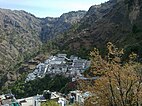
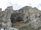
జమ్మూ కాశ్మీర్లోని కొన్ని ప్రధాన పర్యాటక ఆకర్షణలు శ్రీనగర్, మొఘల్ గార్డెన్స్, గుల్మార్గ్, పహల్గామ్, పట్నిటాప్, భదేర్వా, జమ్మూ. ప్రతి సంవత్సరం వేలాది మంది హిందూ యాత్రికులు వైష్ణో దేవి, అమర్నాథ్ పవిత్ర పుణ్యక్షేత్రాలను సందర్శిస్తారు. ఇది రాష్ట్ర ఆర్థిక వ్యవస్థపై గణనీయమైన ప్రభావాన్ని చూపింది.[96]
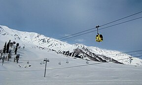
కాశ్మీర్ లోయ భారతదేశంలోని అగ్రశ్రేణి పర్యాటక ప్రదేశాలలో ఒకటి. .[97] భారతదేశంలోని అత్యంత ప్రసిద్ధ స్కీ రిసార్ట్ గమ్యస్థానాలలో ఒకటైన గుల్మార్గ్, ప్రపంచంలోనే ఎత్తైన గ్రీన్ గోల్ఫ్ కోర్సులకు నిలయం.[98] రాష్ట్రంలో హింస తగ్గడం వలన రాష్ట్ర ఆర్థిక వ్యవస్థను, ముఖ్యంగా పర్యాటకాన్ని పెంచింది.[99]
ఇవి కూడా చూడండి
[మార్చు]సూచనలు, మూలాలు
[మార్చు]- ↑ 1.0 1.1 Akhtar, Rais; Kirk, William (22 March 2021), "Jammu and Kashmir", Encyclopaedia Britannica, Encyclopædia Britannica, Inc., retrieved 2 April 2022,
The union territory is part of the larger region of Kashmir, which has been the subject of dispute between India, Pakistan, and China since the partition of the subcontinent in 1947. ... The territory that India administered on its side of the line, which contained both Jammu (the seat of the Dogra dynasty) and the Vale of Kashmir, took on the name Jammu and Kashmir. However, both India and Pakistan have continued to claim the entire Kashmir region
- ↑ Briticannica, Eds Encycl. (1 March 2021), "Ladakh", Encyclopaedia Britannica, Encyclopædia Britannica, Inc., retrieved 2 April 2022,
Ladakh, large area of the northern and eastern Kashmir region, northwestern Indian subcontinent. Administratively, Ladakh is divided between Pakistan (northwest), as part of Gilgit-Baltistan, and India (southeast), as part of Ladakh union territory (until October 31, 2019, part of Jammu and Kashmir state); in addition, China administers portions of northeastern Ladakh.
- ↑ 3.0 3.1 The application of the term "administered" to the various regions of Kashmir and a mention of the Kashmir dispute is supported by the tertiary sources (a) through (e), reflecting due weight in the coverage. Although "controlled" and "held" are also applied neutrally to the names of the disputants or to the regions administered by them, as evidenced in sources (h) through (i) below, "held" is also considered politicised usage, as is the term "occupied," (see (j) below).
(a) Kashmir, region Indian subcontinent, Encyclopaedia Britannica, retrieved 15 August 2019 (subscription required) Quote: "Kashmir, region of the northwestern Indian subcontinent ... has been the subject of dispute between India and Pakistan since the partition of the Indian subcontinent in 1947. The northern and western portions are administered by Pakistan and comprise three areas: Azad Kashmir, Gilgit, and Baltistan, the last two being part of a territory called the Northern Areas. Administered by India are the southern and southeastern portions, which constitute the state of Jammu and Kashmir but are slated to be split into two union territories.";
(b) Pletcher, Kenneth, Aksai Chin, Plateau Region, Asia, Encyclopaedia Britannica, retrieved 16 August 2019 (subscription required) Quote: "Aksai Chin, Chinese (Pinyin) Aksayqin, portion of the Kashmir region, at the northernmost extent of the Indian subcontinent in south-central Asia. It constitutes nearly all the territory of the Chinese-administered sector of Kashmir that is claimed by India to be part of the Ladakh area of Jammu and Kashmir state.";
(c) "Kashmir", Encyclopedia Americana, Scholastic Library Publishing, 2006, p. 328, ISBN 978-0-7172-0139-6 C. E Bosworth, University of Manchester Quote: "KASHMIR, kash'mer, the northernmost region of the Indian subcontinent, administered partlv by India, partly by Pakistan, and partly by China. The region has been the subject of a bitter dispute between India and Pakistan since they became independent in 1947";
(d) Osmańczyk, Edmund Jan (2003), Encyclopedia of the United Nations and International Agreements: G to M, Taylor & Francis, pp. 1191–, ISBN 978-0-415-93922-5 Quote: "Jammu and Kashmir: Territory in northwestern India, subject to a dispute between India and Pakistan. It has borders with Pakistan and China."
(e) Talbot, Ian (2016), A History of Modern South Asia: Politics, States, Diasporas, Yale University Press, pp. 28–29, ISBN 978-0-300-19694-8 Quote: "We move from a disputed international border to a dotted line on the map that represents a military border not recognized in international law. The line of control separates the Indian and Pakistani administered areas of the former Princely State of Jammu and Kashmir.";
(f) Skutsch, Carl (2015) [2007], "China: Border War with India, 1962", in Ciment, James (ed.), Encyclopedia of Conflicts Since World War II (2nd ed.), London and New York: Routledge, p. 573, ISBN 978-0-7656-8005-1,The situation between the two nations was complicated by the 1957–1959 uprising by Tibetans against Chinese rule. Refugees poured across the Indian border, and the Indian public was outraged. Any compromise with China on the border issue became impossible. Similarly, China was offended that India had given political asylum to the Dalai Lama when he fled across the border in March 1959. In late 1959, there were shots fired between border patrols operating along both the ill-defined McMahon Line and in the Aksai Chin.
(g) Clary, Christopher (2022), The Difficult Politics of Peace: Rivalry in Modern South Asia, Oxford and New York: Oxford University Press, p. 109, ISBN 978-0-19-763840-8,Territorial Dispute: The situation along the Sino-Indian frontier continued to worsen. In late July (1959), an Indian reconnaissance patrol was blocked, "apprehended," and eventually expelled after three weeks in custody at the hands of a larger Chinese force near Khurnak Fort in Aksai Chin. ... Circumstances worsened further in October 1959, when a major class at Kongka Pass in eastern Ladakh led to nine dead and ten captured Indian border personnel, making it by far the most serious Sino-Indian class since India's independence.
(h) Bose, Sumantra (2009), Kashmir: Roots of Conflict, Paths to Peace, Harvard University Press, pp. 294, 291, 293, ISBN 978-0-674-02855-5 Quote: "J&K: Jammu and Kashmir. The former princely state that is the subject of the Kashmir dispute. Besides IJK (Indian-controlled Jammu and Kashmir. The larger and more populous part of the former princely state. It has a population of slightly over 10 million, and comprises three regions: Kashmir Valley, Jammu, and Ladakh.) and AJK ('Azad" (Free) Jammu and Kashmir. The more populous part of Pakistani-controlled J&K, with a population of approximately 2.5 million.), it includes the sparsely populated "Northern Areas" of Gilgit and Baltistan, remote mountainous regions which are directly administered, unlike AJK, by the Pakistani central authorities, and some high-altitude uninhabitable tracts under Chinese control."
(i) Fisher, Michael H. (2018), An Environmental History of India: From Earliest Times to the Twenty-First Century, Cambridge University Press, p. 166, ISBN 978-1-107-11162-2 Quote: "Kashmir's identity remains hotly disputed with a UN-supervised "Line of Control" still separating Pakistani-held Azad ("Free") Kashmir from Indian-held Kashmir.";
(j) Snedden, Christopher (2015), Understanding Kashmir and Kashmiris, Oxford University Press, p. 10, ISBN 978-1-84904-621-3 Quote:"Some politicised terms also are used to describe parts of J&K. These terms include the words 'occupied' and 'held'." - ↑ The Hindu Net Desk (8 May 2017). "What is the Darbar Move in J&K all about?". The Hindu. Archived from the original on 10 November 2017. Retrieved 23 February 2019.
- ↑ Singh, Jogindar (1975). "Saser Kangri". The American Alpine Journal: 67. Archived from the original on 14 February 2019. Retrieved 14 February 2019. pdf of original pages
- ↑ Singh, Vijaita (29 February 2020). "Only J&K will use 2011 Census for delimitation". The Hindu. Retrieved 6 November 2020.
- ↑ "The Jammu and Kashmir Official Languages Act, 2020" (PDF). The Gazette of India. 27 September 2020. Archived from the original (PDF) on 19 October 2020. Retrieved 27 September 2020.
- ↑ "Parliament passes JK Official Languages Bill, 2020". Rising Kashmir. 23 September 2020. Archived from the original on 24 September 2020. Retrieved 23 September 2020.
- ↑ "Pakistan's "Burushaski" Language Finds New Relatives". National Public Radio. Retrieved 6 August 2019.
- ↑ Khan, N. (6 August 2012). The Parchment of Kashmir: History, Society, and Polity. Springer. p. 184. ISBN 978-1-137-02958-4. Archived from the original on 23 February 2019. Retrieved 23 February 2019.
- ↑ "Bhadrawahi". Ethnologue: Languages of the World. Dallas: SIL International. Retrieved 6 August 2019.
- ↑ Bateri.
- ↑ Simons, Gary F.; Fennig, Charles D. (2017). Ethnologue: Languages of the World, Twentieth Edition. Dallas: SIL International.
- ↑ Crane, Robert I. (1956). Area Handbook on Jammu and Kashmir State. University of Chicago for the Human Relations Area Files. p. 179.
Shina is the most eastern of these languages and in some of its dialects such as the Brokpa of Dah and Hanu and the dialect of Dras, it impinges upon the area of the Sino-Tibetan language family and has been affected by Tibetan with an overlay of words and idioms.
- ↑ Aggarwal, J. C.; Agrawal, S. P. (1995). Modern History of Jammu and Kashmir: Ancient times to Shimla Agreement. Concept Publishing Company. ISBN 978-81-7022-557-7. Archived from the original on 24 February 2019. Retrieved 23 February 2019.
- ↑ [9][10][11][12][13][14][15]
- ↑ Jones, Daniel (2003) [1917], Peter Roach; James Hartmann; Jane Setter (eds.), English Pronouncing Dictionary, Cambridge: Cambridge University Press, ISBN 978-3-12-539683-8
- ↑ 18.0 18.1 Ministry of Home Affairs (9 August 2019), "In exercise of the powers conferred by clause a of section 2 of the Jammu and Kashmir Reorganisation Act." (PDF), The Gazette of India, retrieved 9 August 2019
- ↑ Snedden, Christopher (2013). Kashmir: The Unwritten History. HarperCollins India. pp. 2–3. ISBN 978-93-5029-898-5.
- ↑ "The enigma of terminology". The Hindu. 27 January 2014. Archived from the original on 16 October 2015.
- ↑ Zain, Ali (13 September 2015). "Pakistani flag hoisted, pro-freedom slogans chanted in Indian Occupied Kashmir – Daily Pakistan Global". En.dailypakistan.com.pk. Archived from the original on 18 November 2015. Retrieved 17 November 2015.
- ↑ "Pakistani flag hoisted once again in Indian Occupied Kashmir". Dunya News. 11 September 2015. Retrieved 17 November 2015.
- ↑ South Asia: fourth report of session 2006–07 by Great Britain: Parliament: House of Commons: Foreign Affairs Committee page 37
- ↑ K. Venkataramanan (5 August 2019), "How the status of Jammu and Kashmir is being changed", The Hindu
- ↑ "Article 370 and 35(A) revoked: How it would change the face of Kashmir". The Economic Times. 5 August 2019.
- ↑ 26.0 26.1 26.2 Article 370: What happened with Kashmir and why it matters. BBC (6 August 2019). Retrieved 7 August 2019.
- ↑ Jeelani, Mushtaq A. (25 June 2001). "Kashmir: A History Littered With Rigged Elections". Media Monitors Network. Archived from the original on 4 March 2016. Retrieved 24 February 2017.
- ↑ Aggarwal, Arshi (7 August 2019). "Article 370 powers gone, Lok Sabha passes J&K bifurcation bill: All you need to know". India Today. Retrieved 22 June 2024.
- ↑ "Parliament Live | Lok Sabha passes Jammu and Kashmir Reorganisation Bill, Ayes: 370, Noes 70". The Hindu. 6 August 2019. Retrieved 6 August 2019.
- ↑ Ghoshal, Devjyot; Pal, Alasdair (12 September 2019). "Thousands detained in Indian Kashmir crackdown, official data reveals". Reuters.
- ↑ "Kashmir in lockdown after autonomy scrapped". BBC News. 6 August 2019. Retrieved 6 June 2021.
- ↑ "Live Updates: Supreme Court Backs Centre On Scrapping Of Jammu & Kashmir Special Status". NDTV. 11 December 2023. Retrieved 11 December 2023.
- ↑ Bhakto, Anando (11 December 2023). "Jammu and Kashmir: Supreme Court upholds abrogation of Article 370 in landmark decision". Frontline. Retrieved 22 June 2024.
- ↑ Vij, Shivam (5 May 2017). "Kashmir Is A Prison With Three Walls". HuffPost. Archived from the original on 5 May 2017. Retrieved 9 August 2019. Alt URL Archived 2021-01-27 at the Wayback Machine
- ↑ 35.0 35.1 Guruswamy, Mohan (28 September 2016). "Indus: The water flow can't be stopped". The Asian Age. Retrieved 9 August 2019.
- ↑ Khan, Asma (26 April 2018). "A Tryst of the Heart and History along the Karakoram Highway". Greater Kashmir. Retrieved 9 August 2019.
- ↑ Andrei, Mihai (11 March 2019). "Why India and Pakistan keep fighting over Kashmir – the history of the Kashmir conflict". GME Science. Retrieved 9 August 2019.
- ↑ Vrinda; J. Ramanan (21 December 2017). "Doorway of the gods: Himalaya crosses five countries". The Hindu. Retrieved 9 August 2019.
- ↑ Agencies (29 July 2019). "Flooding alert issued as India releases water". The Nation. Retrieved 9 August 2019.
- ↑ "Ministry of Home Affairs:: Department of Jammu & Kashmir Affairs". Archived from the original on 8 December 2008. Retrieved 28 August 2008.
- ↑ District Census Handbook Kathua (PDF) (Report). 18 June 2014. p. 8. Retrieved 21 November 2020.
- ↑ District Census Handbook Jammu, Part A (PDF) (Report). 18 June 2014. pp. 13, 51, 116. Retrieved 21 November 2020.
District Census Handbook Jammu, Part B (PDF) (Report). 16 June 2014. pp. 13, 24. Retrieved 21 November 2020. - ↑ District Census Handbook Samba, Part A (PDF) (Report). 18 June 2014. pp. 9, 34, 36, 100. Retrieved 21 November 2020.
District Census Handbook Samba, Part B (PDF) (Report). 16 June 2014. pp. 10, 12, 22. Retrieved 21 November 2020. - ↑ District Census Handbook Udhampur (PDF) (Report). 16 June 2014. pp. 12, 22. Retrieved 21 November 2020.
- ↑ District Census Handbook Reasi, Part A (PDF) (Report). 18 June 2014. pp. 9, 37, 88. Retrieved 21 November 2020.
District Census Handbook Reasi, Part B (PDF) (Report). 16 June 2014. pp. 9, 13, 24. Retrieved 21 November 2020. - ↑ District Census Handbook Rajouri, Part A (PDF) (Report). 18 June 2014. pp. 11, 107. Retrieved 21 November 2020.
District Census Handbook Rajouri, Part B (PDF) (Report). 16 June 2014. pp. 9, 10, 12, 22. Retrieved 21 November 2020. - ↑ District Census Handbook Punch, Part A (PDF) (Report). 18 June 2014. pp. 9, 99. Retrieved 21 November 2020.
District Census Handbook Punch, Part B (PDF) (Report). 16 June 2014. pp. 11, 13, 24. Retrieved 21 November 2020. - ↑ District Census Handbook Doda, Part B (PDF) (Report). 18 June 2014. pp. 9, 12, 99. Retrieved 21 November 2020.
- ↑ District Census Handbook Ramban, Part B (PDF) (Report). 18 June 2014. pp. 10, 12. Retrieved 21 November 2020.
- ↑ District Census Handbook Kishtwar, Part B (PDF) (Report). 18 June 2014. pp. 9, 10, 22. Retrieved 21 November 2020.
Part B page 9 says the rural area is 1,643.65 కి.మీ2 (634.62 చ. మై.), whilst pages 10 and 22 says 1,643.37 కి.మీ2 (634.51 చ. మై.). - ↑ District Census Handbook Anantnag, Part A (PDF) (Report). July 2016. p. 9. Retrieved 21 November 2020.
District Census Handbook Anantnag, Part B (PDF) (Report). July 2016. pp. 12, 22. Retrieved 21 November 2020. - ↑ District Census Handbook Kulgam, Part A (PDF) (Report). July 2016. p. 10. Retrieved 21 November 2020.
District Census Handbook Kulgam, Part B (PDF) (Report). 16 June 2014. pp. 12, 22. Retrieved 21 November 2020.
Part B page 12 says the area of the district is 404 కి.మీ2 (156 చ. మై.), but page 22 says 410 కి.మీ2 (160 చ. మై.). - ↑ District Census Handbook Pulwama, Part B (PDF) (Report). 16 June 2014. pp. 12, 22. Retrieved 21 November 2020.
- ↑ District Census Handbook Shupiyan, Part A (PDF) (Report). 16 June 2014. p. 10. Retrieved 21 November 2020.
District Census Handbook Shupiyan, Part B (PDF) (Report). 16 June 2014. pp. 12, 22. Retrieved 21 November 2020.
Part B pages 12 and 22 say the district area is 312.00 కి.మీ2 (120.46 చ. మై.), but Part A page 10 says 307.42 కి.మీ2 (118.70 చ. మై.). - ↑ District Census Handbook Badgam, Part A (PDF) (Report). July 2016. pp. 10, 46. Retrieved 21 November 2020.
District Census Handbook Badgam, Part B (PDF) (Report). 16 June 2014. pp. 11, 12, 22. Retrieved 21 November 2020.
Part A says the district area is 1,371 కి.మీ2 (529 చ. మై.), Part B says 1,371 కి.మీ2 (529 చ. మై.) (page 11) and 1,361 కి.మీ2 (525 చ. మై.) (page 12s and 22). - ↑ District Census Handbook Srinagar, Part A (PDF) (Report). July 2016. pp. 11, 48. Retrieved 21 November 2020.
Part A page 48 says the district area was 2,228.0 కి.మీ2 (860.2 చ. మై.) in 2001 and 1,978.95 కి.మీ2 (764.08 చ. మై.) in 2011. - ↑ District Census Handbook Ganderbal, Part B (PDF) (Report). July 2016. pp. 11, 12 and 22. Retrieved 21 November 2020.
Part B page 11 says the district area is 393.04 కి.మీ2 (151.75 చ. మై.), but pages 12 and 22 say 259.00 కి.మీ2 (100.00 చ. మై.). - ↑ District Census Handbook Bandipora, Part A (PDF) (Report). July 2016. pp. 10, 47. Retrieved 21 November 2020.
District Census Handbook Bandipora, Part B (PDF) (Report). 16 June 2014. pp. 11, 20. Retrieved 21 November 2020. - ↑ District Census Handbook Baramulla, Part A (PDF) (Report). July 2016. p. 11. Retrieved 21 November 2020.
District Census Handbook Baramulla, Part B (PDF) (Report). 16 June 2014. p. 22. Retrieved 21 November 2020. - ↑ District Census Handbook Kupwara, Part A (PDF) (Report). July 2016. p. 7. Retrieved 21 November 2020.
District Census Handbook Kupwara, Part B (PDF) (Report). 16 June 2014. pp. 11, 12. Retrieved 21 November 2020. - ↑ 61.0 61.1 "Table C-16 Population by Religion: Jammu and Kashmir". censusindia.gov.in. Registrar General and Census Commissioner of India.
- ↑ Ali, Sajid; Pandey, Tanushree (8 June 2022). "'Locked up like animals' – Pandits want to flee Kashmir, hope it's their last exodus". The Print. Retrieved 12 August 2023.
- ↑ "Are Kashmiri Shias The Next Pandits?". 14 November 2013. Archived from the original on 21 June 2015. Retrieved 21 May 2014.
- ↑ Iyer-Mitra, Abhijit (27 September 2019). "After scrapping of Article 370, Shias in Kashmir are in a state of relief and caution". ThePrint. Retrieved 11 September 2021.
- ↑ "Population by religion community – 2011". Census of India, 2011. The Registrar General & Census Commissioner, India. Archived from the original on 25 August 2015.
- ↑ "Explained: Protests For Jammu's Statehood, The Idea Of Jammu & Kashmir's Trifurcation, And RSS 2002 Resolution".
- ↑ Pioneer, The. "Movement launched across Jammu for 'separate State'". The Pioneer.
- ↑ "IkkJutt activists detained after protests demanding separate state for Jammu". 18 July 2022.
- ↑ "Table C-16 Population by Mother Tongue: Jammu and Kashmir". censusindia.gov.in. Registrar General and Census Commissioner of India.
- ↑ 70.0 70.1 70.2 70.3 70.4 Jammu & Kashmir Reorganisation Bill passed by Rajya Sabha: Key takeaways, The Indian Express, 5 August 2019.
- ↑ Ratan, Devesh; Johri, Iti (7 August 2019). "Salient Features Of Jammu & Kashmir Reorganization Bill [Read Bill]". LiveLaw.in: All about law. Retrieved 7 August 2019.
- ↑ "Time for SKUAST-Jammu to start Horti, Dairy Farming, Agri Engineering deptts: LG". The Kashmir Images. 16 March 2021.
- ↑ "Jalandhar bats with Pakistani goods". The New Indian Express. 5 November 2017.
- ↑ "J&K special report: Ready reckoner of top agri-product manufacturers and industry bodies from Jammu & Kashmir". Gulf News. 27 December 2020.
- ↑ 75.0 75.1 75.2 "Jammu And Kashmir Presentation And Economic Growth Report". India Brand Equity Foundation. 29 July 2021.
- ↑ 76.0 76.1 76.2 76.3 76.4 76.5 "New Mining Policy in J&K: Interests of locals are paramount, not revenue". The Kashmir Images. 11 September 2020.
- ↑ Syed Amjad Shah (11 July 2021). "Kishtwar couple globalising local produce; promoting Kashmiri-Dogra arts and crafts". Greater Kashmir.
- ↑ 78.0 78.1 "Kishtwar Ignored Beauty". Daily Excelsior. 15 March 2020.
- ↑ Haneef, Mohammad (31 March 2023). "Kashmir's Apple: An 800-year-old economical backbone of Kashmir". Rising Kashmir. Retrieved 6 August 2023.
- ↑ Mass Media in India - 2004. Publications Division, Ministry of Information & Broadcasting. 2016. ISBN 978-81-230-2338-0.
- ↑ "Kashmir gets its own version of KBC from today". The Tribune. 29 April 2019.
- ↑ "Amid Shutdown, a Private News Channel Connects Thousands in J&K". The Wire. 24 September 2019.
- ↑ "Rediff on the NeT: AIR, DD to counter Pak propaganda along border areas". Rediff.com. 16 December 1999.
- ↑ Mohan, Archis (6 February 2016). "The borderline cases of Jammu & Kashmir". Business Standard India. Archived from the original on 8 November 2017.
- ↑ "FM radio stations and their audiences bloom in restive Kashmir". Asia Times. 25 September 2018.
- ↑ 86.0 86.1 Gupta, Amit (16 October 2020). "Sports in Kashmir: How 5 journalists run a magazine that focuses on local sports". Mumbai Mirror.
- ↑ "Department of Youth Services & Sports". Department of Youth Services and Sports. Government of Jammu and Kashmir. Archived from the original on 29 November 2019. Retrieved 29 November 2019.
- ↑ "Records / Sher-i-Kashmir Stadium, Srinagar / One-Day Internationals". ESPNcricinfo. Archived from the original on 13 August 2014.
- ↑ "Molana Azad Stadium, Jammu". CricketArchive. Retrieved 1 August 2021.
- ↑ "J&K stadium hosts football match after 25-year gap". The Times of India. 16 July 2012. Archived from the original on 11 May 2013. Retrieved 1 August 2021.
- ↑ "UT Govt denies pensionary benefits to retired employees of JIM&WS". Daily Excelsior. 5 July 2021.
- ↑ "India". Robert Trent Jones – Golf Architects. Archived from the original on 12 December 2013.
- ↑ Ashiq, Peerzada (7 March 2020). "Khelo India Winter Games kicked off in J&K". The Hindu. ISSN 0971-751X.
- ↑ Iveson, Ali (15 March 2020). "Hosts win 26 gold medals as first-ever Khelo India Winter Games conclude". Inside the Games. Archived from the original on 19 December 2020.
- ↑ "Spectacular Closing Ceremony of 2nd Khelo India National Winter Games organized at Gulmarg". Kashmir News Service. 2 March 2021.
- ↑ "Amarnath Board to study yatra impact on Kashmir economy". Online edition of The Hindu. Chennai, India. 13 September 2007. Archived from the original on 9 November 2012. Retrieved 6 June 2009.
- ↑ "Foreign tourists flock Kashmir". Online edition of The Hindu. Chennai, India. 18 March 2009. Archived from the original on 9 November 2012. Retrieved 18 March 2009.
- ↑ Cris Prystay (26 October 2007). "Fairway to Heaven". The Wall Street Journal.
- ↑ "Tourists arrival gives boost to J-K economy". Sify. Archived from the original on 16 July 2011.
గమనికలు
[మార్చు]- ↑ జమ్మూ కాశ్మీర్ భారతదేశం, పాకిస్తాన్ మధ్య వివాదాస్పద ప్రాంతం జమ్మూ కాశ్మీర్ ఉంది 42,241 కి.మీ2 (16,309 చ. మై.) of area administered by India and 13,297 కి.మీ2 (5,134 చ. మై.) జమ్మూ కాశ్మీర్లో భాగంగా భారతదేశం క్లెయిమ్ చేస్తున్న ఆజాద్ కాశ్మీర్ కింద పాకిస్తాన్ నియంత్రణలో ఉన్న ప్రాంతం.
- ↑ Pronounced variably as /ˈdʒæmuː/ or /ˈdʒʌmuː/, /ˈkæʃmɪər/ or /kæʃˈmɪər/.[17]

